"To those who have struggled with them, the mountains reveal beauties they will not disclose to those who make no effort. That is the reward that mountains give to effort. And it is because they have so much to give and give it so lavishly to those who will wrestle with them that men love the mountains and go back to them again and again.... The mountains reserve their choice gifts for those who stand upon their summits."
Sir Francis Youngblood
Sir Francis Youngblood
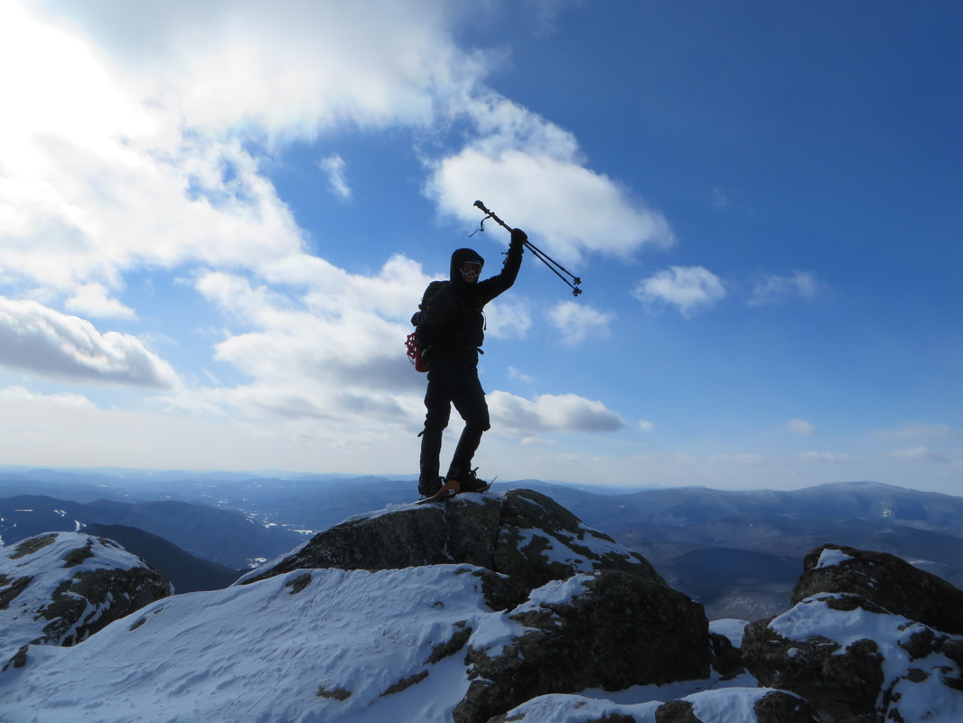
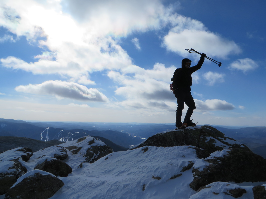
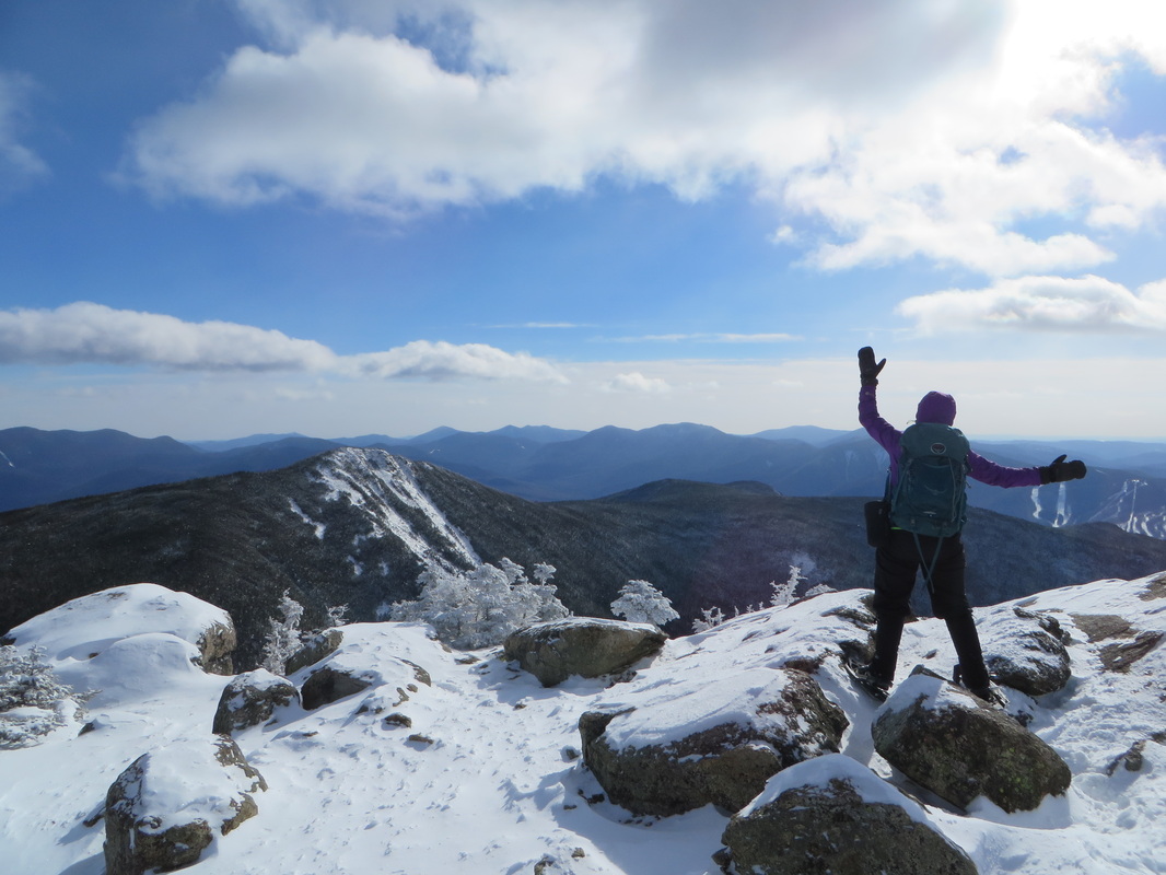
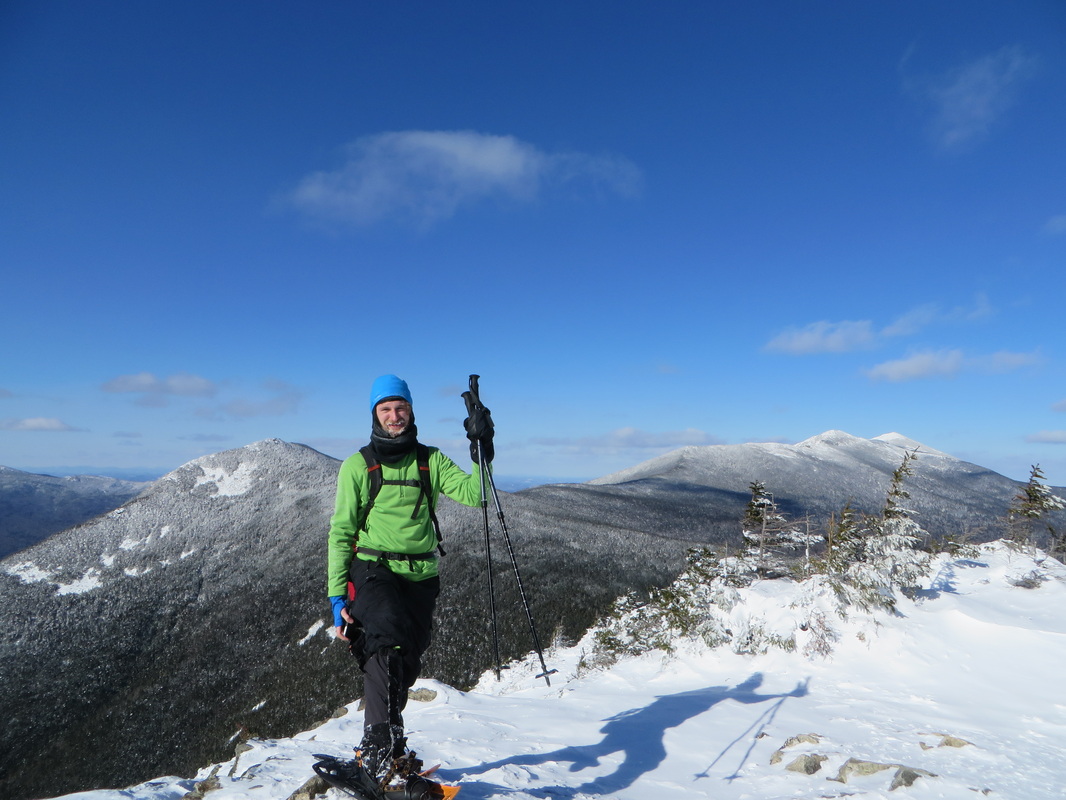
Kyle claims victory on the summit of Mount Liberty
The above quote by Sir Francis Youngblood, echoes in my head on certain hikes. I hike a lot but that doesn't mean that it is always easy. There are some hikes that are, but there are some I struggle on. The hike up Mount Liberty and over to Mount Flume and back isn't a very difficult one. I would say it is moderate at best. But add in not-so-fresh legs coming off of the Osceolas the day before and negative temperatures with double digit negative wind chills and all of a sudden a moderate climb becomes a difficult one. Hiking can be as much of a mental game as it is a physical one...
I picked Kyle up at the New Hampton park and ride at 7:30 Tuesday morning and from there we headed straight to the Basin in Franconia Notch. We were delighted to see bright blue skies as we drove up 93 and into the Notch. Granted there were a few clouds but none looked threatening in any way. NOAA had called for these summits to be in clouds all day so we were keeping our fingers crossed that bigger clouds weren't on their way in from the other side of the ridge.
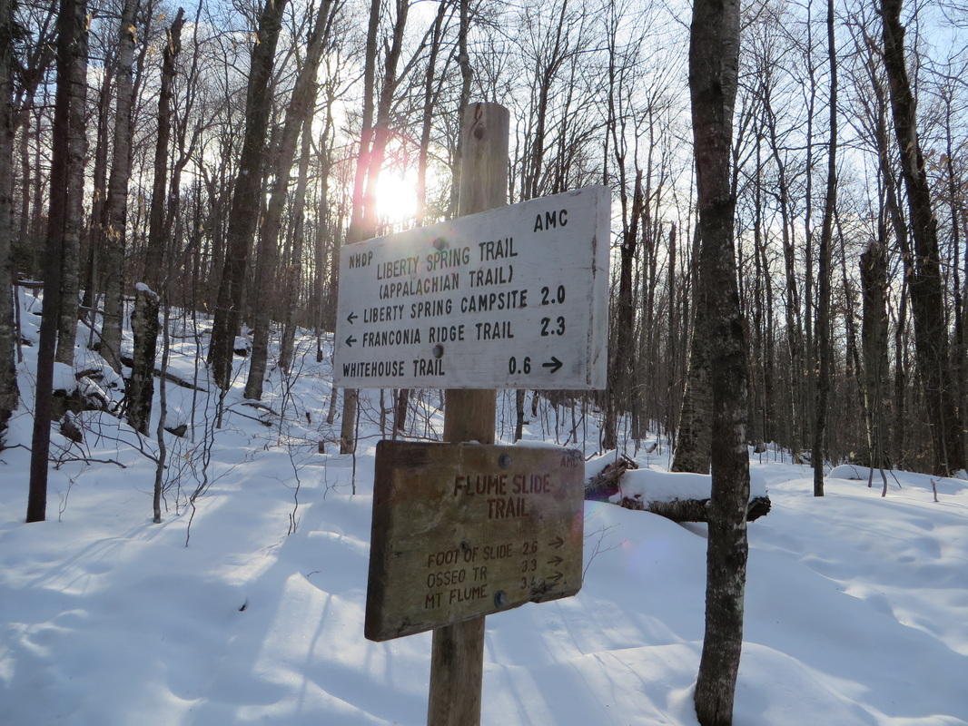
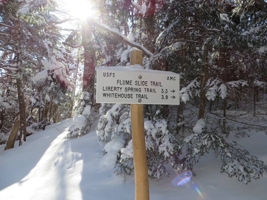
We parked at the Basin so we could take a shortcut to the Liberty Springs Trail. Various guide books say to park at the Flume Gorge Visitors Center or the Whitehouse Trail head parking lot down the road but both these approaches are a bit longer and the latter includes an annoying 0.6 mile jaunt through the woods using the Whitehouse Trail to get to the bike path. From the Basin parking lot we jumped on the bike path for about 5 minutes then entered the open woods to the left and bushwhacked in pretty much a straight line up to the hairpin turn on the Liberty Springs Trail. This shortcut saved us at least 1.5 miles round trip, if not a little more. Shortly after we reached the junction with the Flume Slide Trail where I jokingly asked Kyle if he would like to go up that way. He was quick to respond with a firm "No."
I picked Kyle up at the New Hampton park and ride at 7:30 Tuesday morning and from there we headed straight to the Basin in Franconia Notch. We were delighted to see bright blue skies as we drove up 93 and into the Notch. Granted there were a few clouds but none looked threatening in any way. NOAA had called for these summits to be in clouds all day so we were keeping our fingers crossed that bigger clouds weren't on their way in from the other side of the ridge.
We parked at the Basin so we could take a shortcut to the Liberty Springs Trail. Various guide books say to park at the Flume Gorge Visitors Center or the Whitehouse Trail head parking lot down the road but both these approaches are a bit longer and the latter includes an annoying 0.6 mile jaunt through the woods using the Whitehouse Trail to get to the bike path. From the Basin parking lot we jumped on the bike path for about 5 minutes then entered the open woods to the left and bushwhacked in pretty much a straight line up to the hairpin turn on the Liberty Springs Trail. This shortcut saved us at least 1.5 miles round trip, if not a little more. Shortly after we reached the junction with the Flume Slide Trail where I jokingly asked Kyle if he would like to go up that way. He was quick to respond with a firm "No."
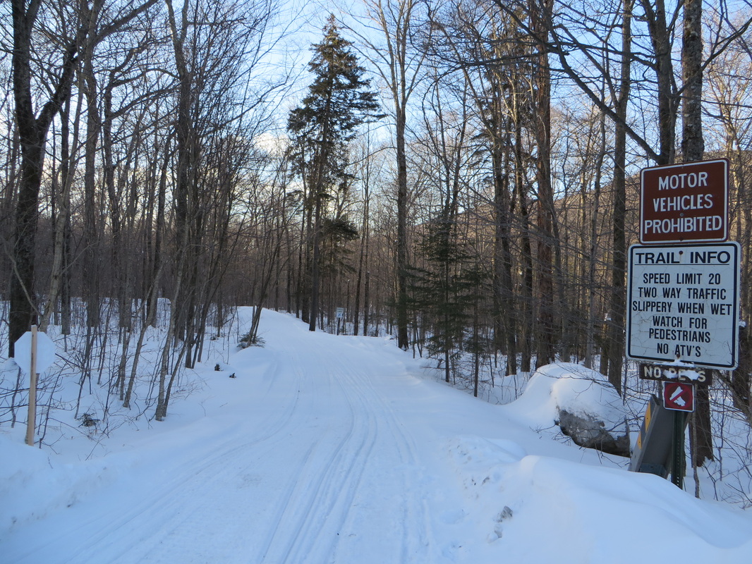
The Franconia Bike Path used by snowmobiles and cross country skiers in winter
The first junction shortly after the hair pin turn on Liberty Springs Trail
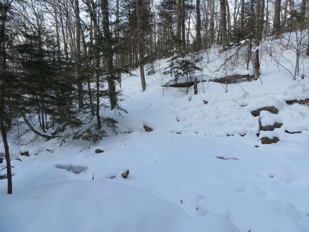
Snow bridged water crossings today. Yay!
A couple of inches of fresh powder on the Liberty Springs Trail
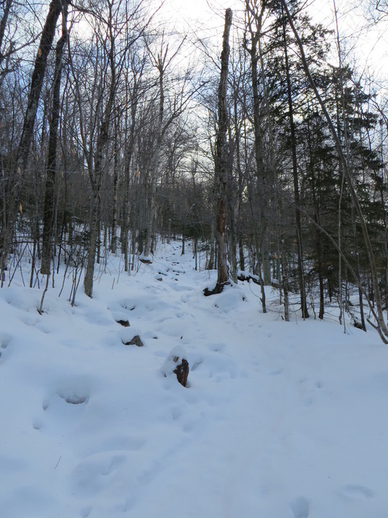
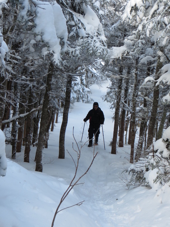
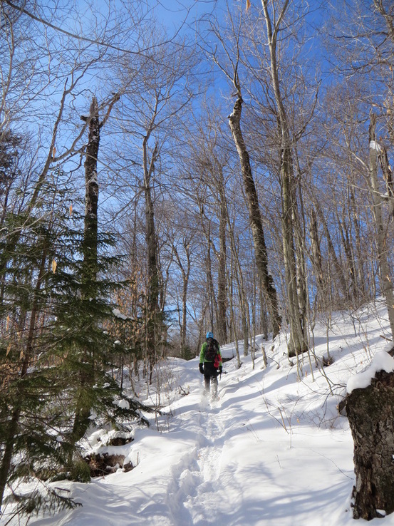
The trail is quite gradual in the beginning and there was only a couple of inches of fresh powder so we left our snow shoes on our packs until we were out of the open hardwood forest. We put them on where the trail begins a more moderate up as there was a few more inches of snow here to contend with. The wind had been pushing against us steadily up to this point making it difficult to stay warm even while moving. We were both having difficulty finding the right combination of layers as we were both sweating on the uphill but it was an instant cold sweat because of the wind. I was growing increasingly frustrated because I very rarely, if ever, find myself chilled while on ascent. The other issue I was perplexed by was my feet were already cold. Again, not normal for me especially on ascent. I constantly had to remind myself that this is what happens when it is below zero and to just keep moving.
The trek up Liberty Springs Trail is rather mundane. It just goes and goes. I have been on this trail a half dozen times in all four seasons and it is never any different. It wasn't helping that my legs were reminding me of the previous day's climb up the steep Osceolas. My feet were still cold and I started to become worried. This wasn't normal for me and I started to have doubts if I would be able make it past Liberty's summit. This would be a huge disappointment as my goal for this hike was to bag Flume for my winter list (I had gotten Liberty last winter during a full Franconia Ridge traverse but had to bail after Liberty due to exhaustion). I knew Kyle would be disappointed if we had to bail but there was no way I was going to risk injury just to bag a peak.
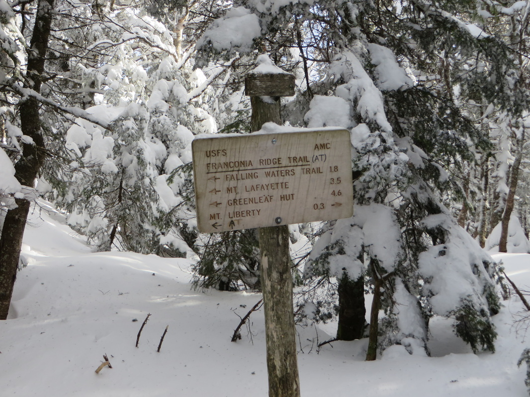
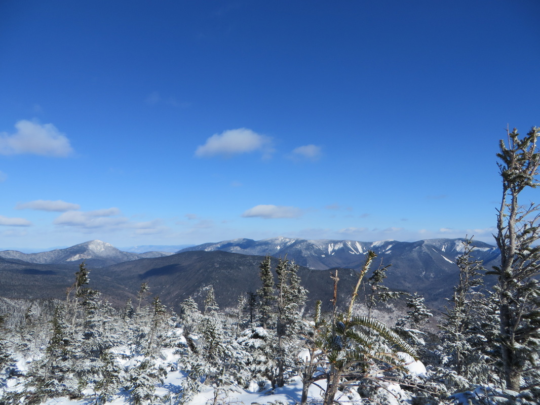
We kept on until we finally reached the junction with the Franconia Ridge Trail. We stopped here to add a layer before breaking out above tree line and I scarfed down a quick snack. I took off fairly quickly to stay warm while Kyle finished layering up. I kept thinking how nice it would be if the wind would just stop for 10 minutes or so especially while we were above tree line. I stopped to wait for Kyle just short of the tree line and wouldn't you know, the wind actually stopped. Kyle caught up and we emerged onto the ridge under beautiful blue skies and the sun pounding down on us. The wind was light to nonexistent and we stood there snapping as many pictures as possible positive that the wind would return with fury. Up to the summit we went both gawking at the remarkable views around us. This was my sixth visit to the summit of Liberty and the views get better every time. Life was good again. The lack of wind coupled with the abundant sunshine made me warm again and I knew I would be good to make the trek over to Flume. I felt bad pulling Kyle off of the summit as he kept saying these were the best views he had seen all winter but it wouldn't be long until we both were chilled again; it was time to go.
The trek up Liberty Springs Trail is rather mundane. It just goes and goes. I have been on this trail a half dozen times in all four seasons and it is never any different. It wasn't helping that my legs were reminding me of the previous day's climb up the steep Osceolas. My feet were still cold and I started to become worried. This wasn't normal for me and I started to have doubts if I would be able make it past Liberty's summit. This would be a huge disappointment as my goal for this hike was to bag Flume for my winter list (I had gotten Liberty last winter during a full Franconia Ridge traverse but had to bail after Liberty due to exhaustion). I knew Kyle would be disappointed if we had to bail but there was no way I was going to risk injury just to bag a peak.
We kept on until we finally reached the junction with the Franconia Ridge Trail. We stopped here to add a layer before breaking out above tree line and I scarfed down a quick snack. I took off fairly quickly to stay warm while Kyle finished layering up. I kept thinking how nice it would be if the wind would just stop for 10 minutes or so especially while we were above tree line. I stopped to wait for Kyle just short of the tree line and wouldn't you know, the wind actually stopped. Kyle caught up and we emerged onto the ridge under beautiful blue skies and the sun pounding down on us. The wind was light to nonexistent and we stood there snapping as many pictures as possible positive that the wind would return with fury. Up to the summit we went both gawking at the remarkable views around us. This was my sixth visit to the summit of Liberty and the views get better every time. Life was good again. The lack of wind coupled with the abundant sunshine made me warm again and I knew I would be good to make the trek over to Flume. I felt bad pulling Kyle off of the summit as he kept saying these were the best views he had seen all winter but it wouldn't be long until we both were chilled again; it was time to go.
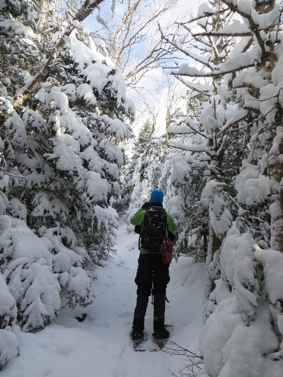
Kyle in the midst of a Winter Wonderland on Liberty Springs Trail
At the junction...
What happened here?
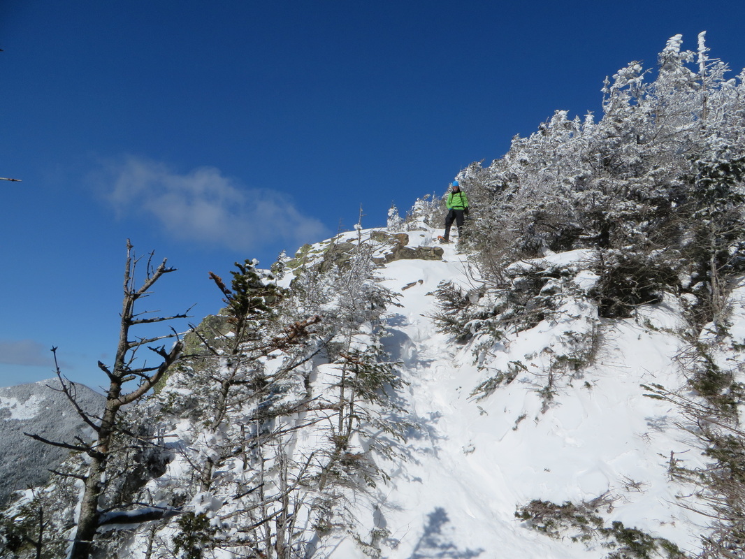
Kyle makes his way up the final stretch before tree line
Magical
The Cannonballs and Cannon Mountain
The Kinsmans, Cannonballs and part of Cannon
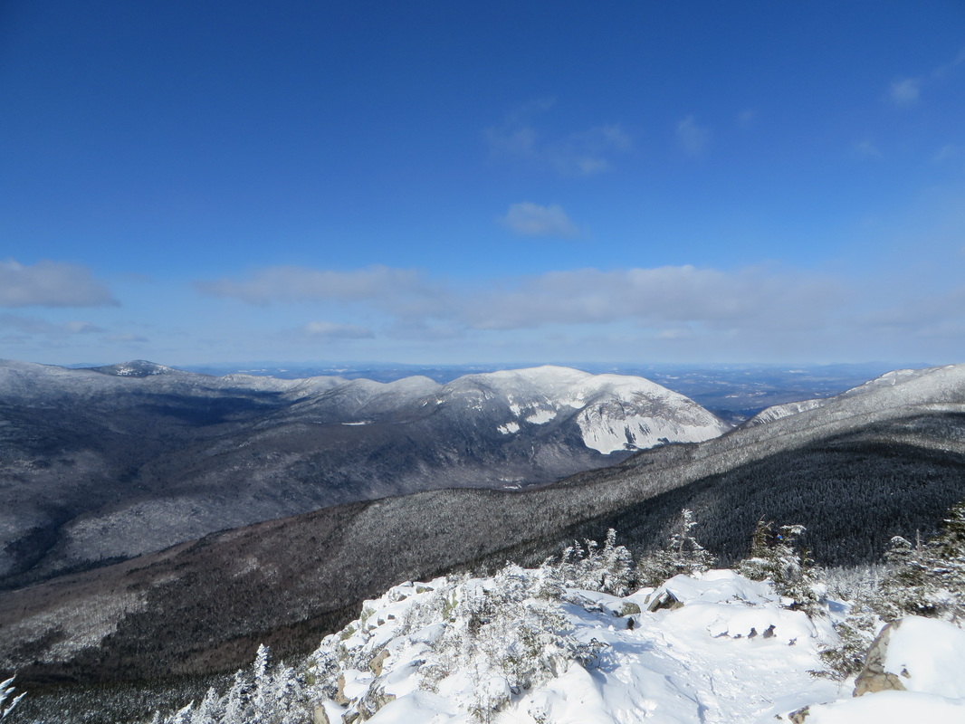
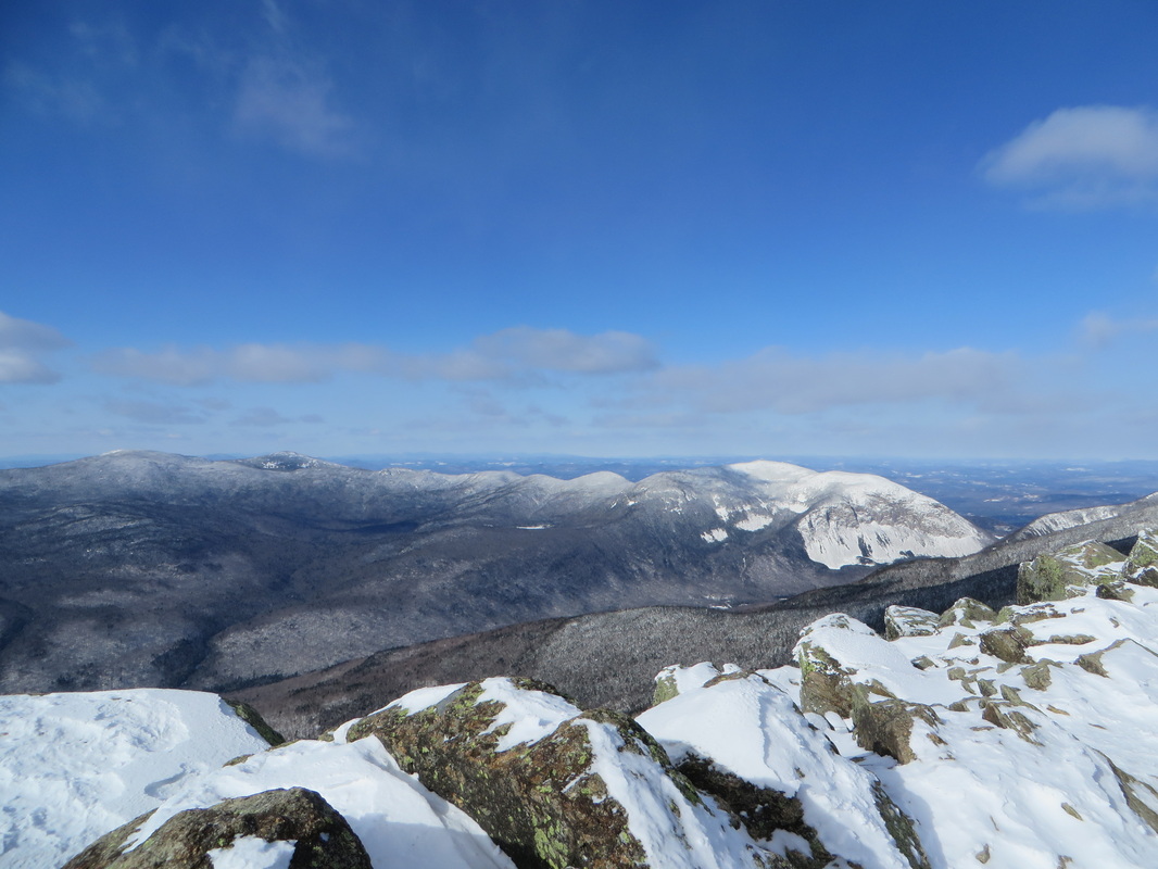
Cannon Mountain on the left, Little Haystack Mountain on the right
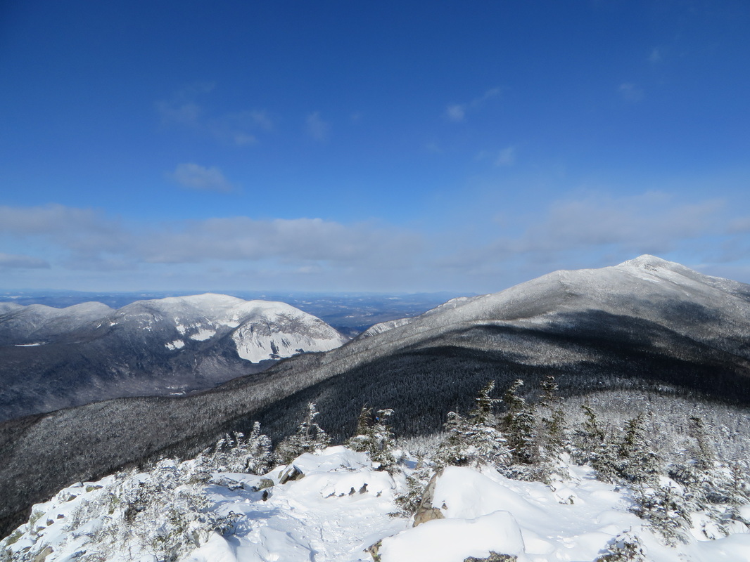
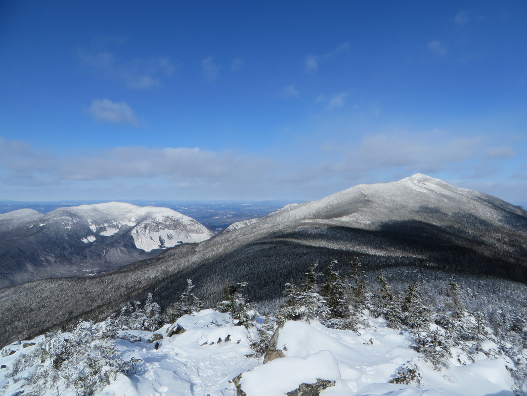
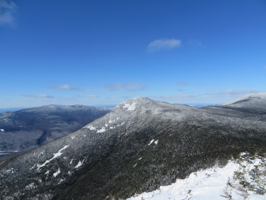
The dark lump in the center is Owls Head Mountain with the Twins and the Bonds behind
The summit of Liberty, straight ahead
Kyle on the summit with the ski slopes of Loon Mountain in the background
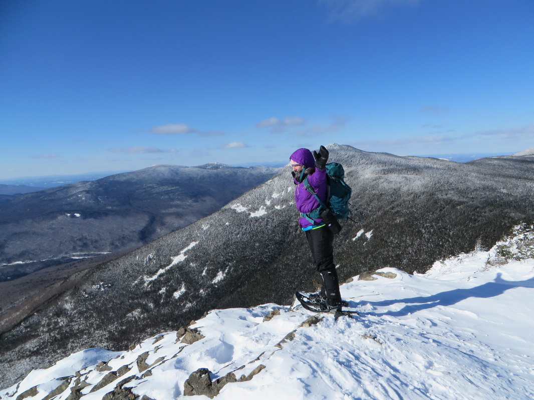
Am I directing traffic? Waving to Flume? Who knows!
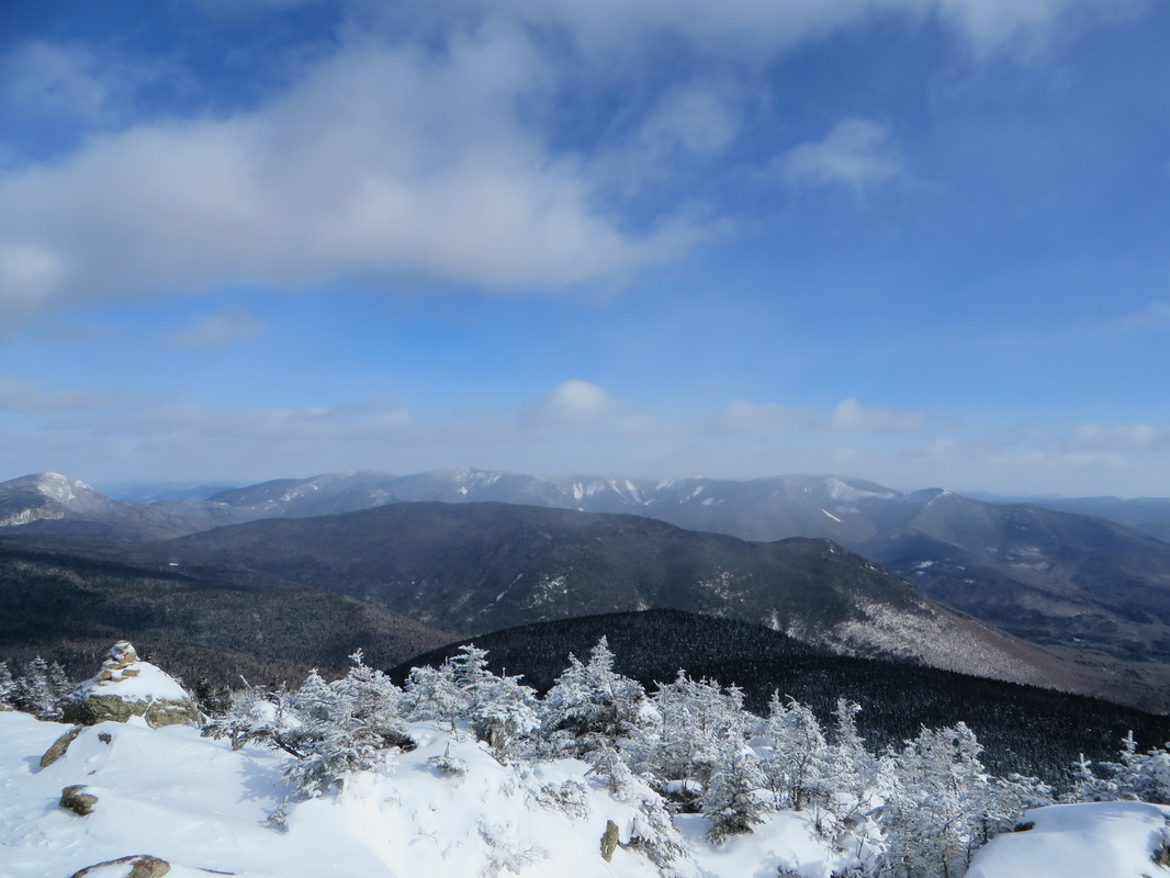
Owls Head with the Twins and Bonds behind
Another look at the Kinsmans, Cannonballs and Cannon
Close up of Cannon and Cannon Cliffs. Makes me want a powdered donut!
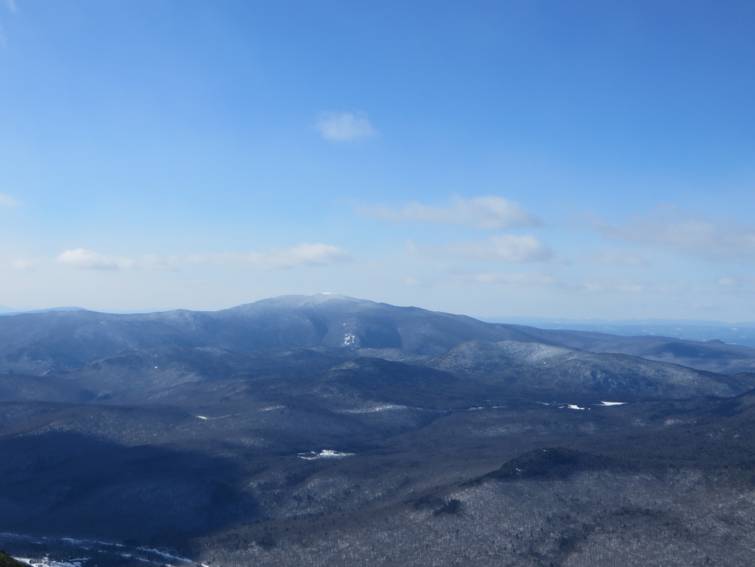
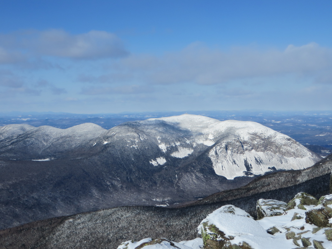
Mount Moosilauke in the distance
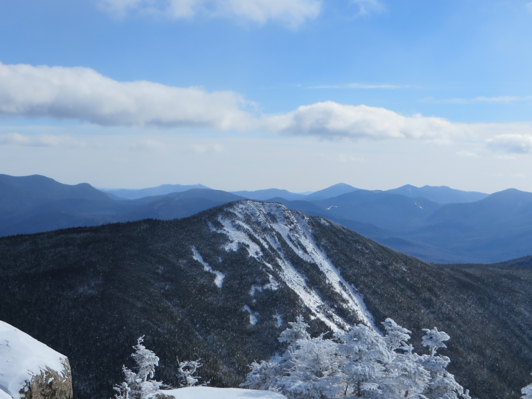
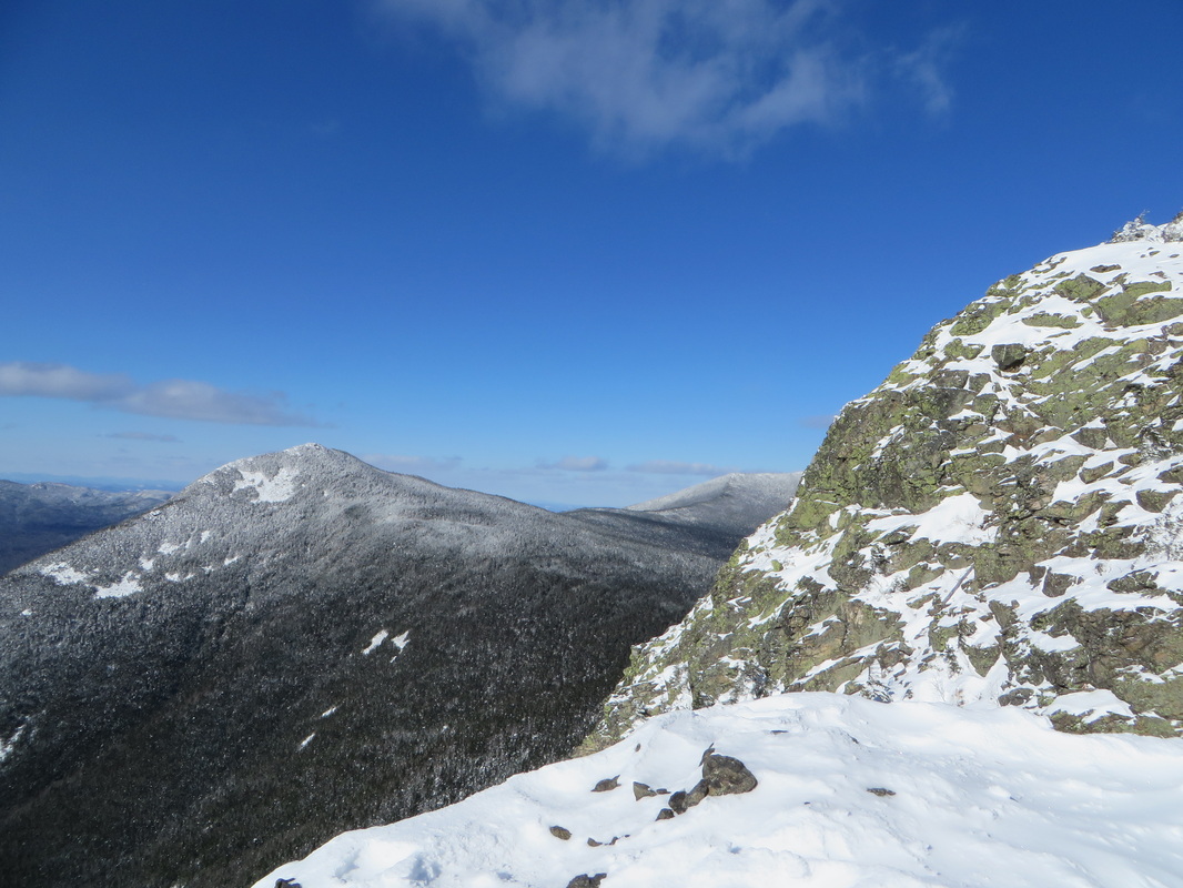
Looking over to our next destination; Mount Flume, one and a half miles away.
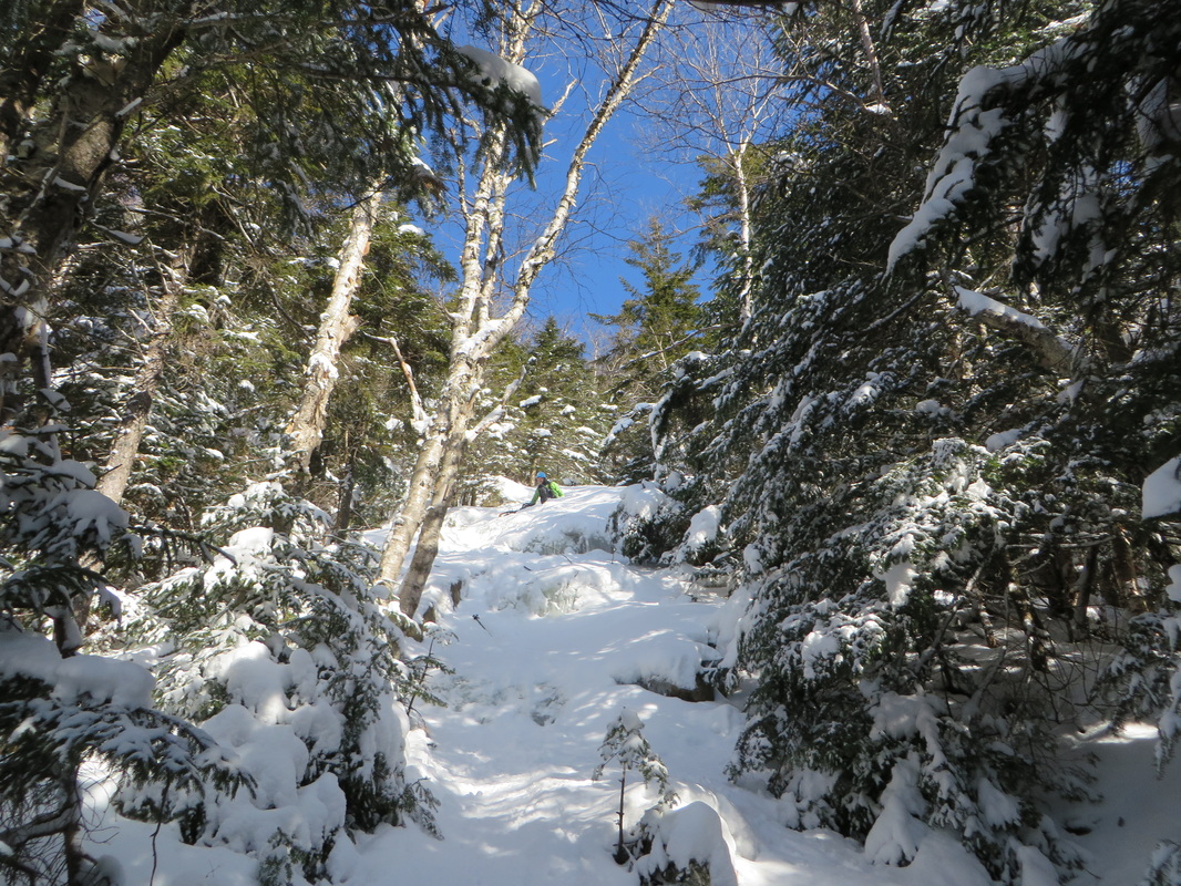
The descent into the col between Liberty and Flume begins quickly as it is a quick and steady drop down and today was full of unbroken fresh powder. My legs were grateful for the break but my brain was already dreading the return climb up this lengthy hill. This is where the thought of a descent down Flume Slide Trail started. More on that later...
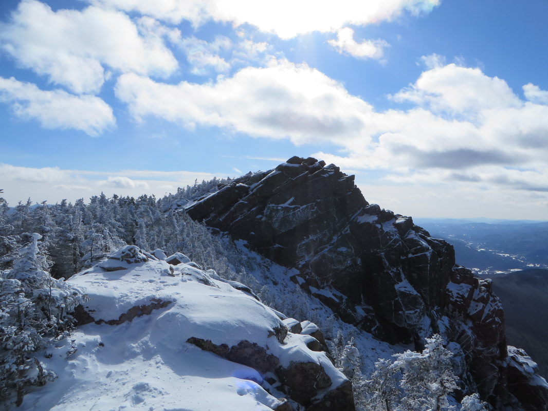
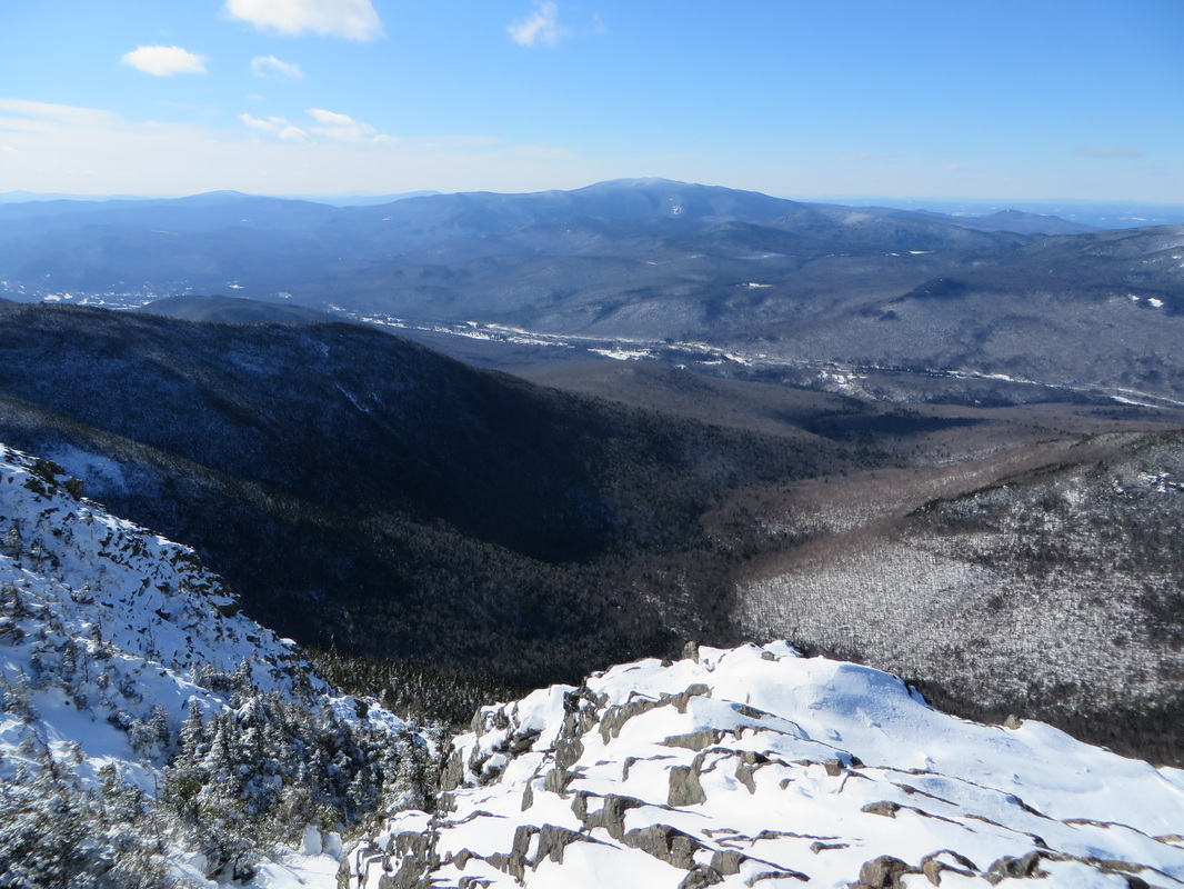
The col was full of sun and the wind was quiet again which made it feel that much warmer. As we made the final climb up to Flume we encountered a solo hiker wearing crampons and dawning an ice ax coming down. I knew he had come up Flume Slide Trail which made me happy (I'll explain why in a minute). We chatted with him briefly and he asked us if we were considering going down Flume Slide Trail. I said we were and he said he thought we would be fine but that there were definitely some sketchy parts. We went on our separate ways and I told Kyle to keep the option in the back of his mind. We made our way up to the summit of Flume shortly after. The wind had picked back up again but was still not nearly as strong as it had been earlier that morning. This was my third time on the summit of Flume and the first time with views! It was as just as awesome as I had imagined it would be. And now it was official; winter 4K #24 meant I was halfway through my winter list!
The col was full of sun and the wind was quiet again which made it feel that much warmer. As we made the final climb up to Flume we encountered a solo hiker wearing crampons and dawning an ice ax coming down. I knew he had come up Flume Slide Trail which made me happy (I'll explain why in a minute). We chatted with him briefly and he asked us if we were considering going down Flume Slide Trail. I said we were and he said he thought we would be fine but that there were definitely some sketchy parts. We went on our separate ways and I told Kyle to keep the option in the back of his mind. We made our way up to the summit of Flume shortly after. The wind had picked back up again but was still not nearly as strong as it had been earlier that morning. This was my third time on the summit of Flume and the first time with views! It was as just as awesome as I had imagined it would be. And now it was official; winter 4K #24 meant I was halfway through my winter list!
Looking back at Liberty
Liberty on the left and the rest of Franconia Ridge to the right
Kyle on the summit with Franconia Ridge behind
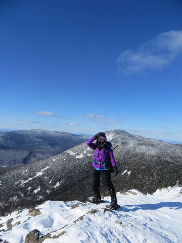
Holding onto my hood! Winter 4K #24! Woo-Hoo!!!!
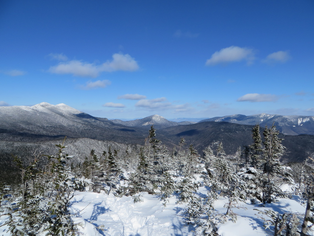
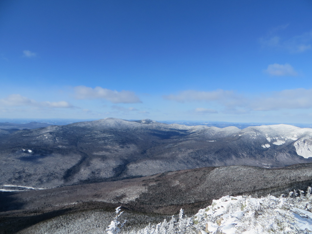
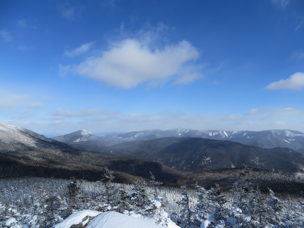
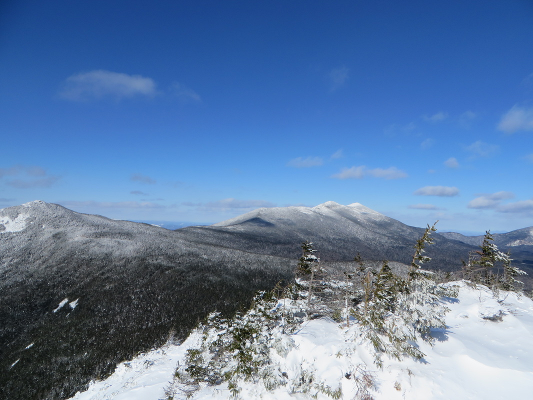
Looking into the middle of the Pemi Wilderness: Franconia Ridge on the left, Garfield in the middle and the Twins and Bonds on the right.
Owls Head in front, Bonds behind
Looking down into the Notch
Okay. So here is my basis and reasoning for deciding to descend Flume Slide Trail as opposed to going back over to Liberty and down Liberty Springs Trail:
Once we reached the more open portion of the slide our nerves were eased. There was lots of fresh powder which provided great traction for our bums as we carefully slid down section by section. There were a couple of sketchy parts that we had to strategically plan around which we did with great success. We stuck to the side of the slide when we needed to and used the trees as handle bars to carefully inch our way down. We were both screaming with laughter in the open and less steep parts of the slide as we slid down in a blanket of powder. We definitely used extreme caution where it was warranted and always avoided sliding too fast and out of control by using our hands and poles as breaks as well as leaning back on our packs to slow us down. We reached the bottom of the slide in high spirits and began the 2.6 mile easy walk through the woods back to the Liberty Springs junction. From the junction it was a quick jaunt back down to the bushwhack and back to the bike path and car.
It was hard to believe that is was just that morning that I had serious doubts of continuing on past Liberty. I'm glad that I was able to warm up and that I didn't have to give up and turn back. This ended up being one of the best hikes I have ever experienced. The reward of blue skies and amazing views is always awesome. But the reward of defeating the challenge is always much sweeter in my opinion.
- I was done with going 'up' before we even got to the summit of Liberty.
- The thought of the climb back up Liberty after Flume was enough to make me wanna puke.
- Judging by the amount of fresh powder we had encountered all day I knew there would be plenty of fresh powder on Flume Slide Trail to cover any serious ice flows as well as to provide us with traction while butt-sledding.
- The solo hiker who we spoke with who had come up that way confirmed #3.
- The portion of the Flume Slide Trail from the base of the slide back to the junction (2.6 miles) would be broken out (foot steps to follow) through the somewhat confusing open hard wood forest. This is what sealed the deal for me as I was more worried about finding our way back to the Liberty Springs Trail then I was about descending the slide.
Once we reached the more open portion of the slide our nerves were eased. There was lots of fresh powder which provided great traction for our bums as we carefully slid down section by section. There were a couple of sketchy parts that we had to strategically plan around which we did with great success. We stuck to the side of the slide when we needed to and used the trees as handle bars to carefully inch our way down. We were both screaming with laughter in the open and less steep parts of the slide as we slid down in a blanket of powder. We definitely used extreme caution where it was warranted and always avoided sliding too fast and out of control by using our hands and poles as breaks as well as leaning back on our packs to slow us down. We reached the bottom of the slide in high spirits and began the 2.6 mile easy walk through the woods back to the Liberty Springs junction. From the junction it was a quick jaunt back down to the bushwhack and back to the bike path and car.
It was hard to believe that is was just that morning that I had serious doubts of continuing on past Liberty. I'm glad that I was able to warm up and that I didn't have to give up and turn back. This ended up being one of the best hikes I have ever experienced. The reward of blue skies and amazing views is always awesome. But the reward of defeating the challenge is always much sweeter in my opinion.
Kyle coming down the Franconia Ridge trail off of Flume
One last look back at Liberty
And heeeeeerrrrrrreeeeee we go!
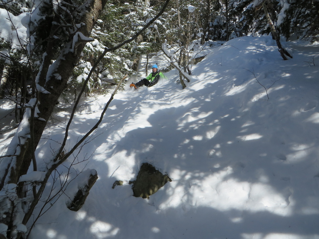
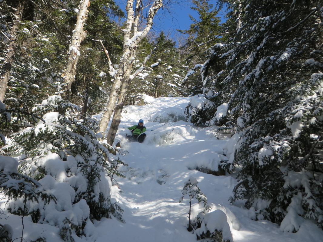
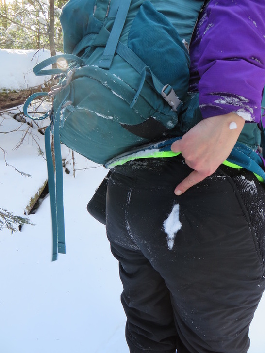
You know the butt-sledding has been good when...
The long walk out from the base of the slide
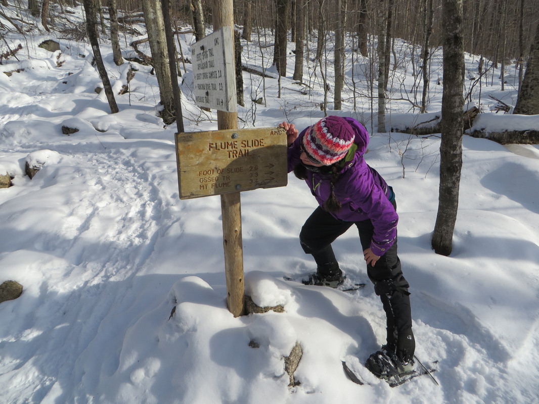
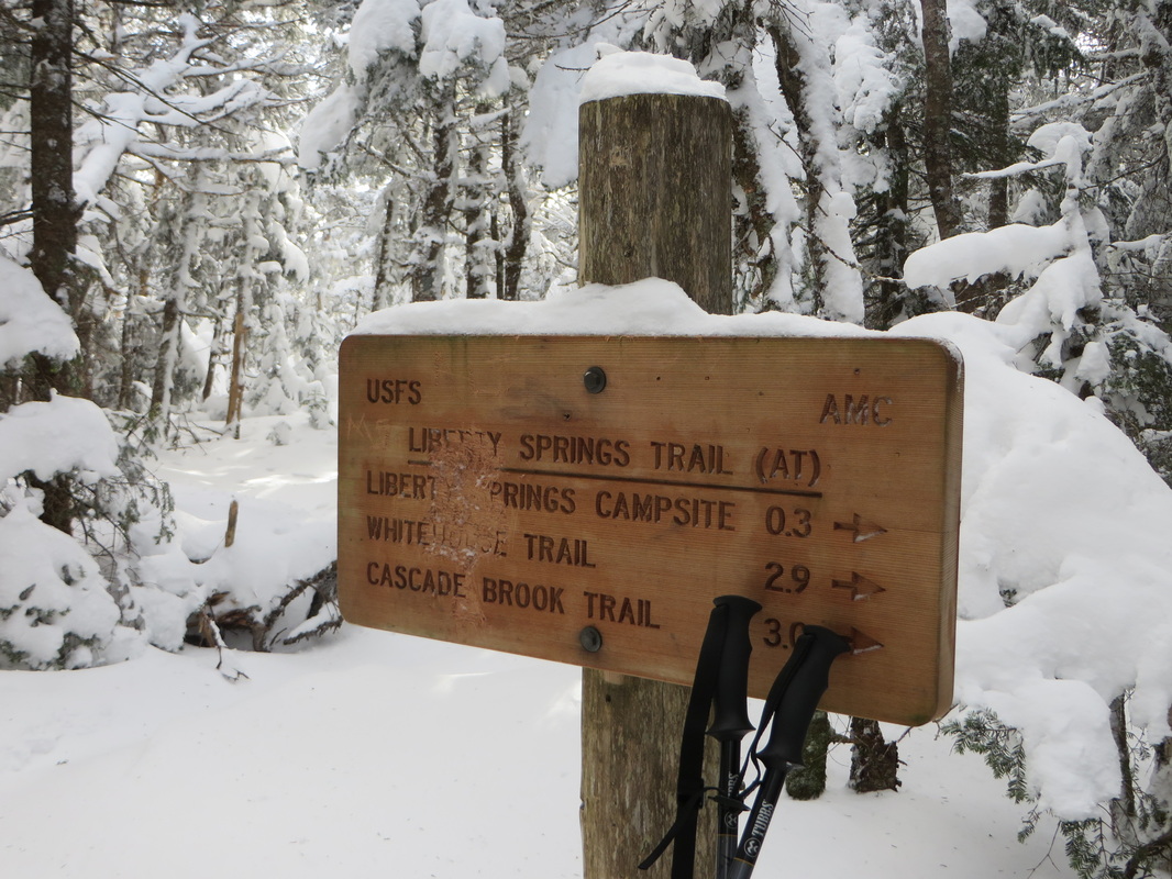
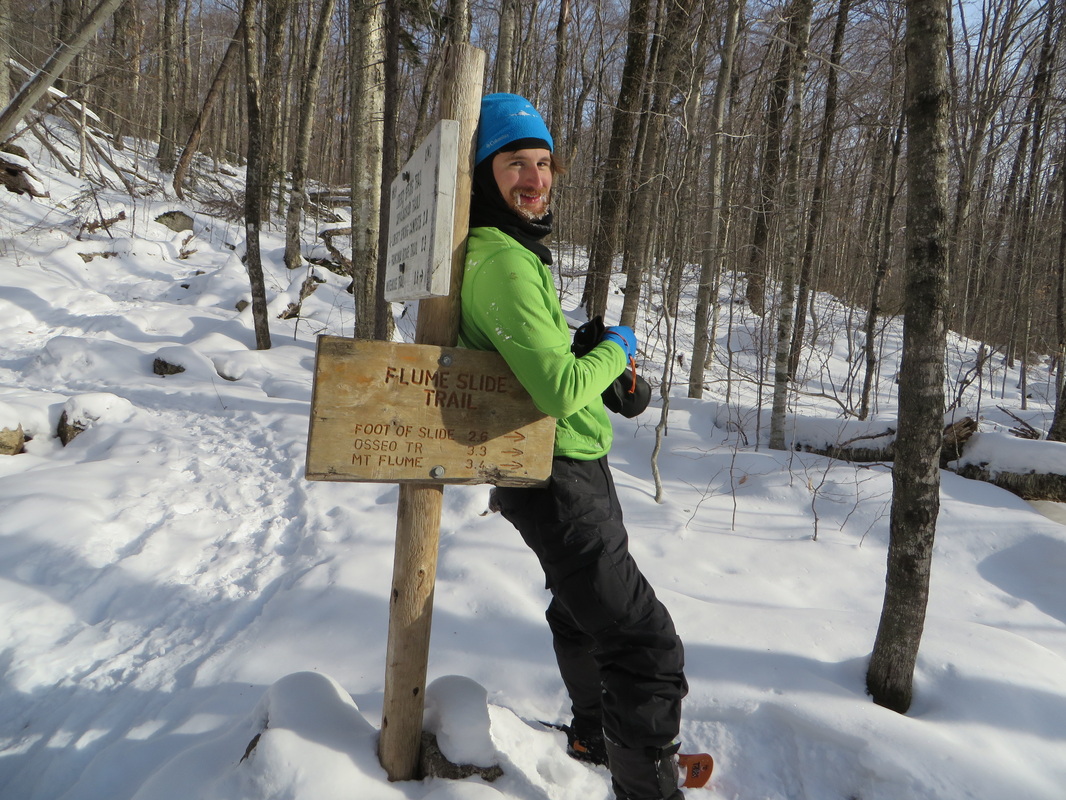
Back at the junction I check the sign to make sure I wasn't dreaming...
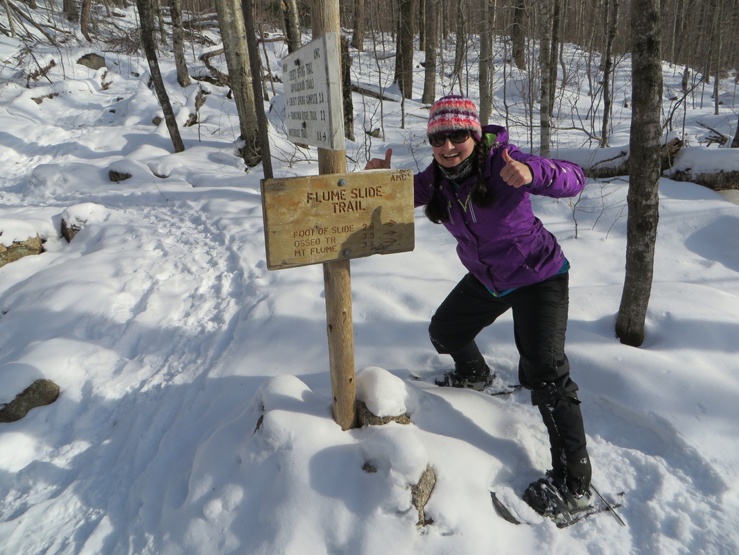
Yup, that's what I thought!
Kyle takes a break before we head back to the car
 RSS Feed