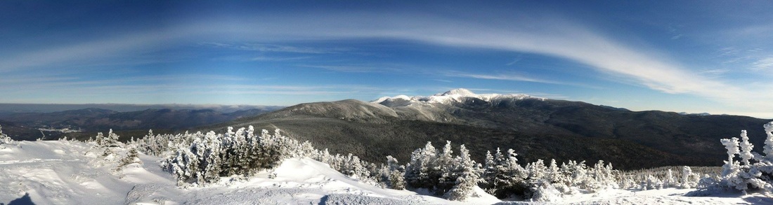
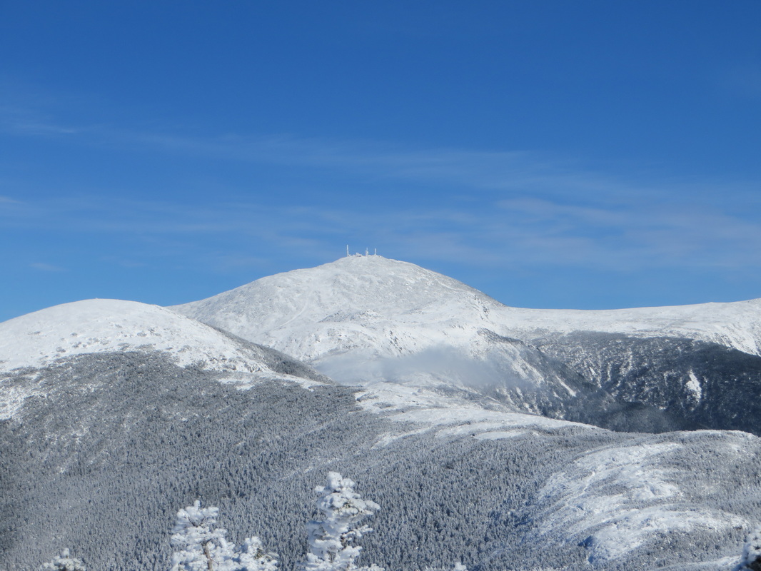
Amazing panoramic photo taken by Kyle Legg from the summit of Mt. Jackson
First, let's go back to the time of SAT prep:
Powder Day :: Skier as Presi Day ::
A) Biker
B) Boater
C) Shopper
D) Hiker
Since this is a blog about hiking you probably guessed D correctly. In the world of White Mountain hiking, the term 'Presi Day' refers to any day that is suitable for a visit to the above treeline alpine zone of the Presidential Range. While this term is used in all four seasons, it is during wintertime when it becomes gold. It is an unspoken rule among hiking friends that all hiking plans for any given day become null and void if it turns out to be a 'Presi Day.' Most people know that mountain weather is often hard to predict and can be extremely volatile on short notice. The Presidential Range is no different and its highest peak, Mt. Washington, is known as being the "home of the world's worst weather." If you want to learn more about the weather on Mt. Washington I would highly recommend visiting the Mount Washington Observatory's website to learn more. I spent a week volunteering on the summit of Mt. Washington and I have seen first hand the incredible weather scenarios that can unfold in a short time! So with all of that being said, if the weather dictates a Presi Day (clear skies, no chance of precipitation, moderate temperatures and no or low wind), then you head to the Presidentials and hike!
The other thing about the mountain weather forecast is it is not reliable until about 36 hours out. It usually comes down to making a decision the morning of the hike as even a minor increase in wind for the day can mean a lower wind chill factor which can become unsafe in terms of exposure. This was the case Tuesday for Kyle and I.
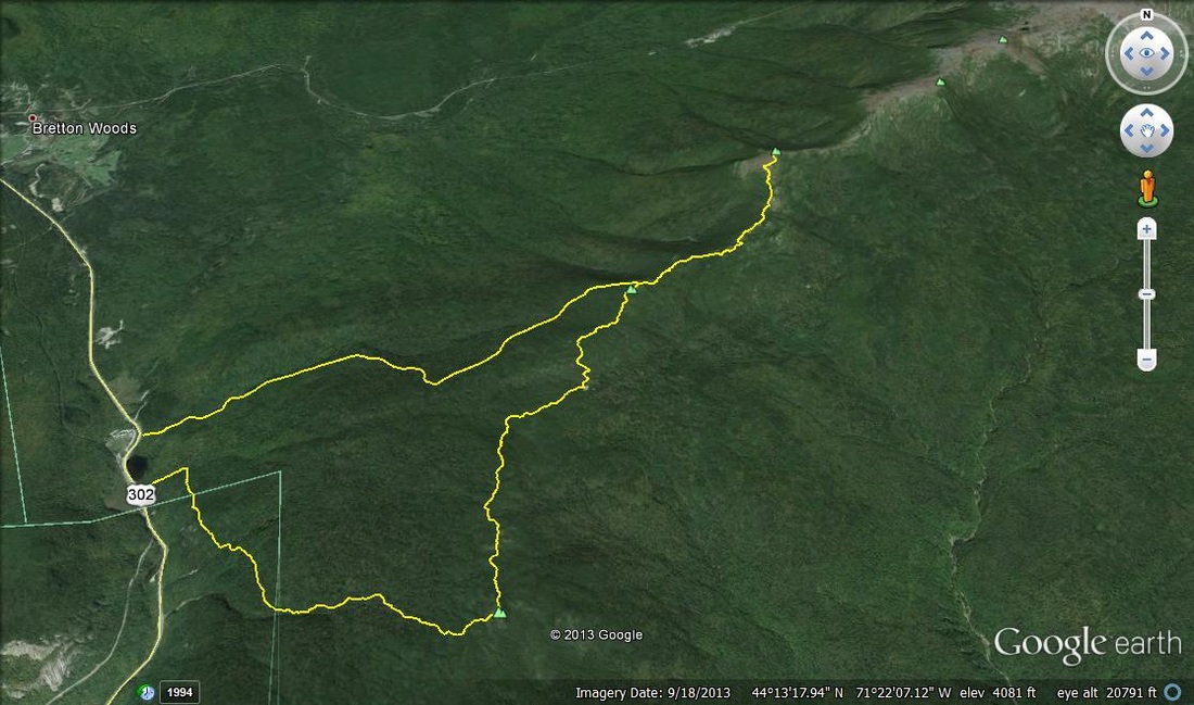
Kyle had been chomping at the bit to get in a hike above treeline and to be honest, I had been feeling the same way for awhile. Our original plan for the day that we kept all the way up until the night before the hike was to hike up the Ammonoosuc Ravine Trail to the Lakes of the Clouds Hut then up to Mt. Monroe then over to Mt. Washington then over to Mt. Jefferson then back down the Jewell Trail to the car. The forecast hadn't changed much in the days leading up to our hike; bright sunshine, little cloud cover, OK temps (high teens), and very light wind (10-15 MPH). The forecast was slightly different when I woke up at 4:30 Tuesday morning. The winds had picked up to 30-45 MPH with potential gusts up to 55 MPH making the wind chill dangerously low. Knowing we would be exposed above treeline most of the day I made the call to scrap Plan A and go with Plan B which would be a nice 11 mile hike through the southern Presidentials (the winds were forecasted to be a little bit quieter over here too). We would have the complete coverage of the trees between Jackson and Pierce and some partial shelter provided by the scrub (alpine shrubs) between Pierce and Eisenhower. Plan A would have to wait for a warmer day and less windy day.
We met at the Highland Center at the top of Crawford Notch just after the sun had come up. We began our hike shortly after 7:00 on the Webster-Jackson Trail which is a short 0.2 of a mile down the road from the Highland Center. The Webster-Jackson Trail is short but has lots of short steep pushes to keep the heart rate up. The trail was nicely packed out from the very beginning and only had a couple of fresh inches of powder on it as we gained elevation. Kyle chose to wear his Microspikes while I decided to strap on my snowshoes asI knew I would need them on eventually and I absolutely detest wearing them on my back. Yes, I am a rare breed of winter hiker that actually prefers to have snow shoes on my feet when at all possible!
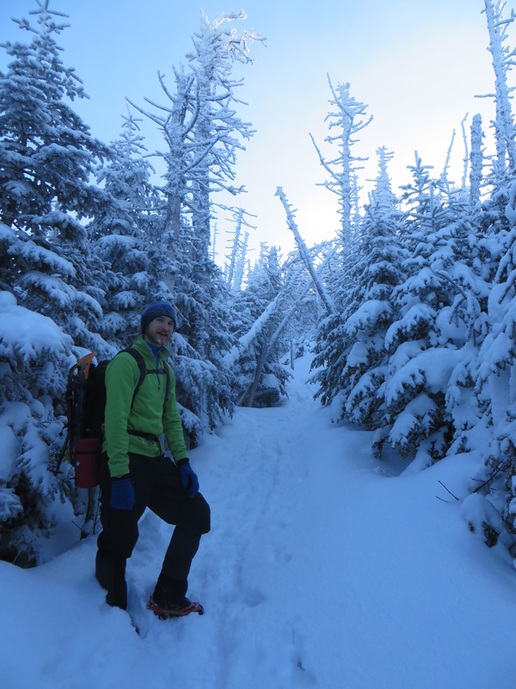
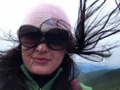
The wind picked up a bit as we approached the summit. We stopped to layer up and take in our first views of the day. It was breathtaking. The sky was incredibly blue with hints of light pink here and there. Sights like these are a huge payoff for starting a hike early in the morning. Once on the summit, the wind was driving into us in a straight line, it was bitter and made me glad I was not standing on one the peaks of the northern Presidentials. We snapped some pics then headed down into the col to make our way over to Mizpah Hut and then up to Mt. Pierce.
Powder Day :: Skier as Presi Day ::
A) Biker
B) Boater
C) Shopper
D) Hiker
Since this is a blog about hiking you probably guessed D correctly. In the world of White Mountain hiking, the term 'Presi Day' refers to any day that is suitable for a visit to the above treeline alpine zone of the Presidential Range. While this term is used in all four seasons, it is during wintertime when it becomes gold. It is an unspoken rule among hiking friends that all hiking plans for any given day become null and void if it turns out to be a 'Presi Day.' Most people know that mountain weather is often hard to predict and can be extremely volatile on short notice. The Presidential Range is no different and its highest peak, Mt. Washington, is known as being the "home of the world's worst weather." If you want to learn more about the weather on Mt. Washington I would highly recommend visiting the Mount Washington Observatory's website to learn more. I spent a week volunteering on the summit of Mt. Washington and I have seen first hand the incredible weather scenarios that can unfold in a short time! So with all of that being said, if the weather dictates a Presi Day (clear skies, no chance of precipitation, moderate temperatures and no or low wind), then you head to the Presidentials and hike!
The other thing about the mountain weather forecast is it is not reliable until about 36 hours out. It usually comes down to making a decision the morning of the hike as even a minor increase in wind for the day can mean a lower wind chill factor which can become unsafe in terms of exposure. This was the case Tuesday for Kyle and I.
Kyle had been chomping at the bit to get in a hike above treeline and to be honest, I had been feeling the same way for awhile. Our original plan for the day that we kept all the way up until the night before the hike was to hike up the Ammonoosuc Ravine Trail to the Lakes of the Clouds Hut then up to Mt. Monroe then over to Mt. Washington then over to Mt. Jefferson then back down the Jewell Trail to the car. The forecast hadn't changed much in the days leading up to our hike; bright sunshine, little cloud cover, OK temps (high teens), and very light wind (10-15 MPH). The forecast was slightly different when I woke up at 4:30 Tuesday morning. The winds had picked up to 30-45 MPH with potential gusts up to 55 MPH making the wind chill dangerously low. Knowing we would be exposed above treeline most of the day I made the call to scrap Plan A and go with Plan B which would be a nice 11 mile hike through the southern Presidentials (the winds were forecasted to be a little bit quieter over here too). We would have the complete coverage of the trees between Jackson and Pierce and some partial shelter provided by the scrub (alpine shrubs) between Pierce and Eisenhower. Plan A would have to wait for a warmer day and less windy day.
We met at the Highland Center at the top of Crawford Notch just after the sun had come up. We began our hike shortly after 7:00 on the Webster-Jackson Trail which is a short 0.2 of a mile down the road from the Highland Center. The Webster-Jackson Trail is short but has lots of short steep pushes to keep the heart rate up. The trail was nicely packed out from the very beginning and only had a couple of fresh inches of powder on it as we gained elevation. Kyle chose to wear his Microspikes while I decided to strap on my snowshoes asI knew I would need them on eventually and I absolutely detest wearing them on my back. Yes, I am a rare breed of winter hiker that actually prefers to have snow shoes on my feet when at all possible!
The wind picked up a bit as we approached the summit. We stopped to layer up and take in our first views of the day. It was breathtaking. The sky was incredibly blue with hints of light pink here and there. Sights like these are a huge payoff for starting a hike early in the morning. Once on the summit, the wind was driving into us in a straight line, it was bitter and made me glad I was not standing on one the peaks of the northern Presidentials. We snapped some pics then headed down into the col to make our way over to Mizpah Hut and then up to Mt. Pierce.
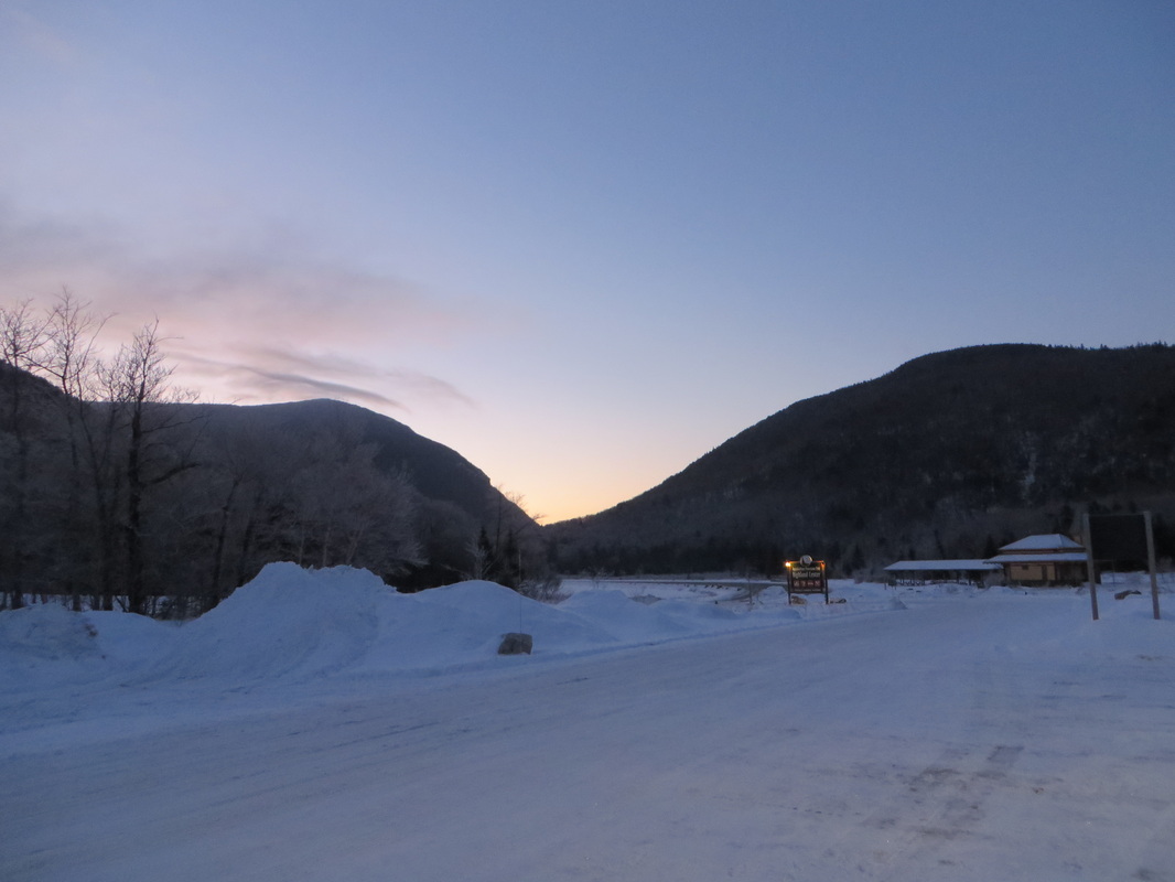
The sun coming up at the Highland Center
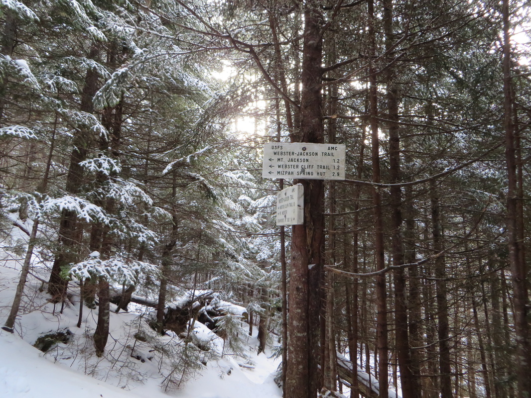
Making our way up the Jackson branch of the Webster-Jackson Trail
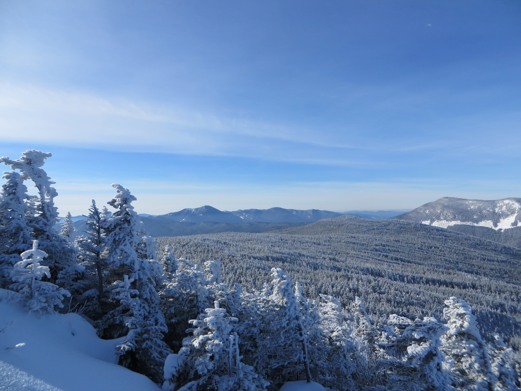
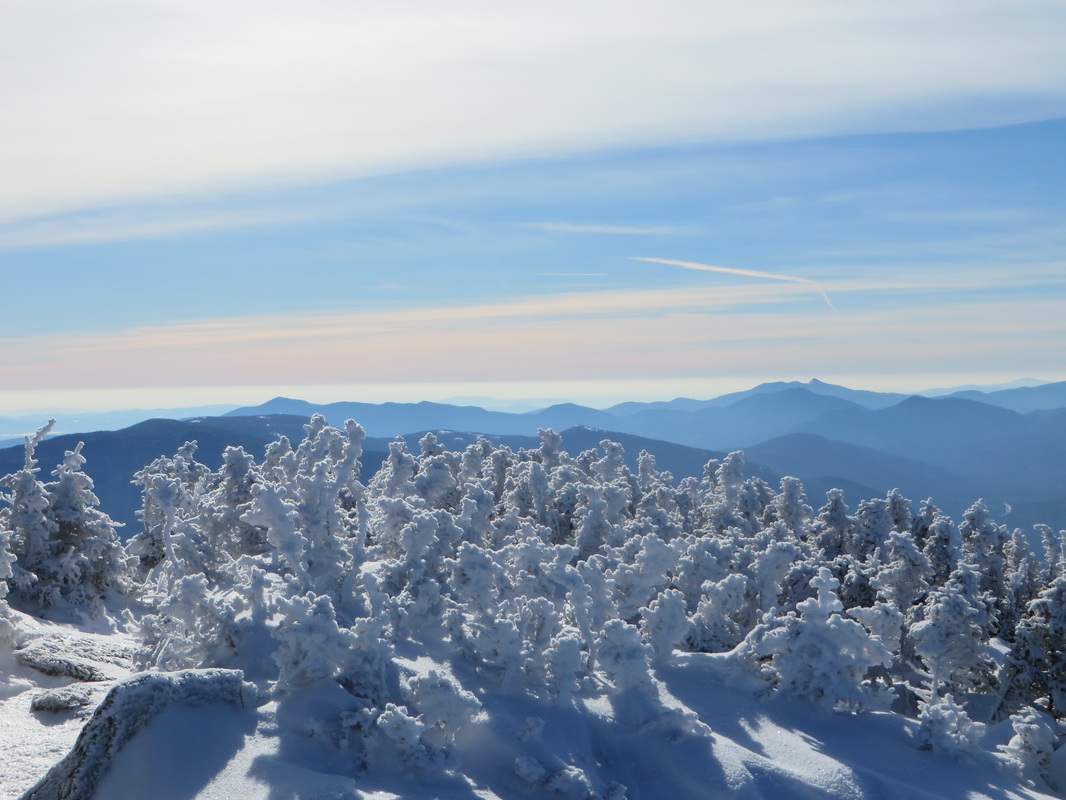
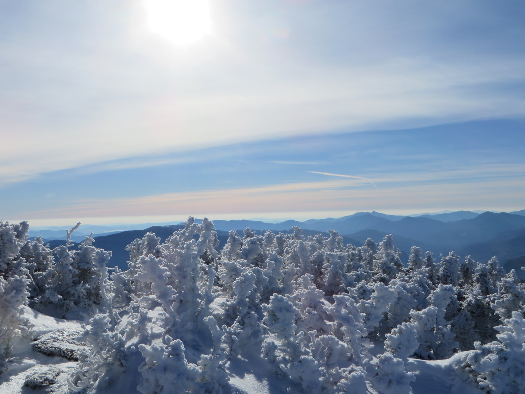
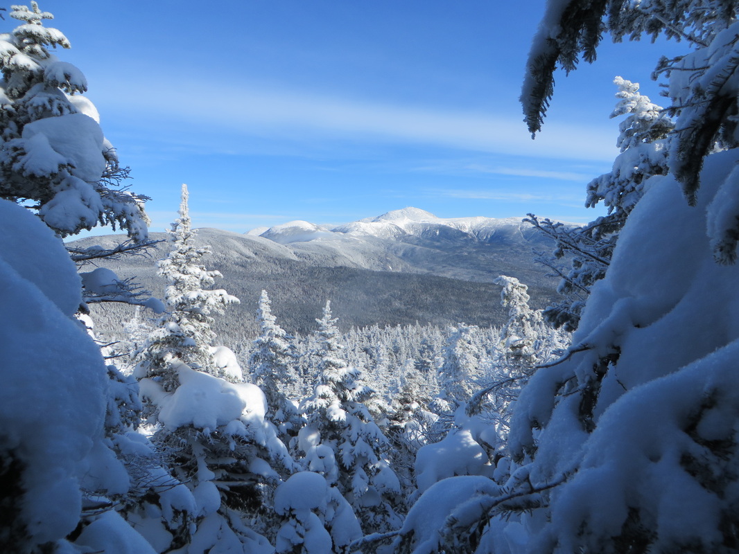
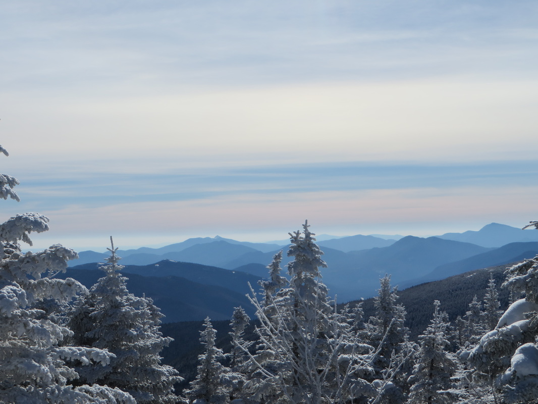
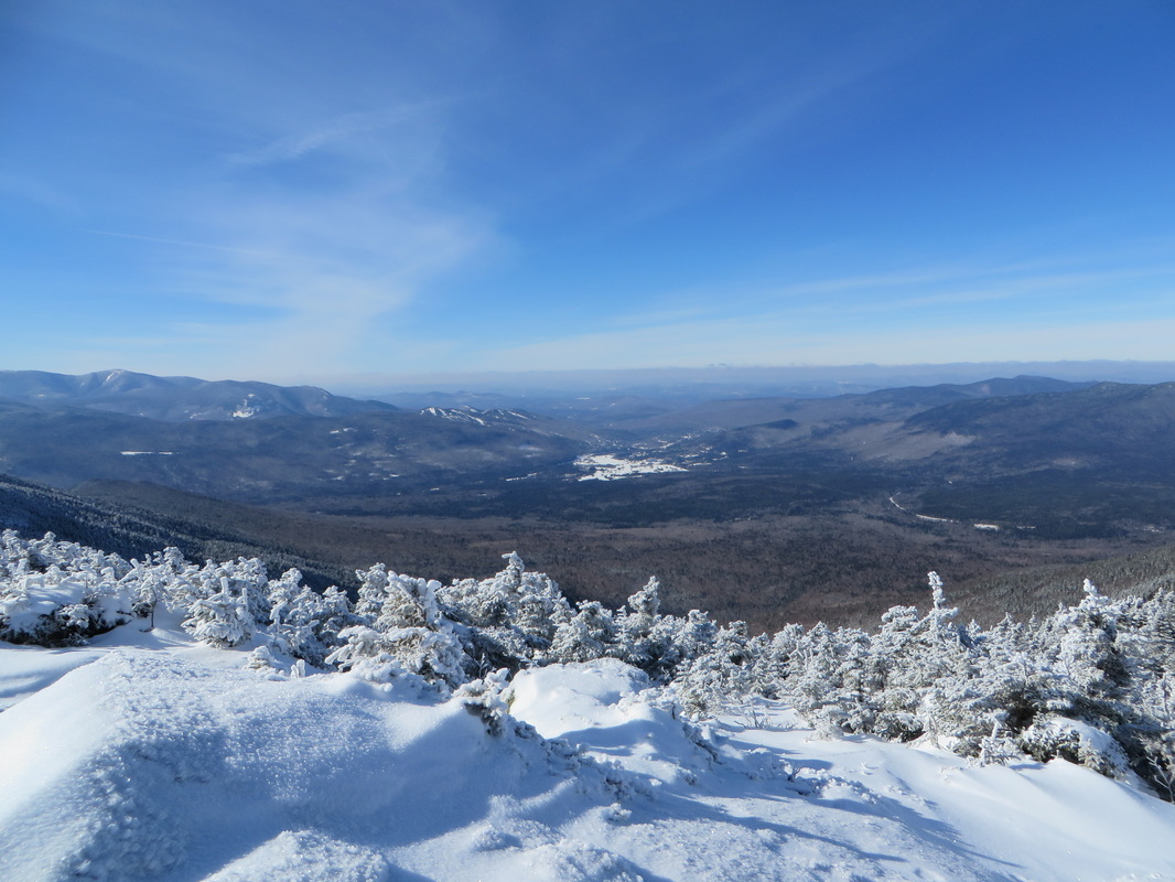
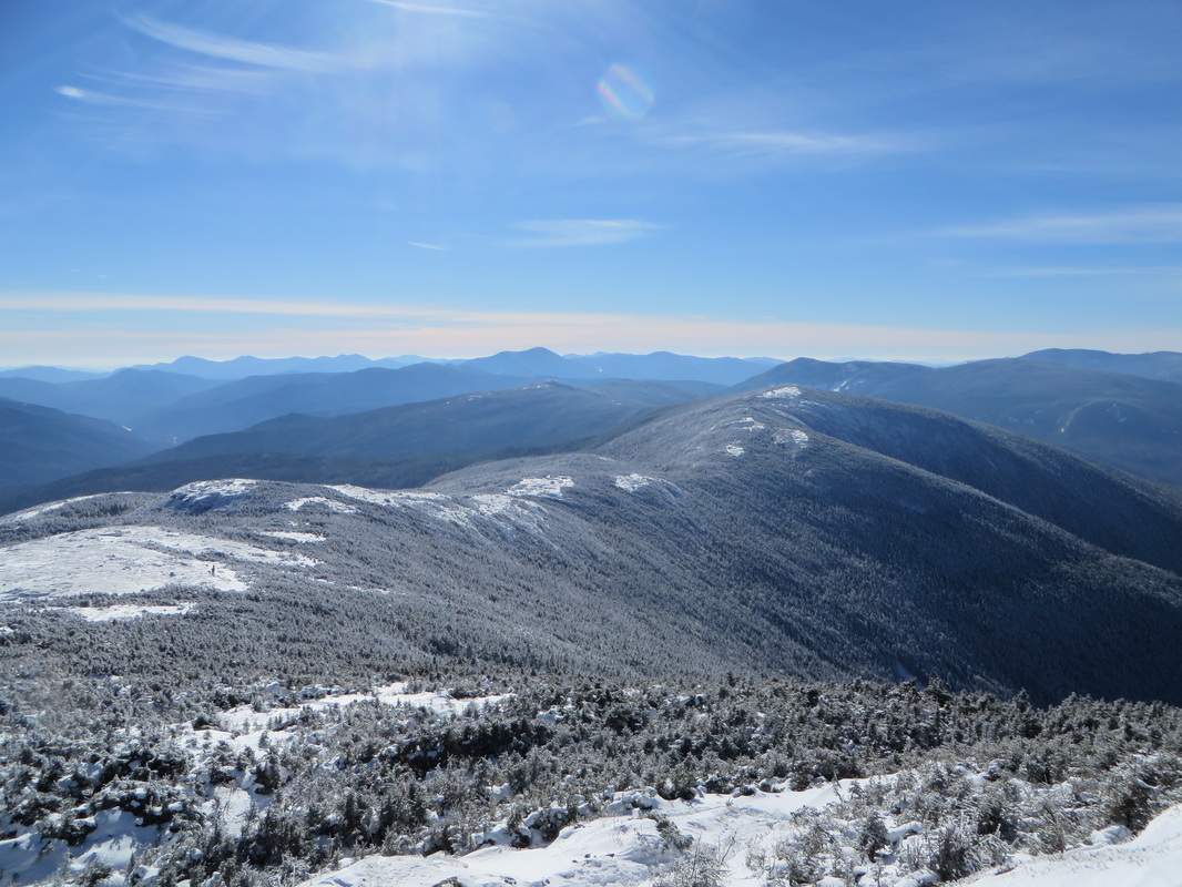
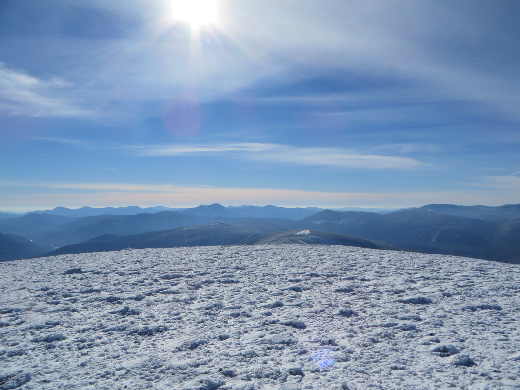
First views
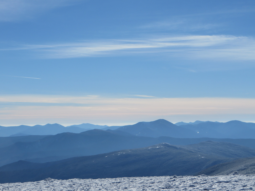
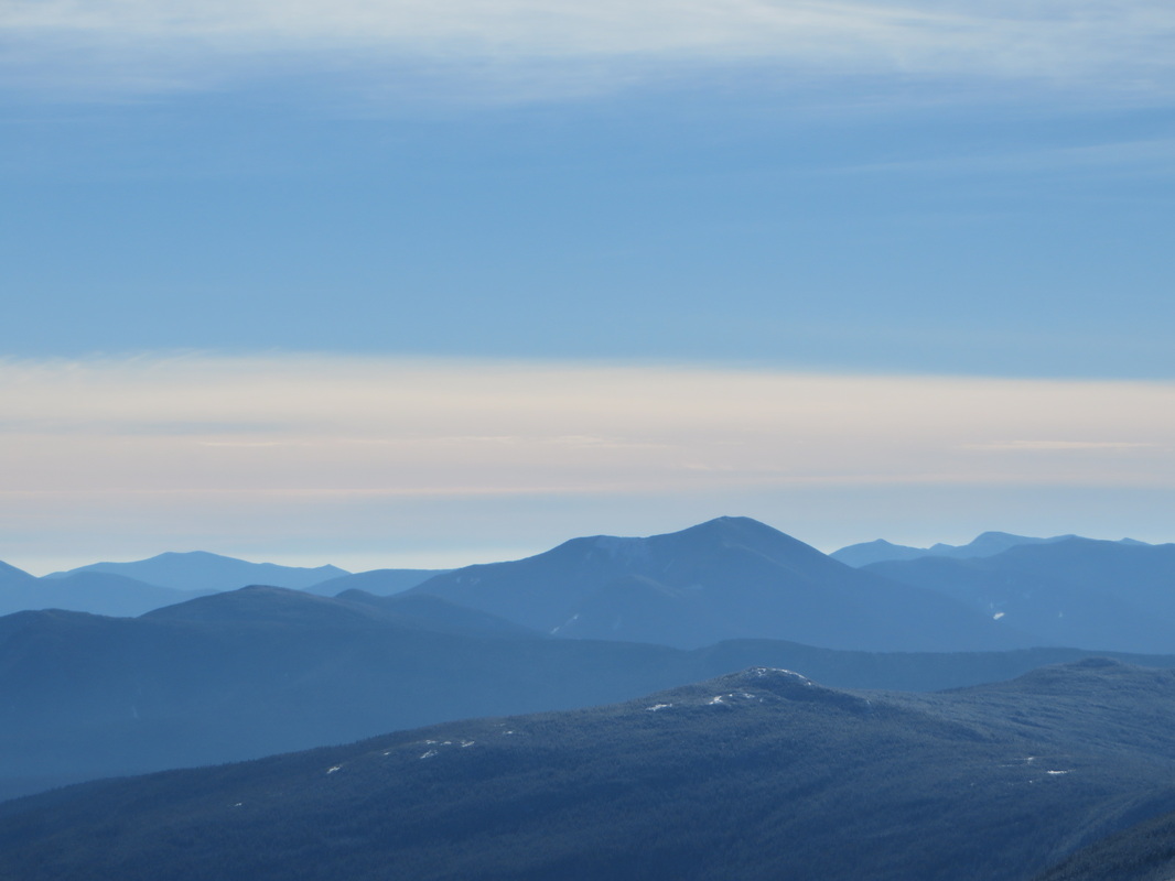
The Willey Range
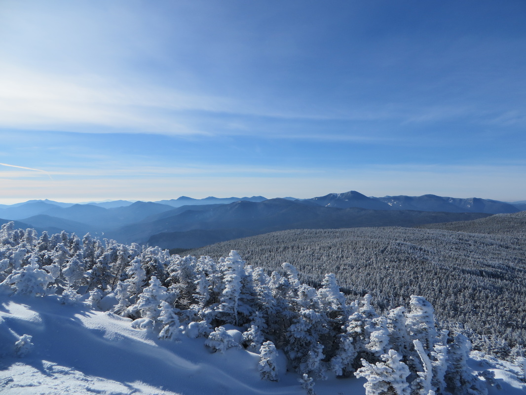
Mt. Carrigain and Signal Ridge
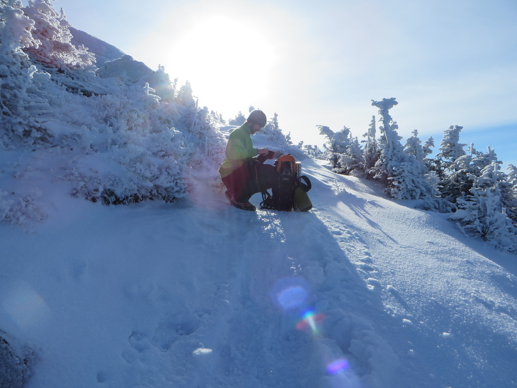
Kyle layers up before popping up onto the summit
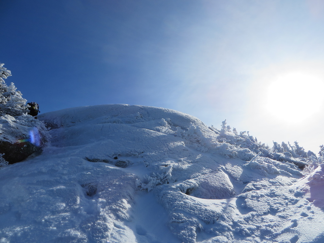
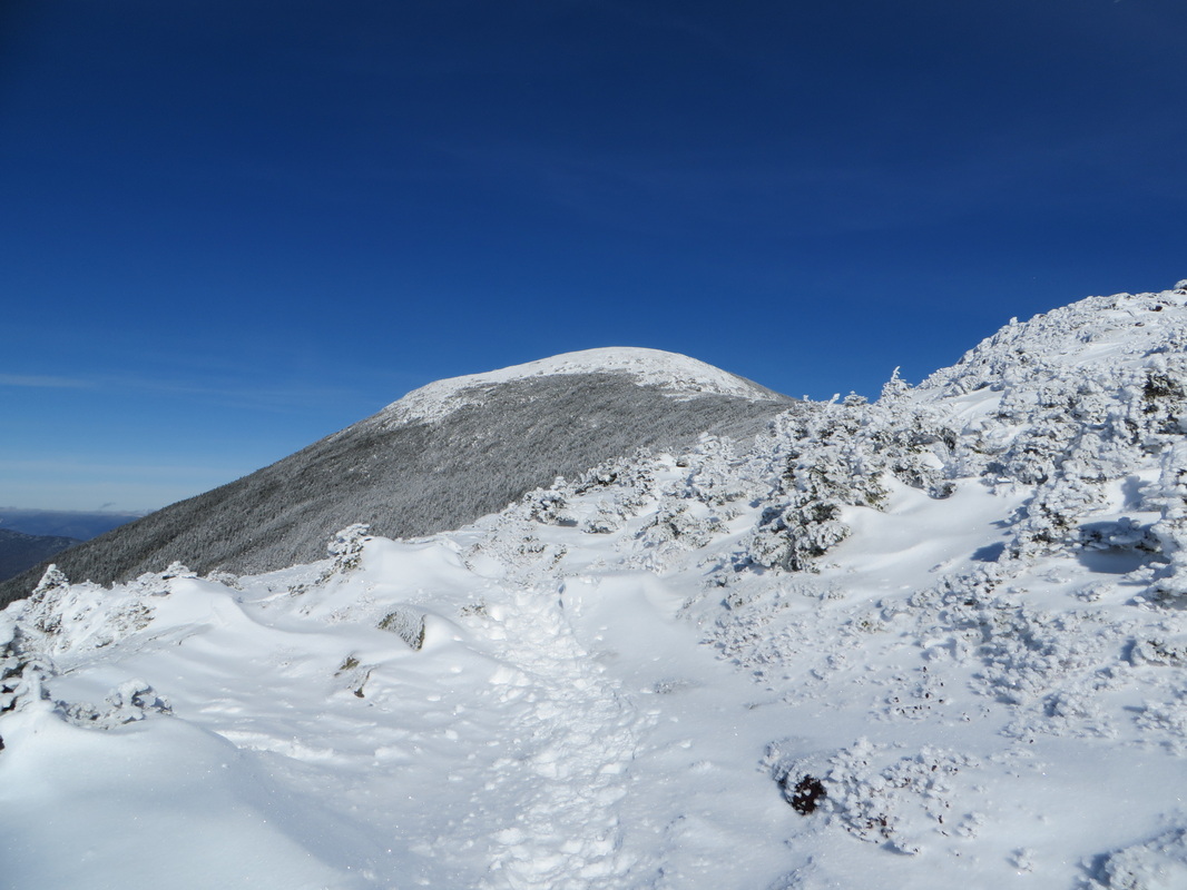
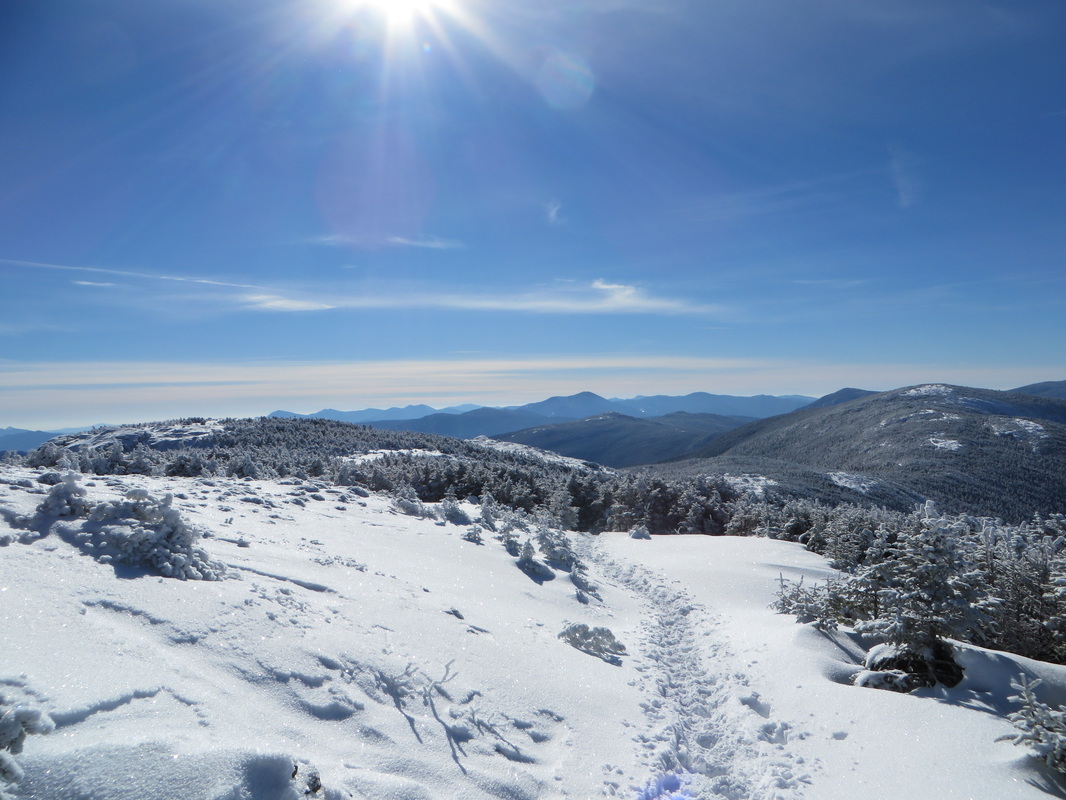
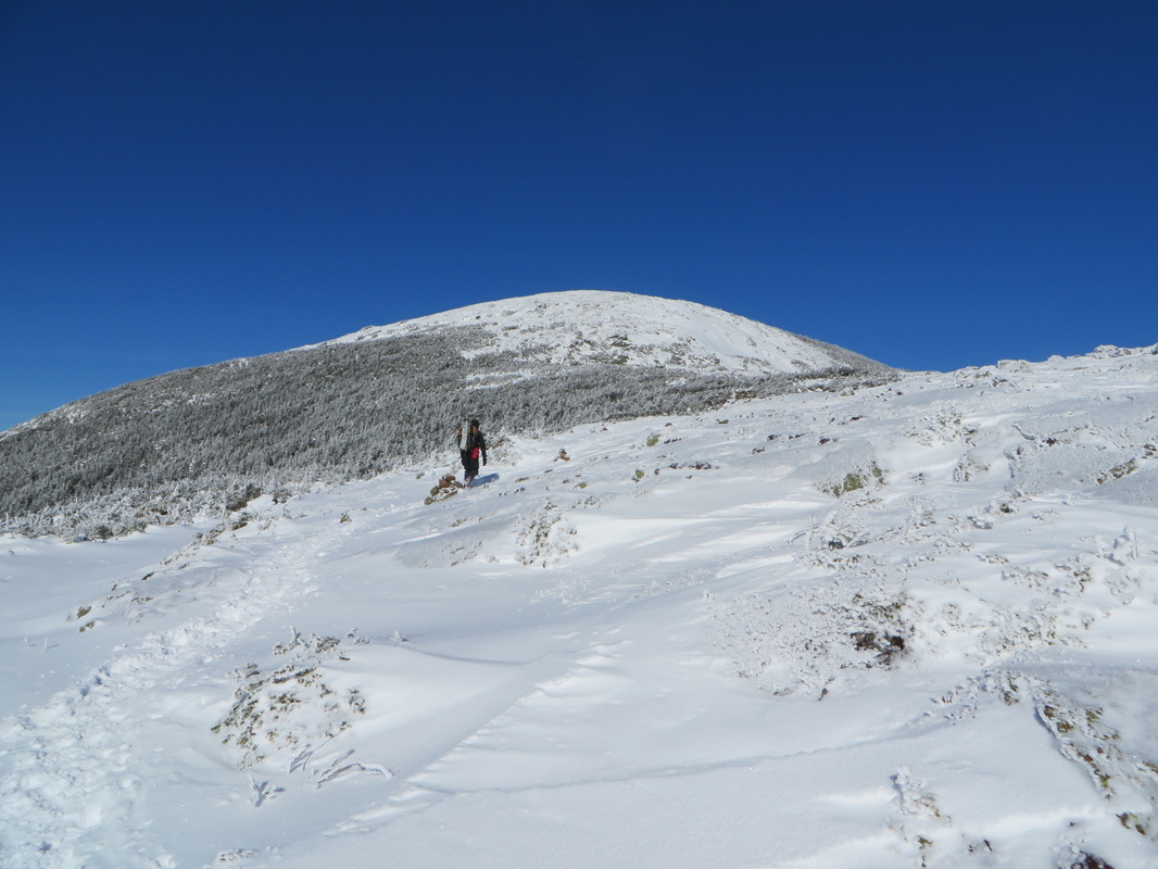
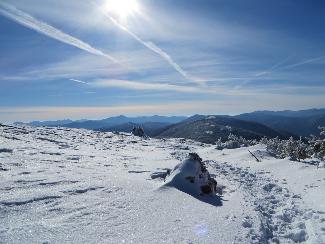
Approaching the summit
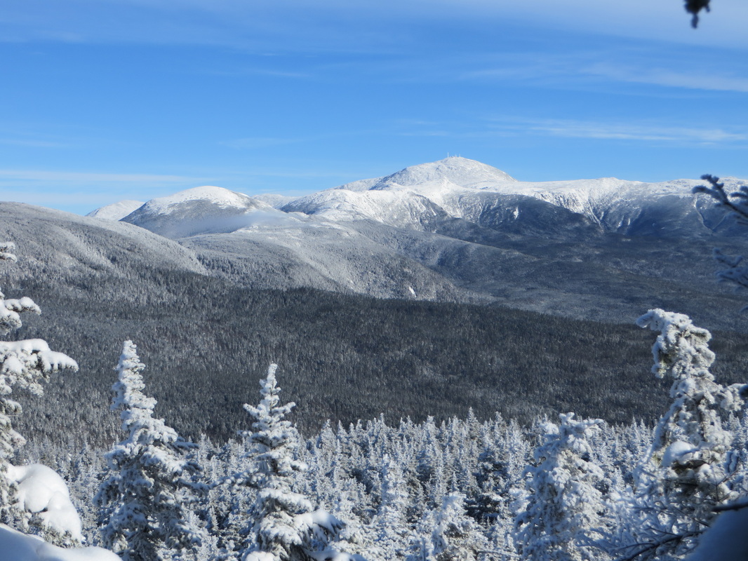
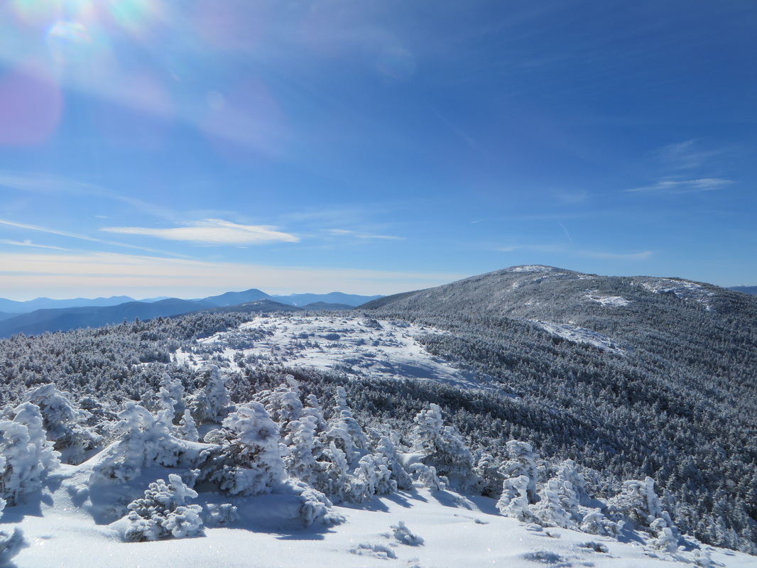
Magical
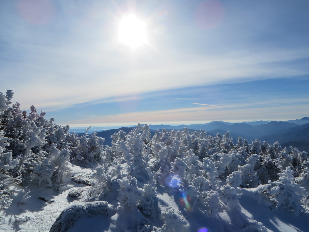
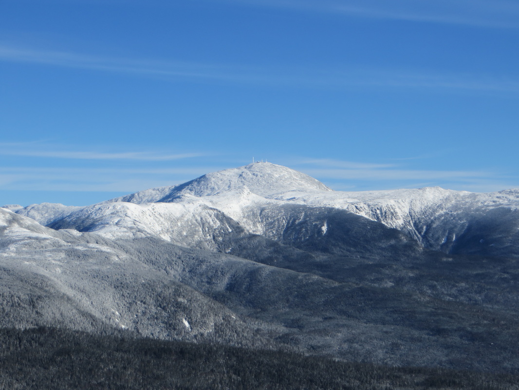
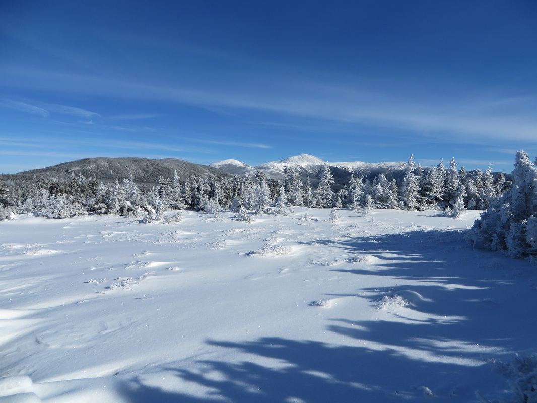
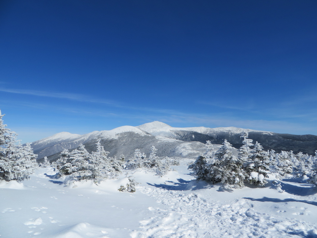
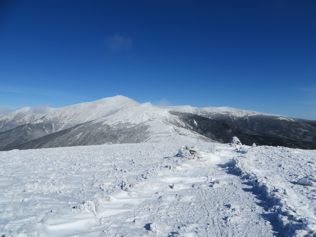
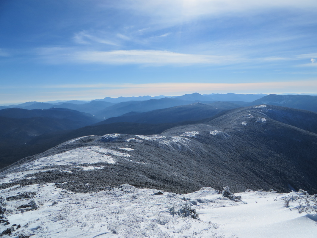
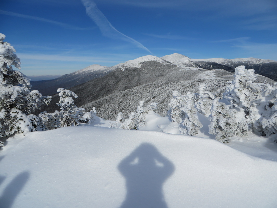
The summit of Mt. Jackson with the rest of the Presidential Range in the distance
George looks so handsome dressed in his winter whites!
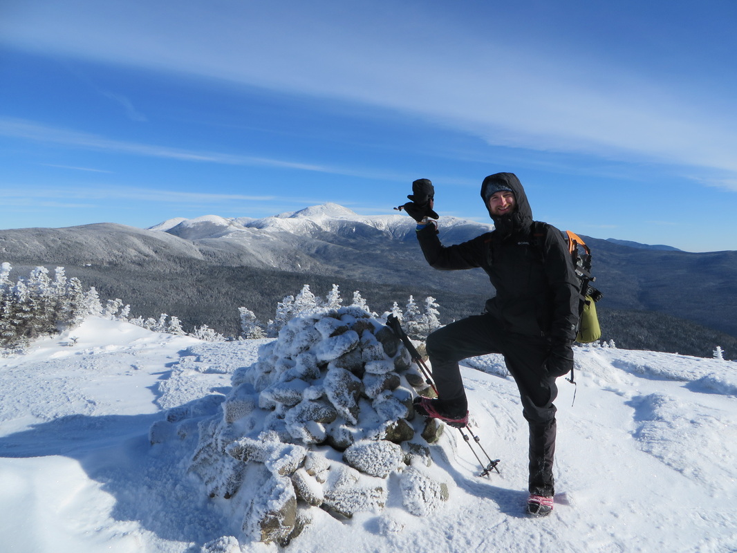
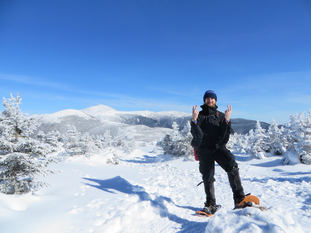
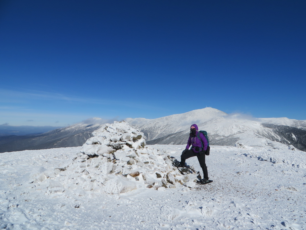
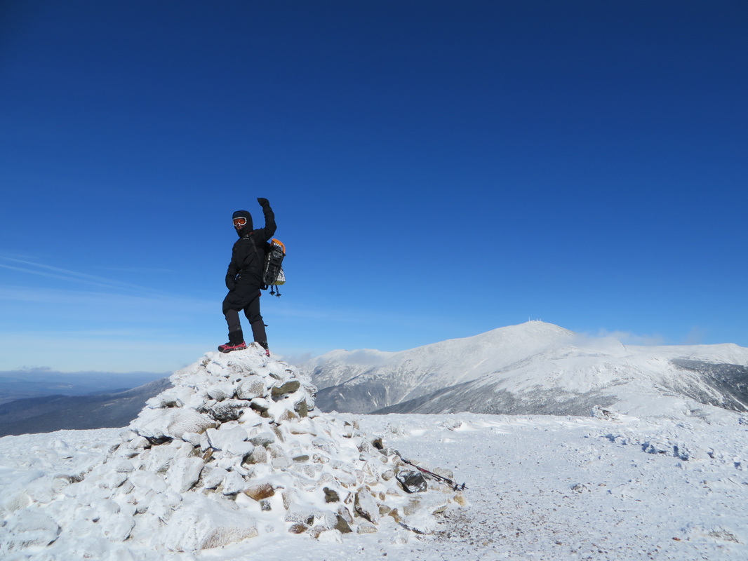
Kyle on the summit
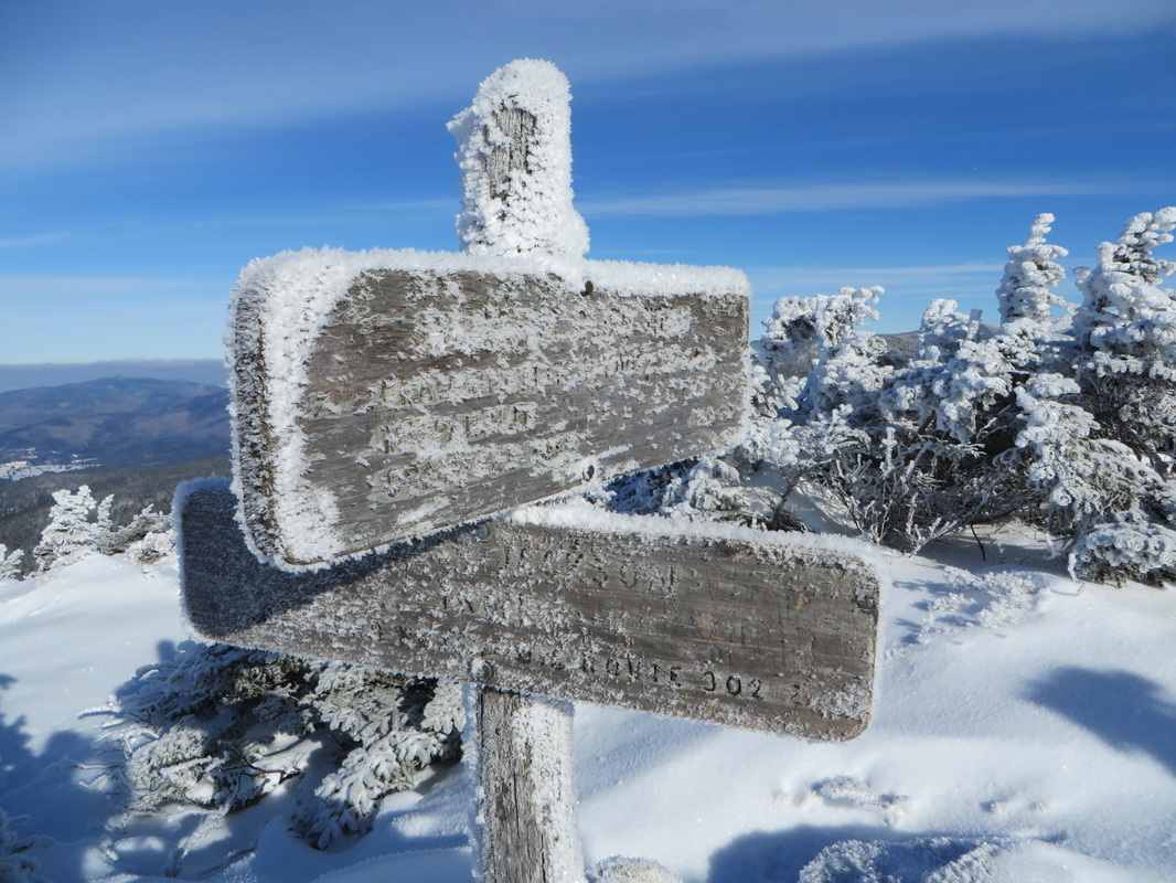
Summit of Mt. Jackson: Winter 4K #28!
Mountain hug
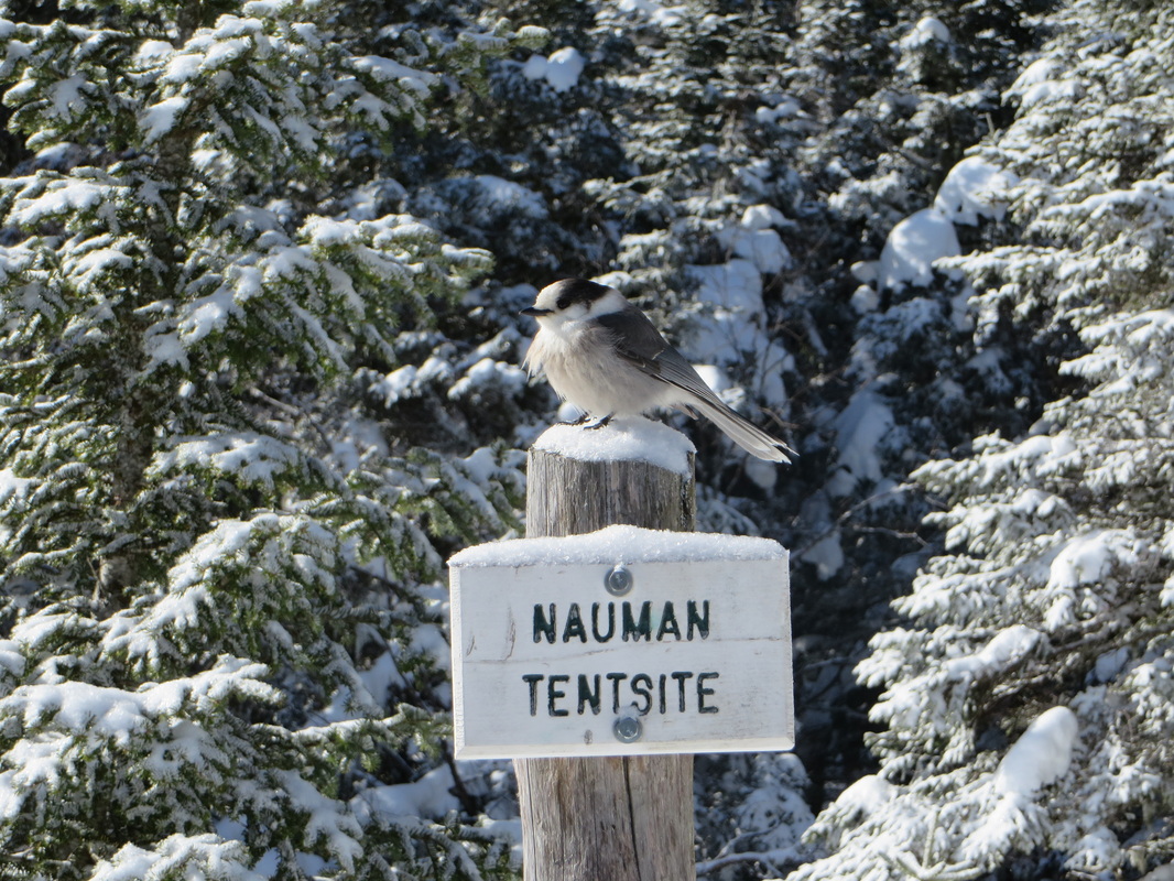
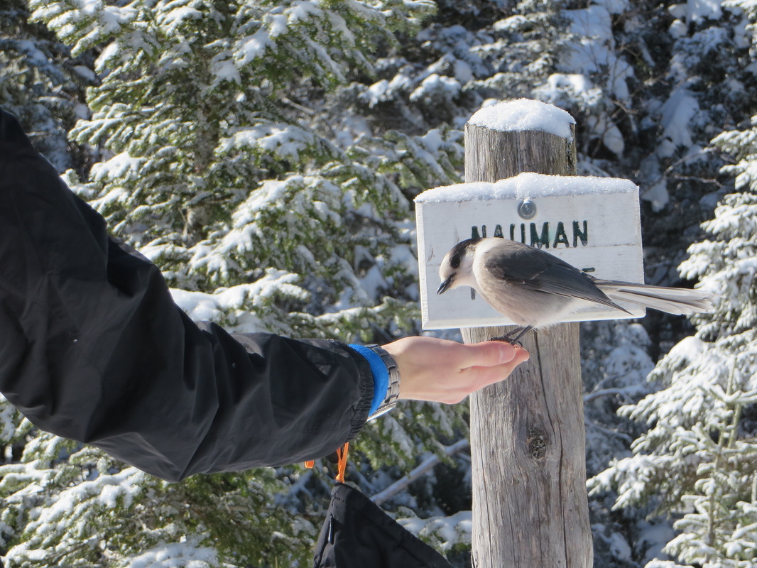
From the summit of Jackson it is 2.4 miles to reach the summit of Mt. Pierce. The AMC Mizpah Spring Hut is reached after 1.6 miles and though it is not open during the winter, it is a great spot to stop and take a break. The Gray Jays greeted us shortly before we reached the hut despite neither one of us having any food out yet. I guess they were lonely though they are nice and fat so someone has been around to feed them! After a quick snack break at the hut we continued on for another 0.8 of a mile where we reached the summit of Pierce. The wind was not nearly as strong as it had been on Jackson and the sun was shining down in full force making it feel that much warmer. We snapped countless pictures before moving onward towards Eisenhower.
One last view before ducking back down into the trees on the way to Pierce
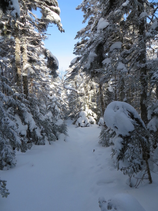
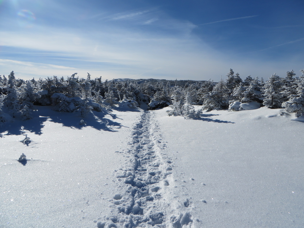
More fresh powder in the col between Jackson and Pierce
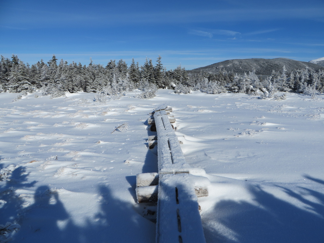
An open alpine bog area
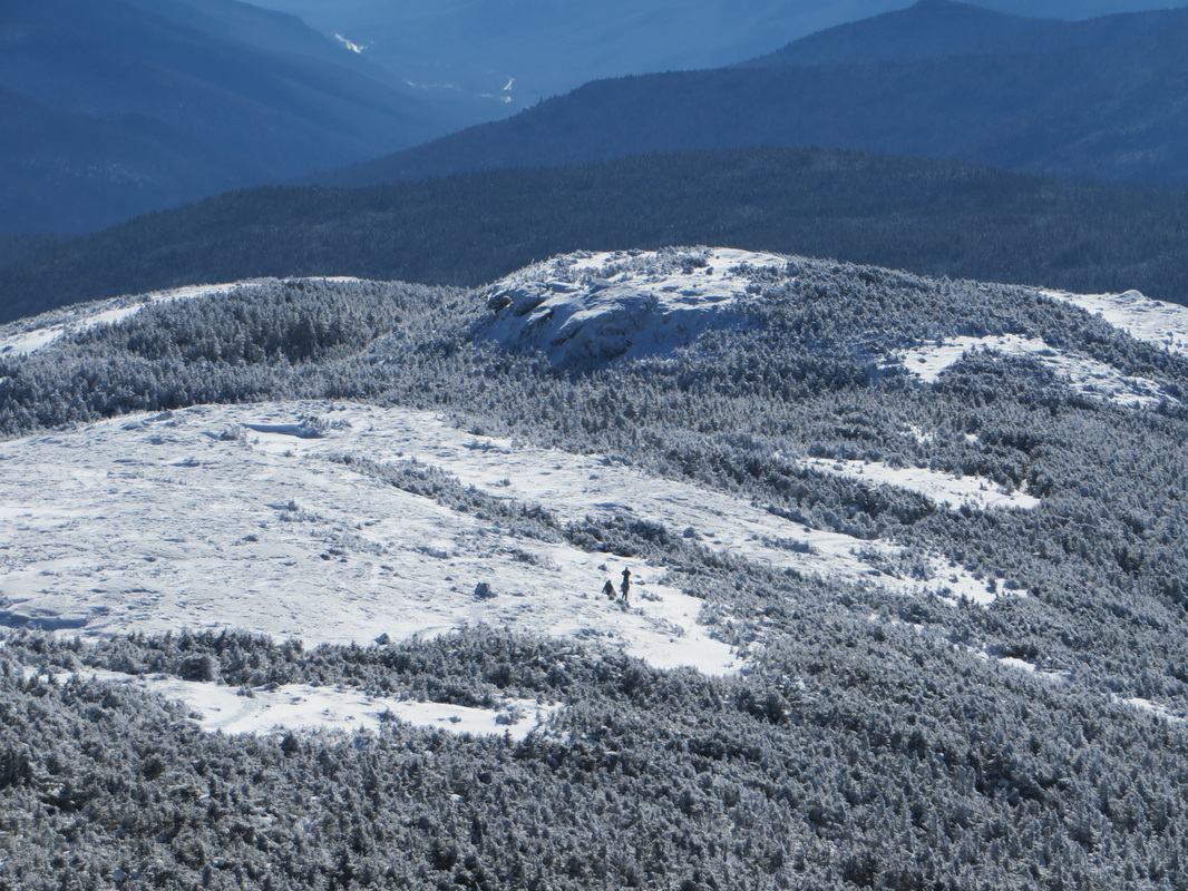
Looking back at Jackson
Here comes Kyle!
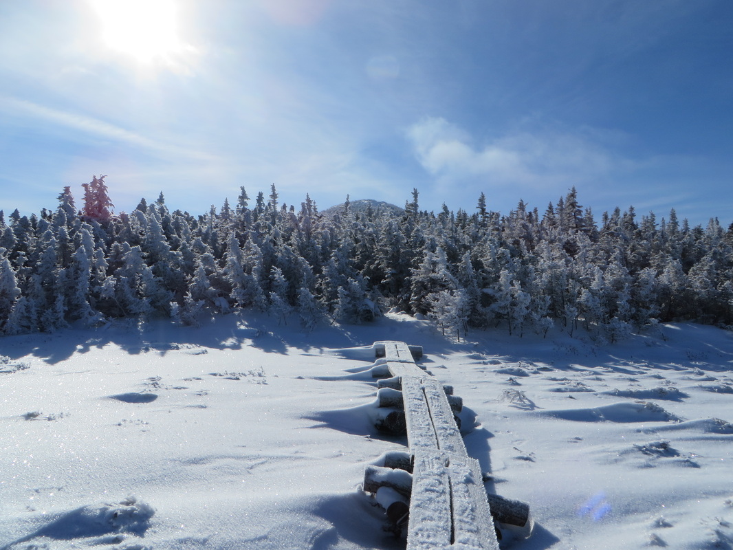
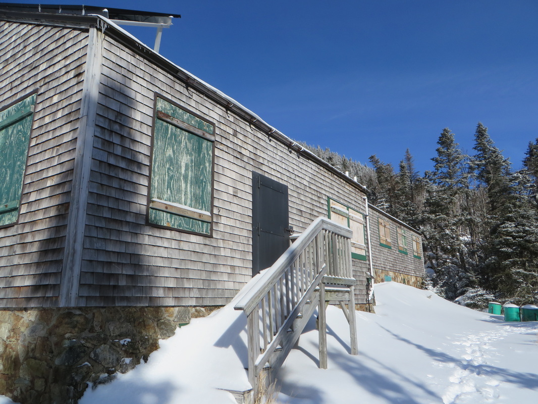
Approaching the hut
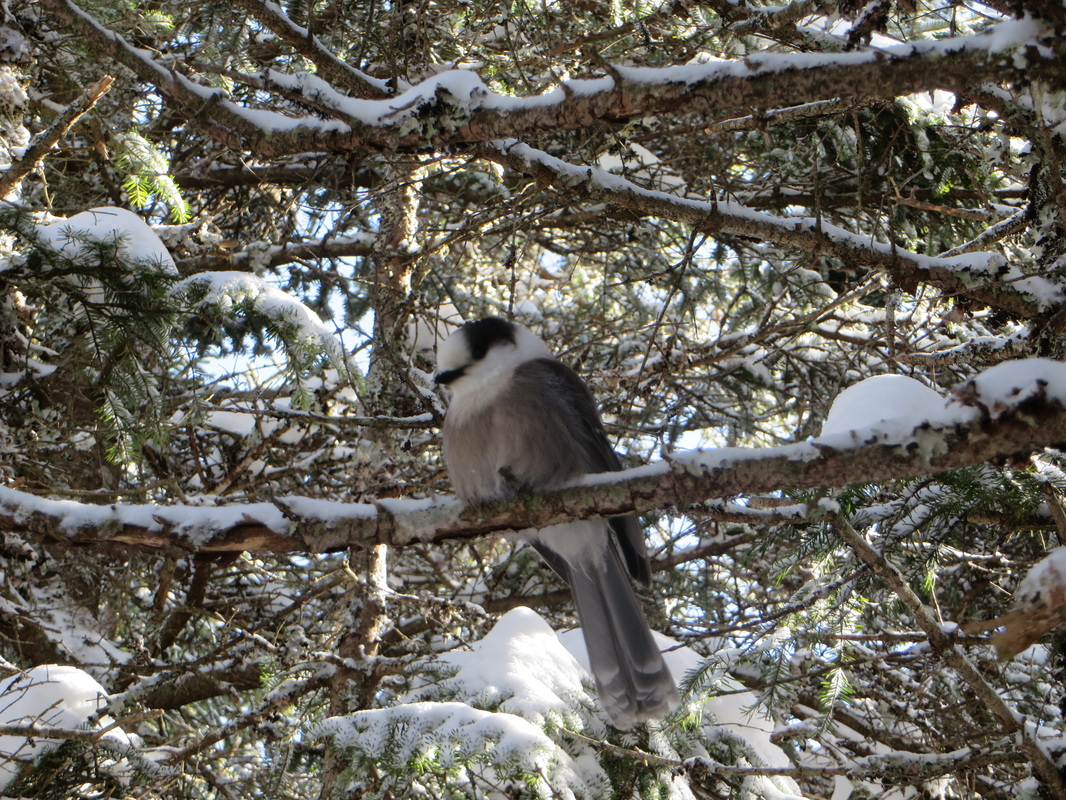
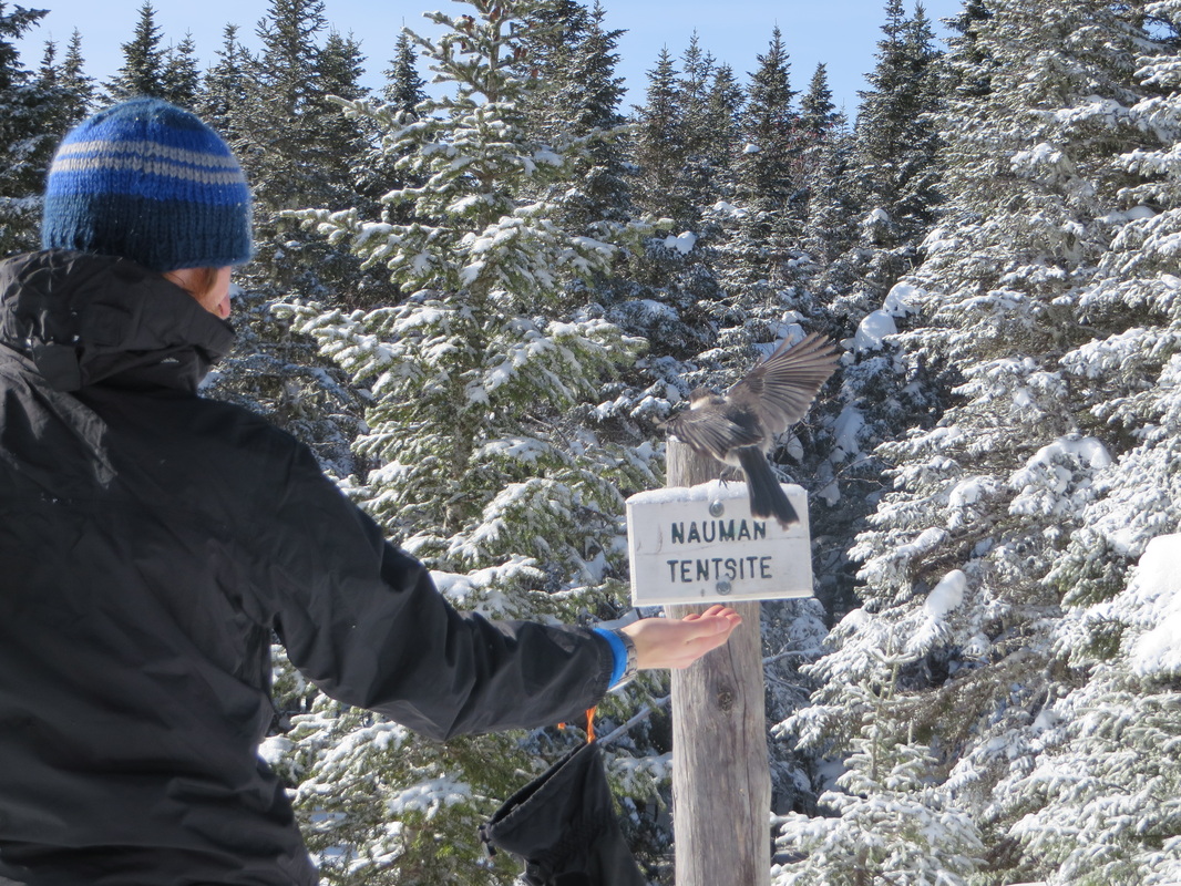
Our welcoming party!
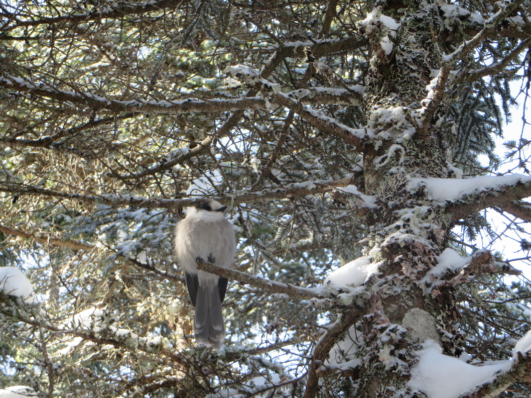
What's up Chubbs?
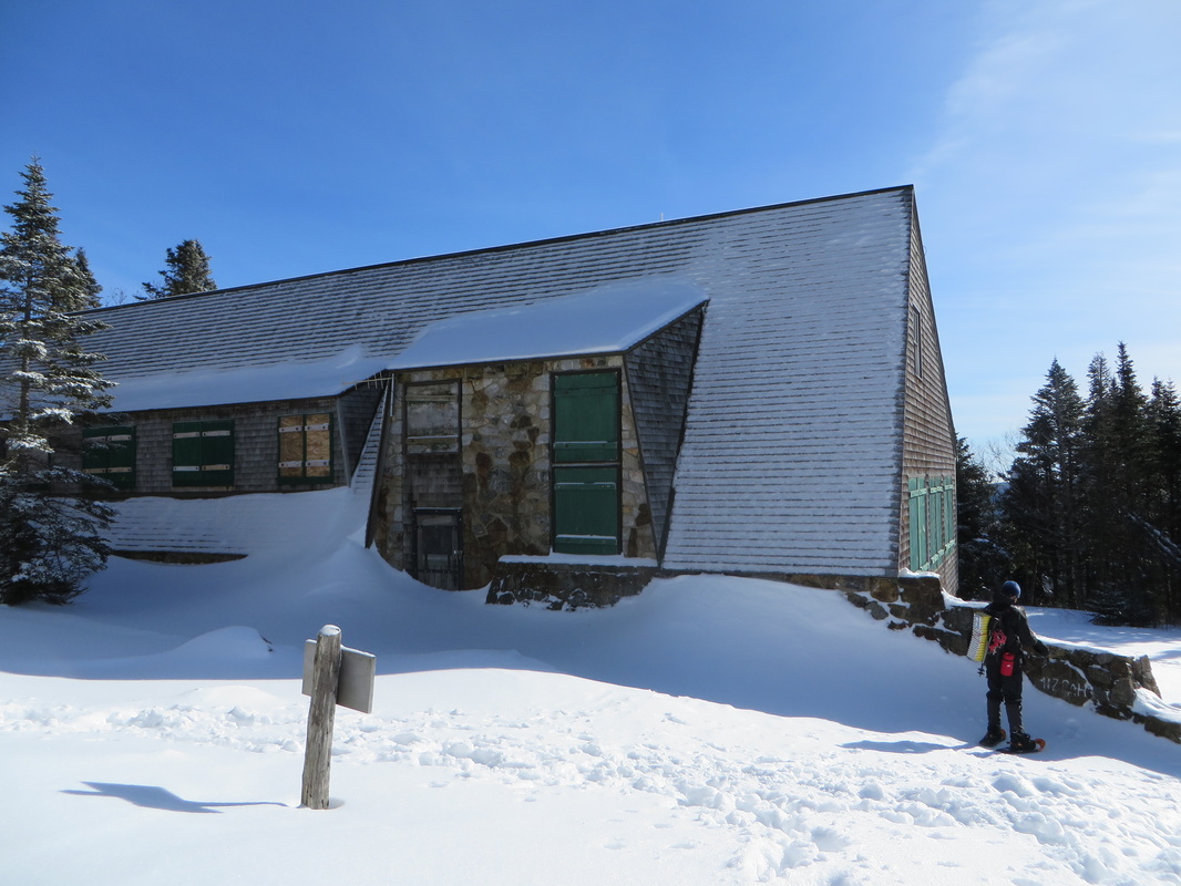
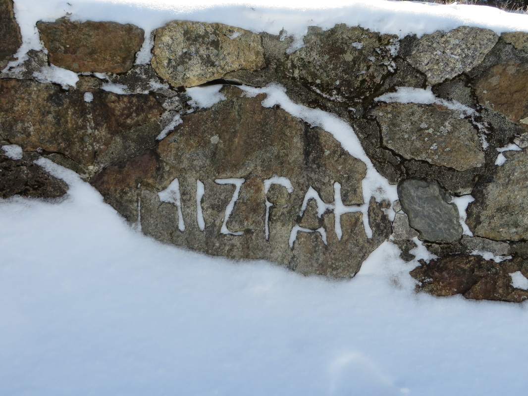
AMC Mizpah Spring Hut
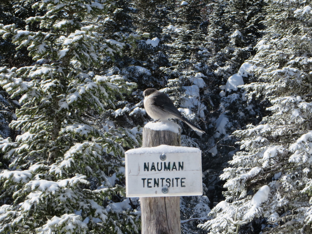
Chubbs is back
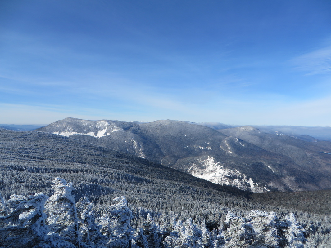
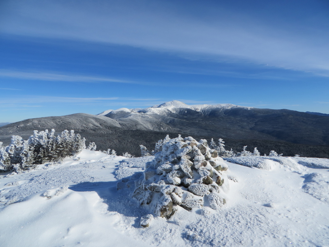
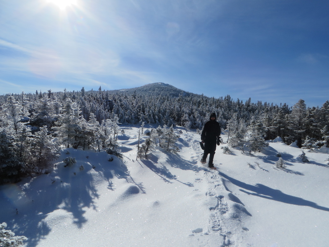
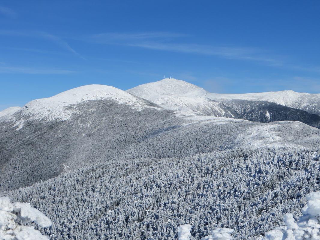
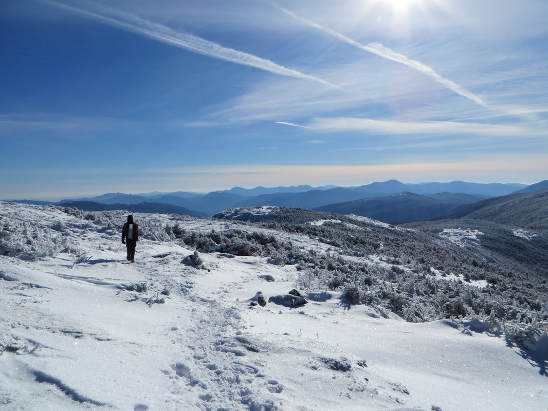
First views from the backside of Pierce
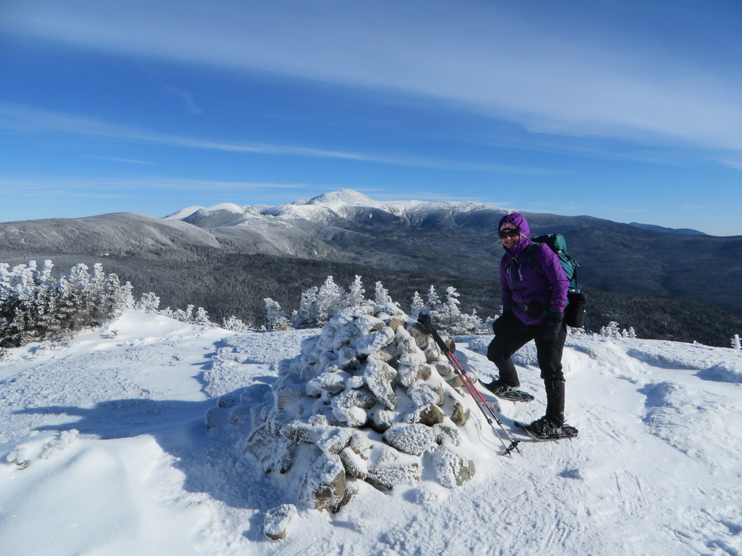
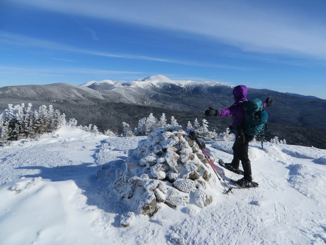
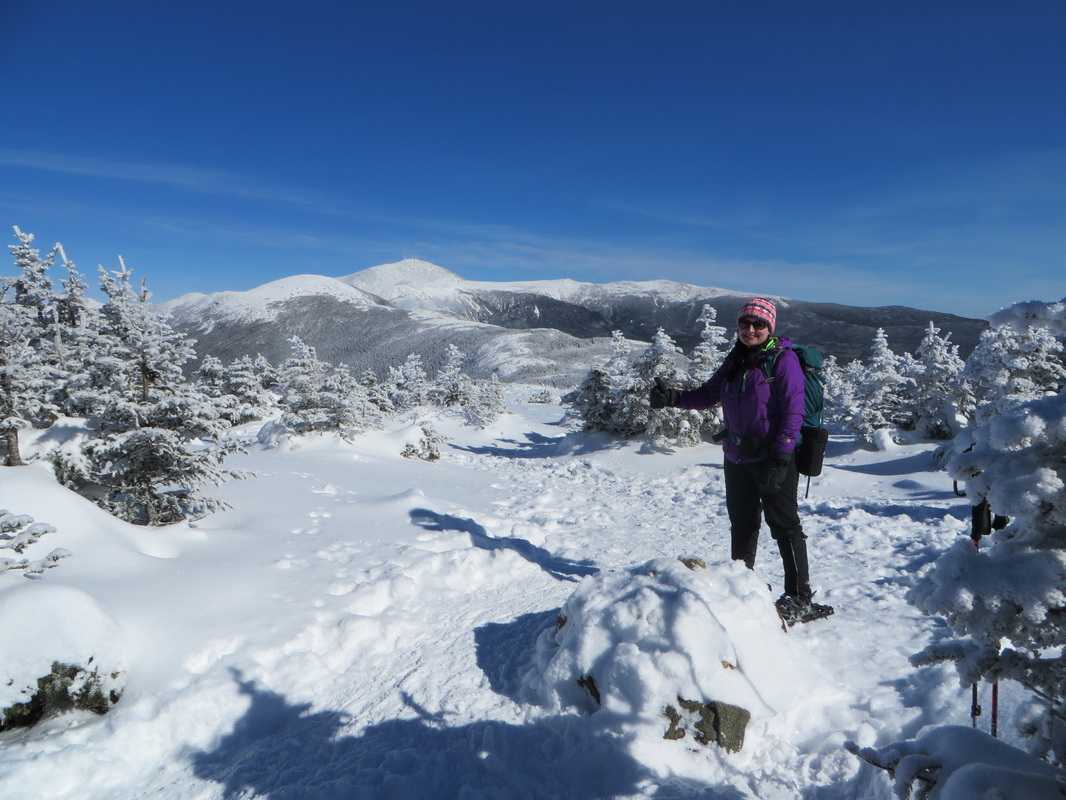
The view from the summit of Pierce
Winter 4K #22 for Kyle!
I got Pierce last winter but this hike will count towards my single season winter 48 finish if I have enough days left to finish the remaining peaks
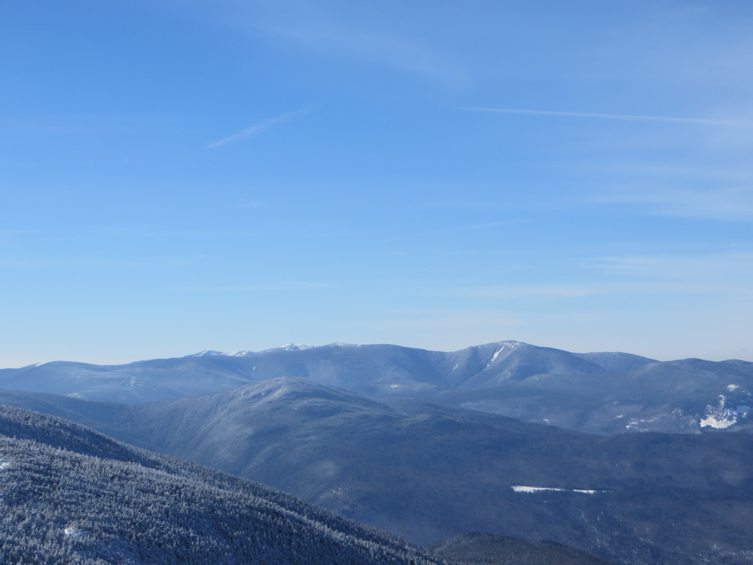
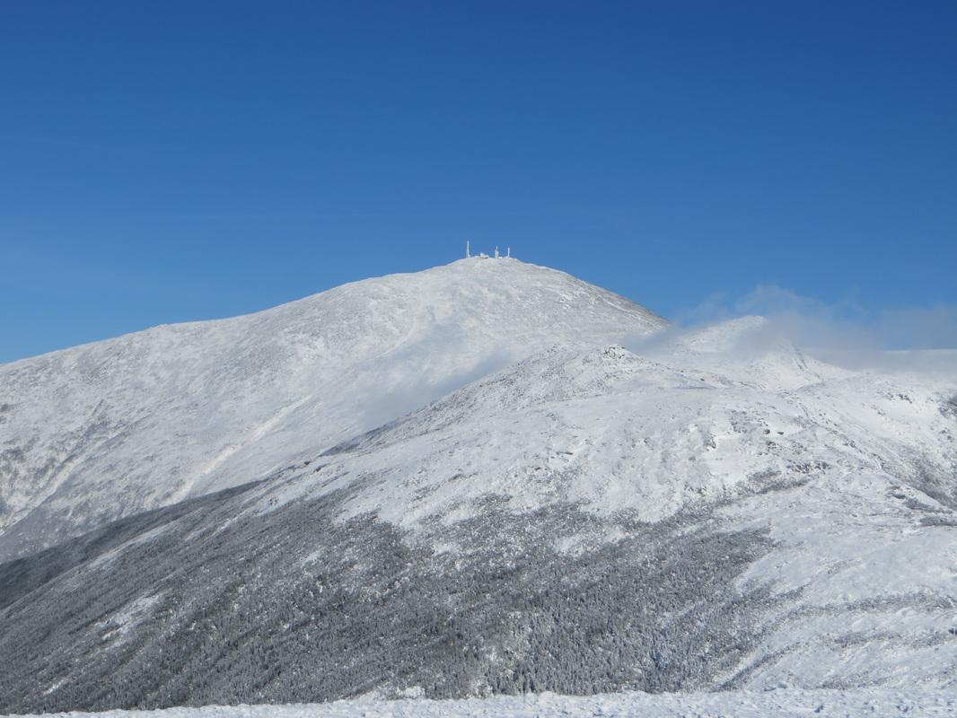
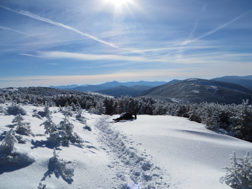
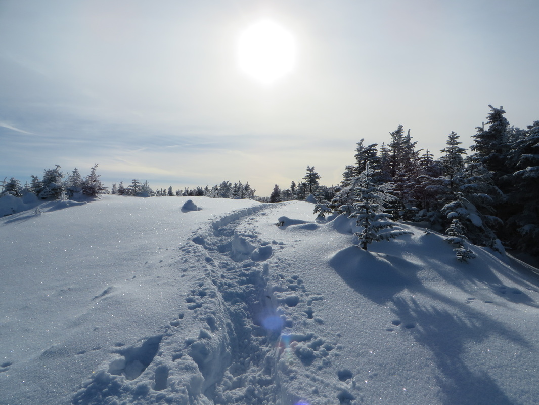
We left the summit of Pierce and made the short hike down to the Crawford Path which we stay on for 1.2 miles until the junction of the Mt. Eisenhower Loop. This part of the hike dips in and out of the scrub but is mostly exposed and open. It was here we saw a few other hikers in passing as well as a group of three and one solo hiker ahead of us already nearing the summit. The wind would whip around us here and there but was very tolerable. We took our time as it was impossible not to stop to take in the amazing views in every direction. I took about a hundred pictures on this section of trail (don't worry, I won't post them all). Just before the summit we stopped so I could put on my face mask and Kyle his goggles as we knew the wind would be quite strong up there. It was, but we were content dressed in our cold weather attire. We stayed up there for a good ten or fifteen minutes taking in the views and snapping photos. It was easy to ignore the wind with so much beauty to look at. Finally it was time to get moving so we waved goodbye to Washington and the other Presidents and made our way back down the Crawford Path and back to Mt. Pierce. From there is was an easy 2.7 miles on a hard packed trail back to the car.
Heading down the summit of Pierce to get to the Crawford Path
Looking back at Pierce (upper right) and Jackson (small hump to the left)
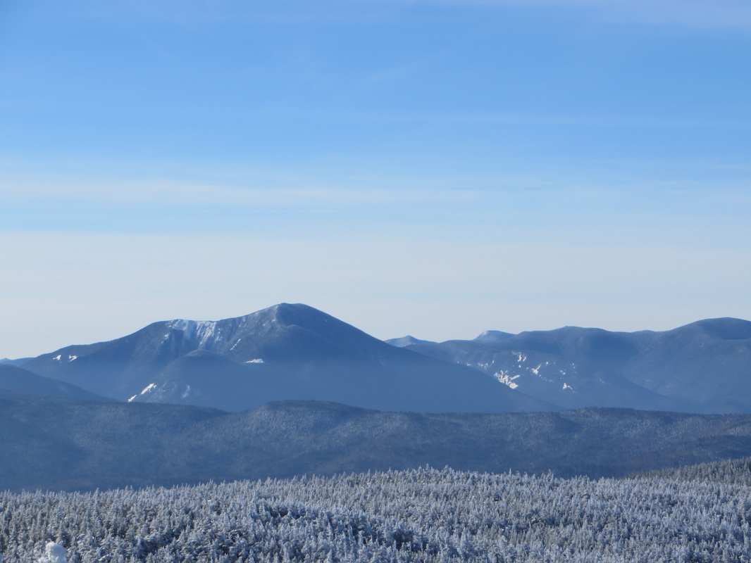
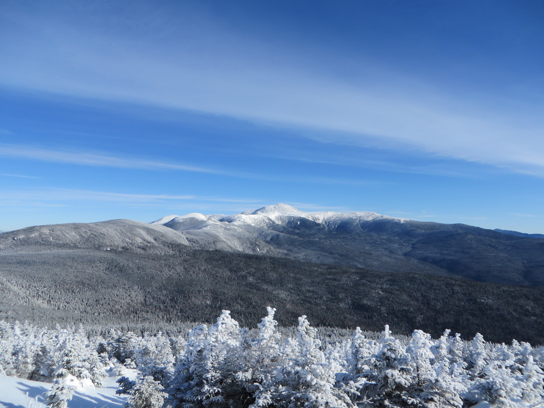
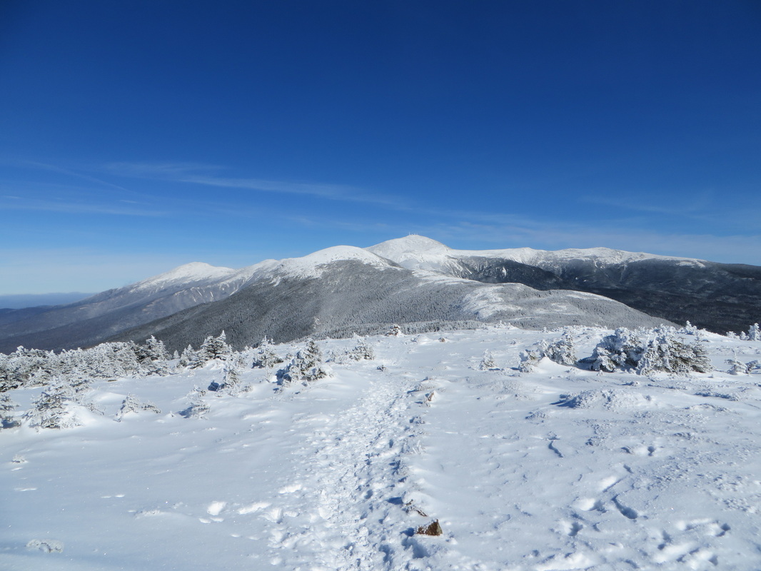
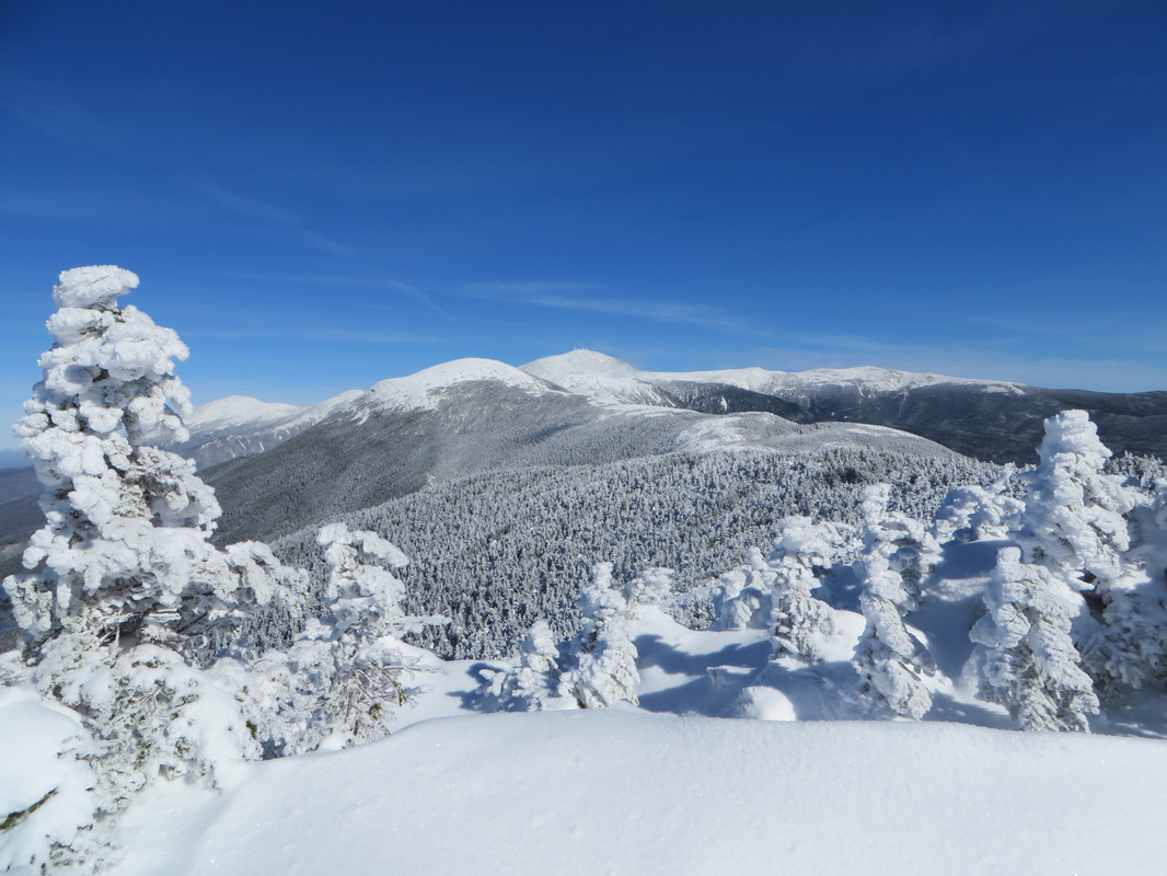
Looking ahead to Eisenhower
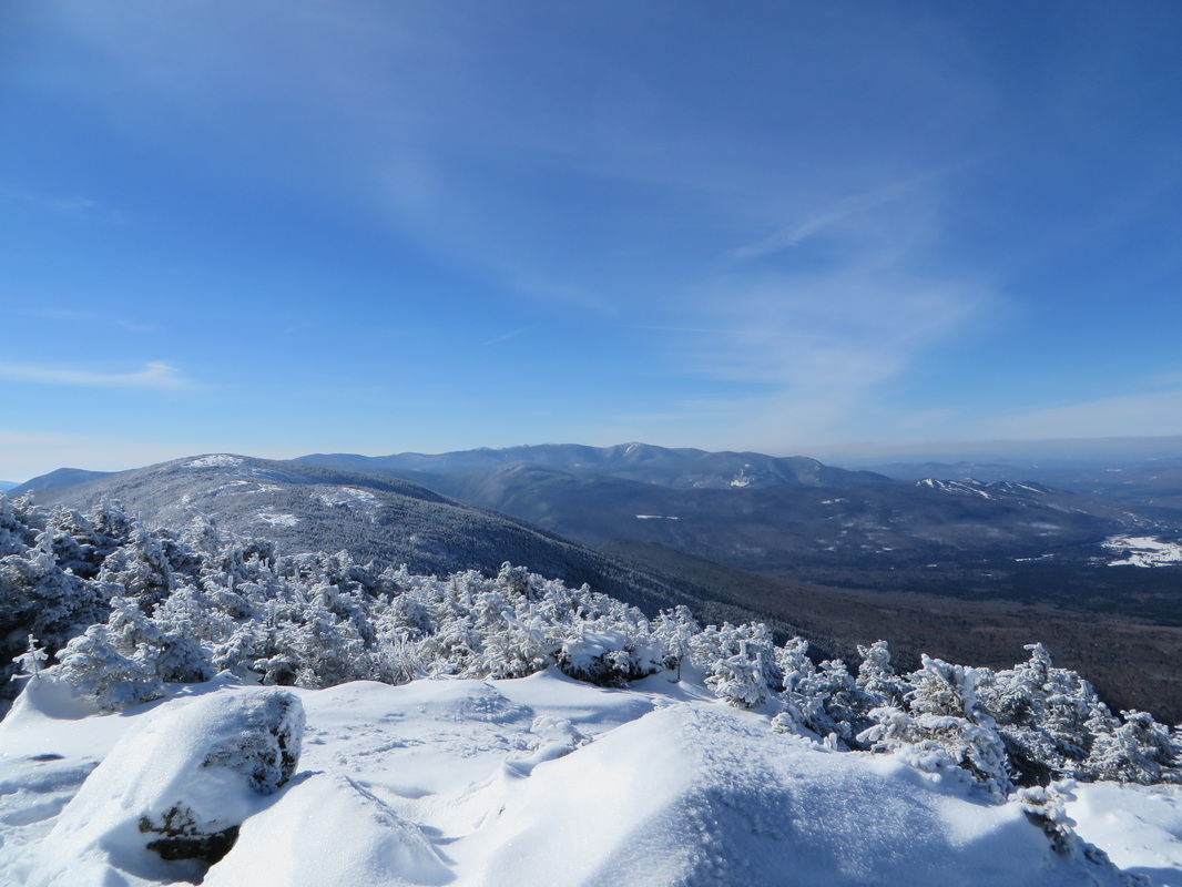
Franconia Ridge in the distance
Looks like it is a nice day over there too
Looking down at Bretton Woods
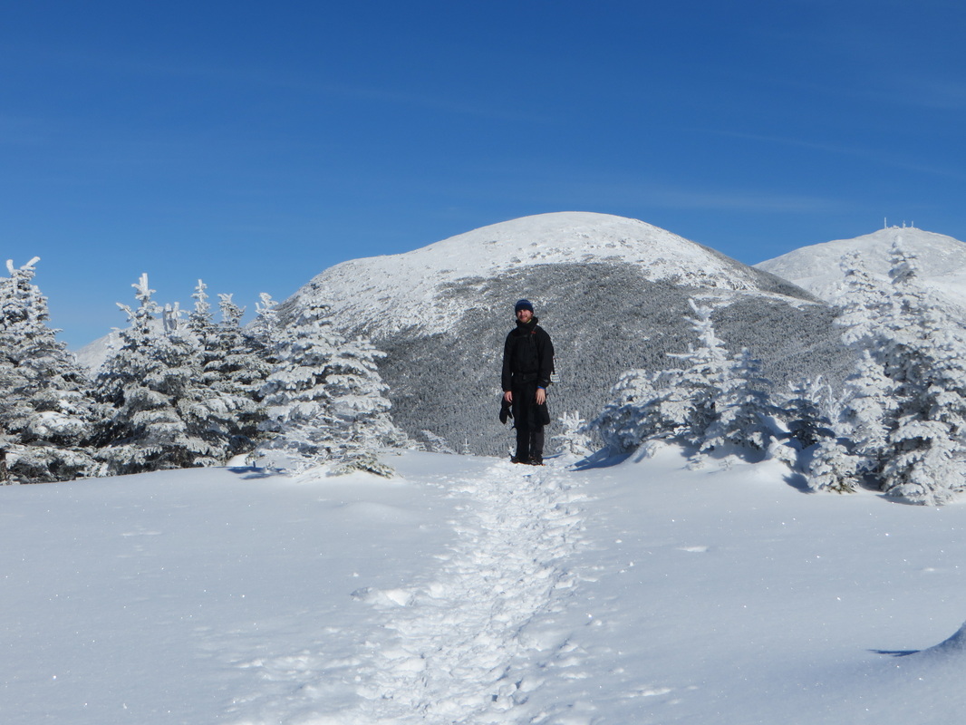
Kyle makes his way up to the summit loop junction
The three guys we passed as were going up Eisenhower
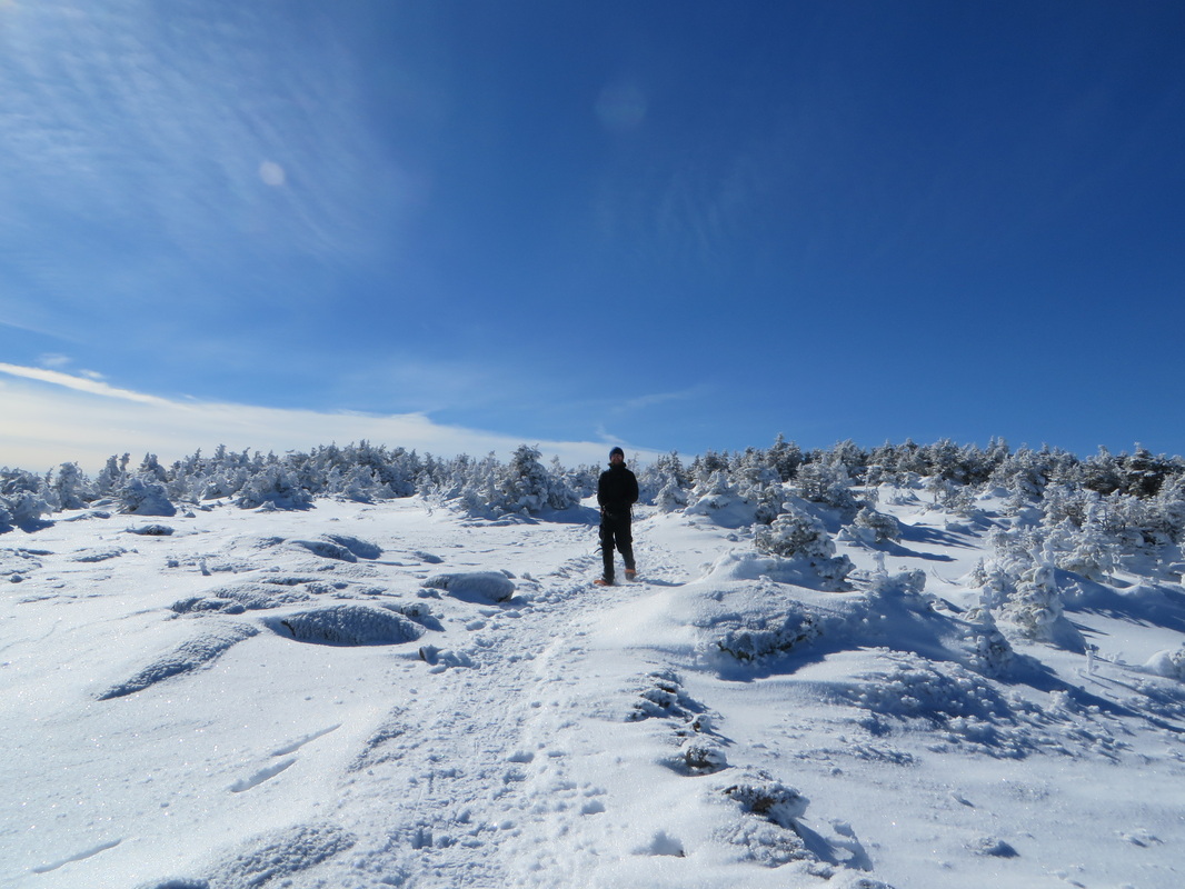
Looking back on our morning hike
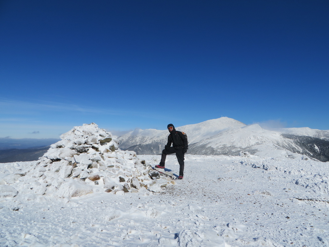
I look like I'm ready to rob a bank! Mt. Eisenhower summit: Winter 4K #29!
Time to head back down
Kyle takes a break...
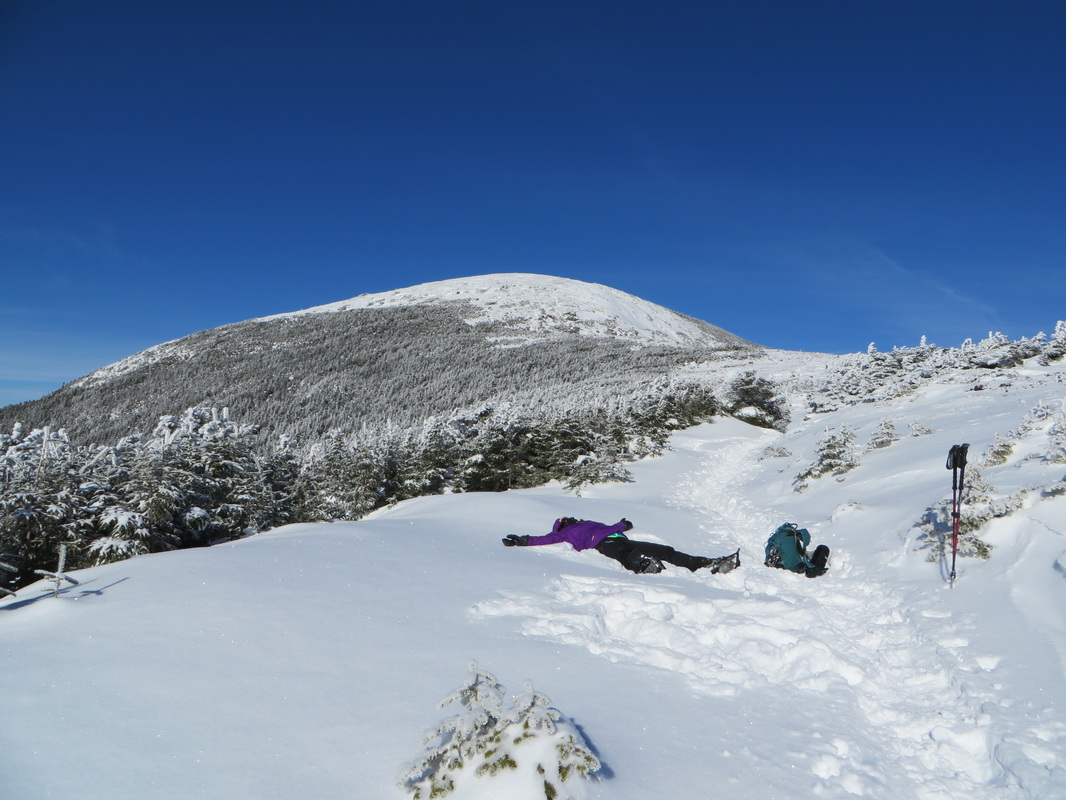
Ahhhhhhh....It feels SO GOOD to lay down!
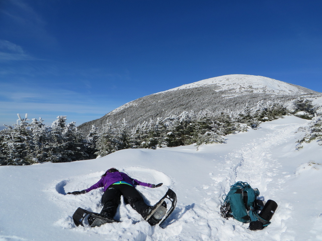
Sometimes you just gotta take a break, lie down, and make a snow angel.
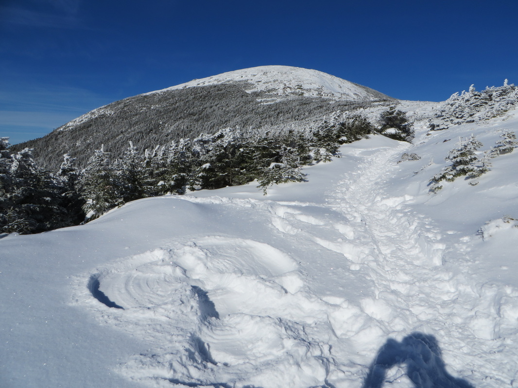
One last look before we head back into the trees and back down to the car
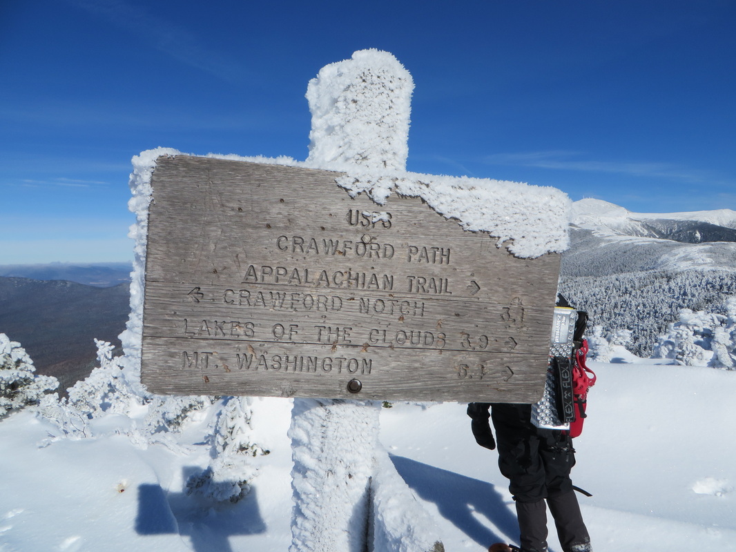
The beginning of the Crawford Path and the end of our hike for today
 RSS Feed