For day two of hiking this week I had made plans to meet up with Kyle. The forecast promised sunshine until the afternoon however it also promised single digit temperatures and wind chills well into the negatives. We both have had the itch to get above treeline but the threat of -45 degree wind chills made us back off and instead pick a hike that offered protection from the wind. So the Hancocks it would be!
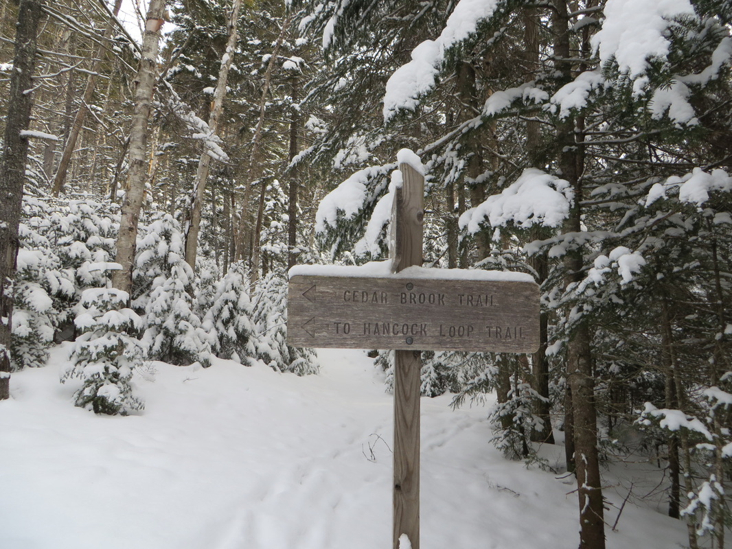
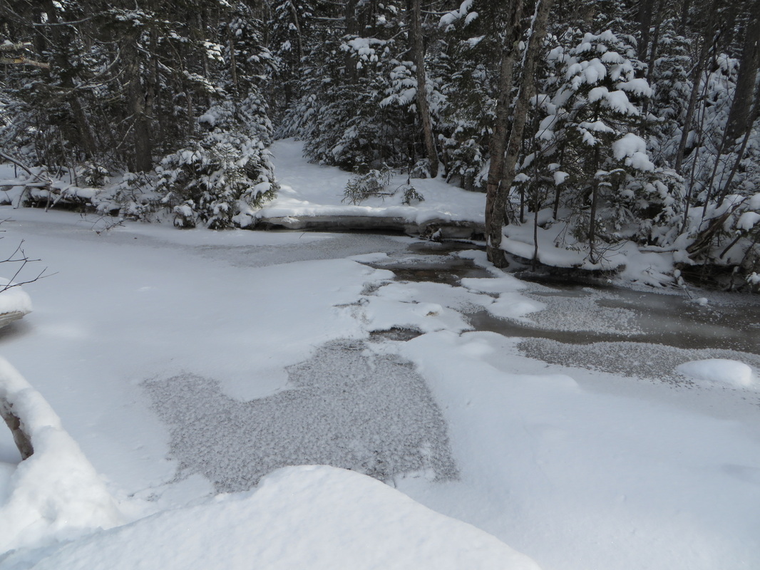
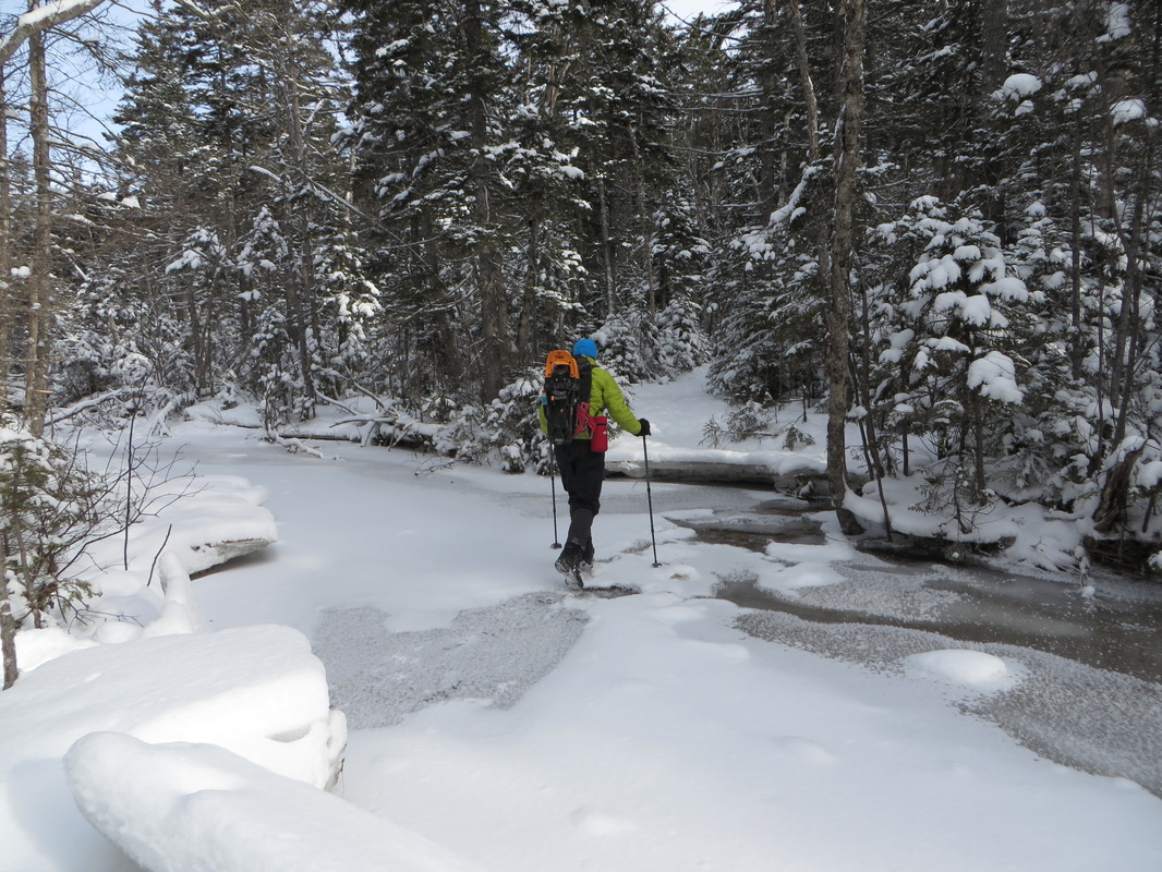
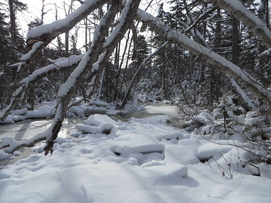
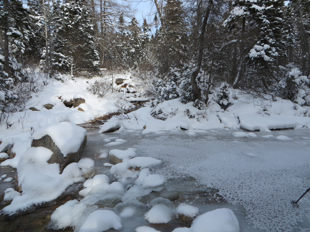
The hike to the Hancocks begins at the hairpin turn on the Kancamagus Highway on the Hancock Notch Trail. The trail is mostly flat and though it can be a bit soggy in places we didn't have to worry about that today as there was enough snow to make a nice even sidewalk. We made quick work of the 1.8 miles to the junction with the Cedar Brook Trail. From here it would be another 0.7 of a mile to the start of the Hancock Loop Trail. This part of the Cedar Brook Trail is also flat for the most part but there are 5 pain-in-the-butt water crossings to contend with which slowed us down a little bit. In a normal winter there would have been enough snow by now to form snow bridges over these crossings but with the whacky weather we have had this winter most streams had a medium-thick layer of ice over them (at best) while some still remained partially open! We took our time and used extreme caution on all crossings and even had to get a little creative for some. We managed across all them without incident and with dry boots!
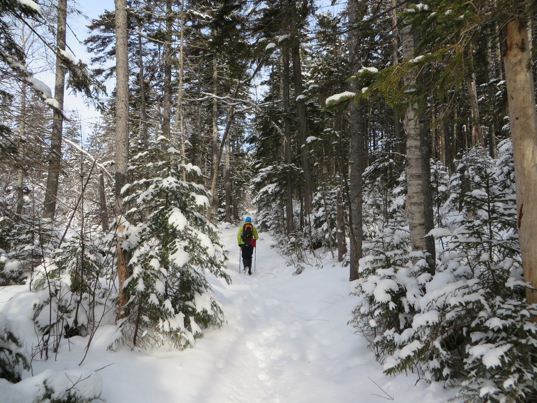
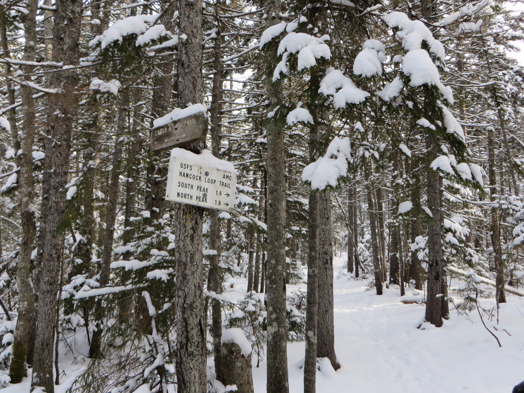
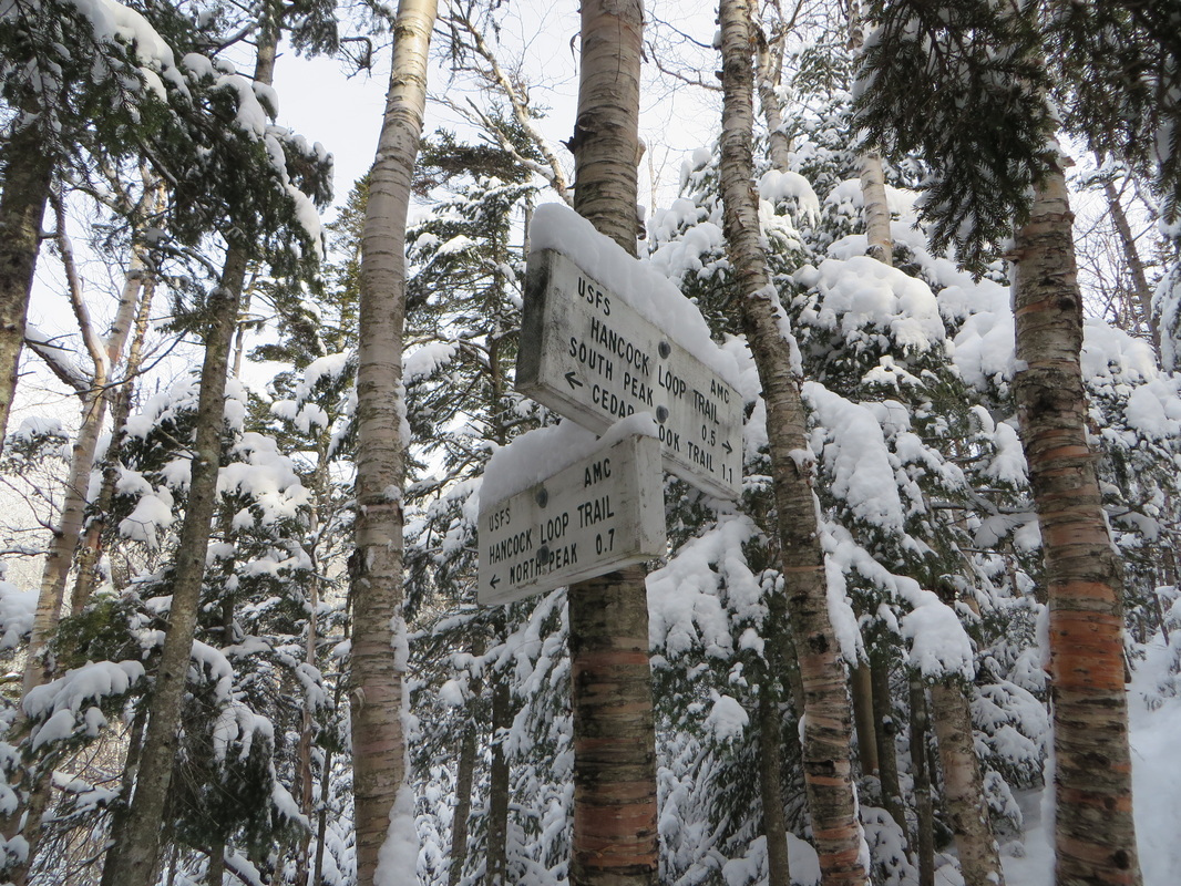
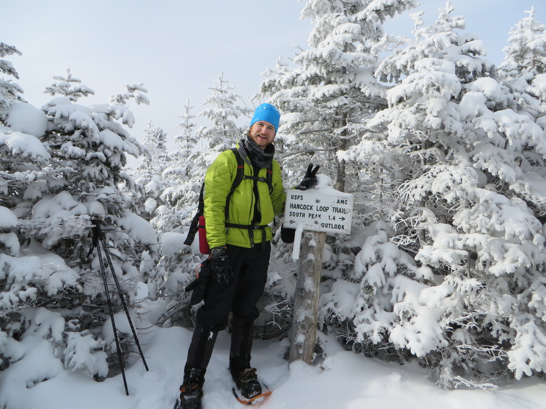
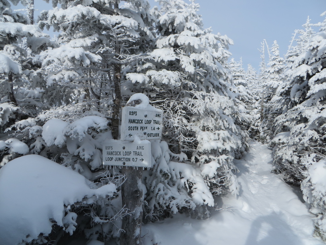
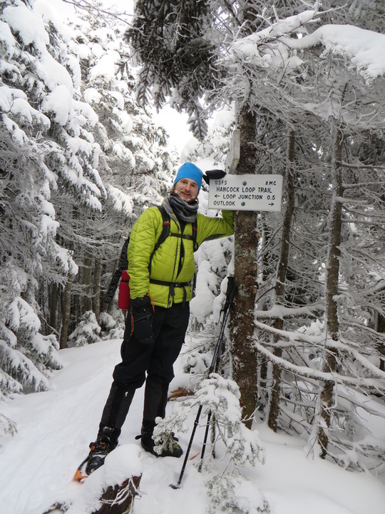
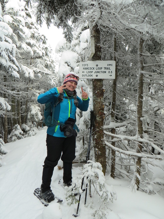
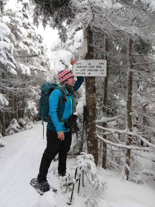
From the junction of the Hancock Loop Trail it is another 1.1 miles of mostly easy to moderate climbing with one more tricky crossing to contend with. A fork is reached at the end of this 1.1. mile stretch and this is where the real fun begins. One can either take a right to begin the climb of South Hancock (0.5 miles) or a left to begin the climb up North Hancock (0.7 miles). While it is a shorter distance to South Hancock it is also a bit steeper than the ascent to North Hancock. Most people ascend North Hancock and descend South Hancock which is the direction that we also chose to go.
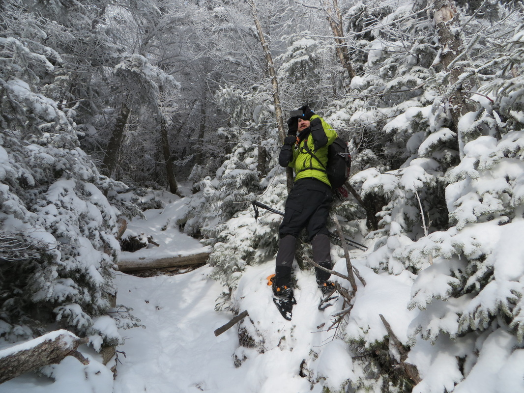
Up until this point we had both bare booted the entire trail. Though I knew there would not be enough snow depth to warrant bringing my snow shoes along I did anyway. My climb up the Hancocks from this past fall was still fresh in my mind and I knew the climb up North Hancock would be relentlessly steep and most likely a mix of ice and crusty snow. I wanted the superior traction of my MSR Evo Ascent snow shoes along with the televators (heel lift bars) to prevent my calf muscles from burning out. I can not put into words how pleased I was with this decision. The climb up was still relentlessly steep, but I was able to easily put one foot in front of the other and go without backsliding or looking for a tree to grab onto. It was worth carrying the extra weight on my back to this point for this 0.7 mile climb up.
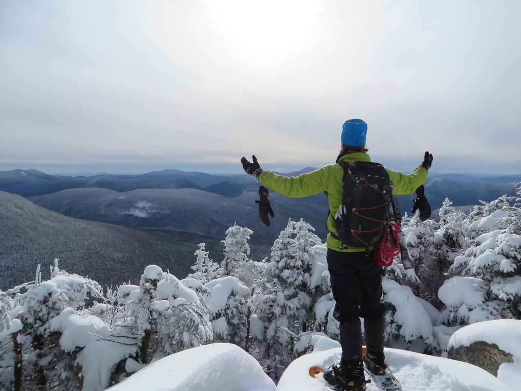
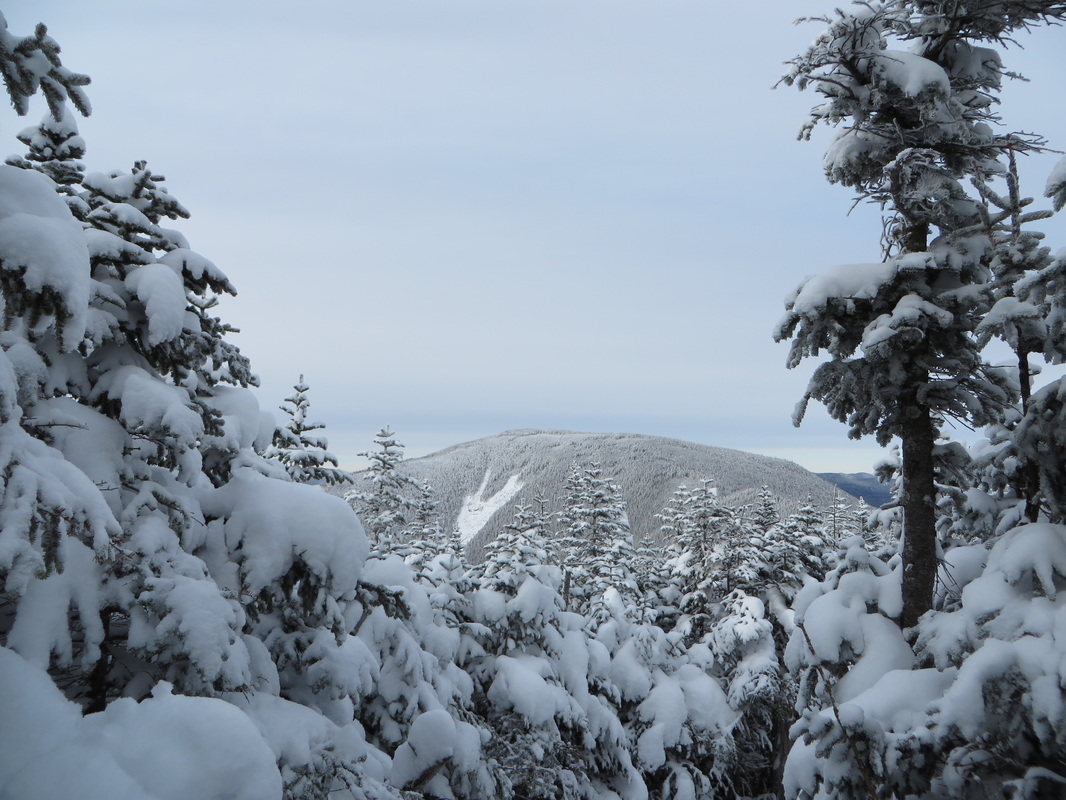
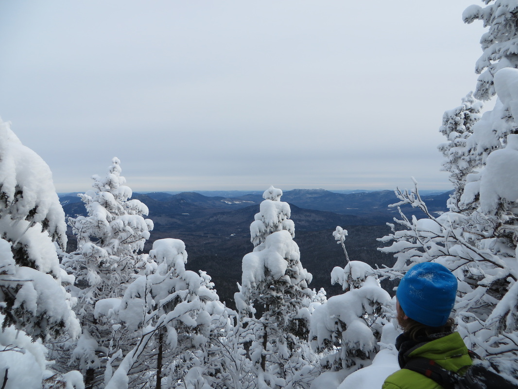
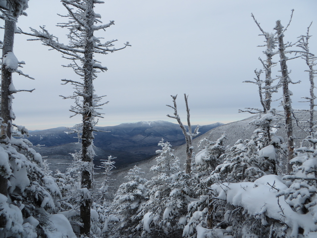
As we ascended the trees started to part and we started to get some views over to South Hancock. After what seemed like quite awhile we reached the wooded summit of North Hancock. We meandered down to the outlook, which had been opened up some this past fall, and gawked at the amazing open view before us. The sun was shining and the sky was blue with some wispy clouds here and there. There was absolutely zero wind (much to our surprise) which made the scene even more serene. It is moments like this that remind me why I wake up so early on my days off, why I drive in less than favorable conditions for 2-3 hours to get there, and why I hike in the bitter cold. It is moments like this that remind me of why exactly I hike.
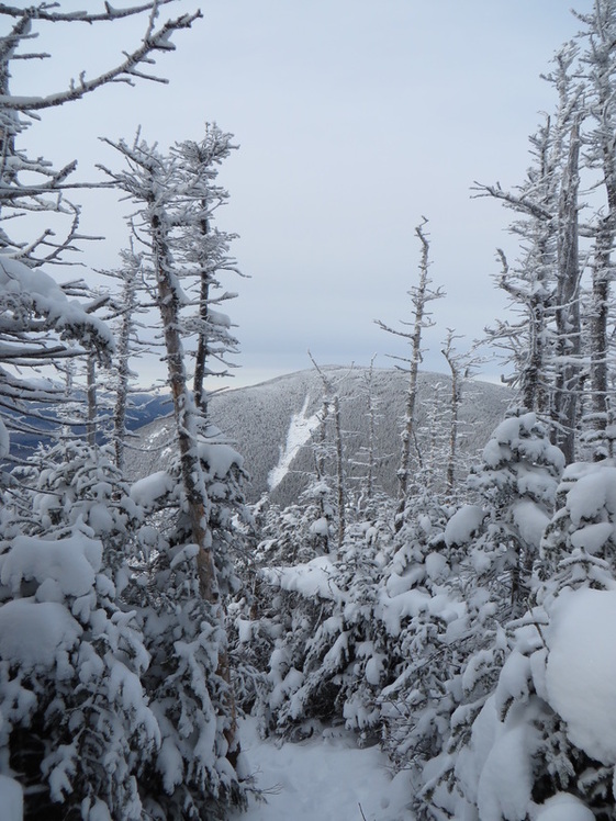
We left our snow shoes on for the 1.4 mile stretch over to the summit of South Hancock. The summit of South Hancock is also wooded and it too has an outlook just off of its summit. This outlook though much smaller and partially restricted still provides a good view down into the Sawyer River Valley. After some quick summit pics we started our way down the super steep South Hancock side of the Hancock Loop Trail. There are some great views at the beginning of the descent that look over to the Arrow Slide on North Hancock as well as across the Pemigewasset Wilderness to Franconia Ridge and Owls Head Mountain. I had heard rumors that South Hancock, with enough snow cover, had excellent grades for butt sledding. I have to say this rumor is true (we exercised great caution so we wouldn't go too fast) and we were back down to the fork in less than 20 minutes. It was pretty awesome. With our snow shoes back on our packs we headed back out the way we came as the sun disappeared behind thickening clouds. The water crossings were a bit trickier than they were in the morning but with some patience and careful planning we again made it across all of them with out incident.
I have to say that this hike made me like the Hancocks a lot more. My first time doing this hike was this past fall on a cold and wet day. Hancock Notch Trail and Cedar Brook Trail (should be called Cedar Swamp Trail) are notoriously a soggy wet and muddy mess. The water crossings can be difficult (though they weren't that day) and both of the steep sections on North and South Hancock are terribly eroded and gravelly which makes for awful footing. There were no views that day either to boot. You can read a report from that trip on my friend Chris's Blog by clicking here. While the snow covers all of the mud pits and eroded sections of trail making it easier to deal with, I have a feeling it will be a long time before I find myself on these trails again. Thanks Kyle for another great (and frigid) hike! Glad we got our views on this one!
The hike to the Hancocks begins at the hairpin turn on the Kancamagus Highway on the Hancock Notch Trail. The trail is mostly flat and though it can be a bit soggy in places we didn't have to worry about that today as there was enough snow to make a nice even sidewalk. We made quick work of the 1.8 miles to the junction with the Cedar Brook Trail. From here it would be another 0.7 of a mile to the start of the Hancock Loop Trail. This part of the Cedar Brook Trail is also flat for the most part but there are 5 pain-in-the-butt water crossings to contend with which slowed us down a little bit. In a normal winter there would have been enough snow by now to form snow bridges over these crossings but with the whacky weather we have had this winter most streams had a medium-thick layer of ice over them (at best) while some still remained partially open! We took our time and used extreme caution on all crossings and even had to get a little creative for some. We managed across all them without incident and with dry boots!
From the junction of the Hancock Loop Trail it is another 1.1 miles of mostly easy to moderate climbing with one more tricky crossing to contend with. A fork is reached at the end of this 1.1. mile stretch and this is where the real fun begins. One can either take a right to begin the climb of South Hancock (0.5 miles) or a left to begin the climb up North Hancock (0.7 miles). While it is a shorter distance to South Hancock it is also a bit steeper than the ascent to North Hancock. Most people ascend North Hancock and descend South Hancock which is the direction that we also chose to go.
Up until this point we had both bare booted the entire trail. Though I knew there would not be enough snow depth to warrant bringing my snow shoes along I did anyway. My climb up the Hancocks from this past fall was still fresh in my mind and I knew the climb up North Hancock would be relentlessly steep and most likely a mix of ice and crusty snow. I wanted the superior traction of my MSR Evo Ascent snow shoes along with the televators (heel lift bars) to prevent my calf muscles from burning out. I can not put into words how pleased I was with this decision. The climb up was still relentlessly steep, but I was able to easily put one foot in front of the other and go without backsliding or looking for a tree to grab onto. It was worth carrying the extra weight on my back to this point for this 0.7 mile climb up.
As we ascended the trees started to part and we started to get some views over to South Hancock. After what seemed like quite awhile we reached the wooded summit of North Hancock. We meandered down to the outlook, which had been opened up some this past fall, and gawked at the amazing open view before us. The sun was shining and the sky was blue with some wispy clouds here and there. There was absolutely zero wind (much to our surprise) which made the scene even more serene. It is moments like this that remind me why I wake up so early on my days off, why I drive in less than favorable conditions for 2-3 hours to get there, and why I hike in the bitter cold. It is moments like this that remind me of why exactly I hike.
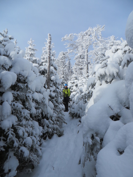
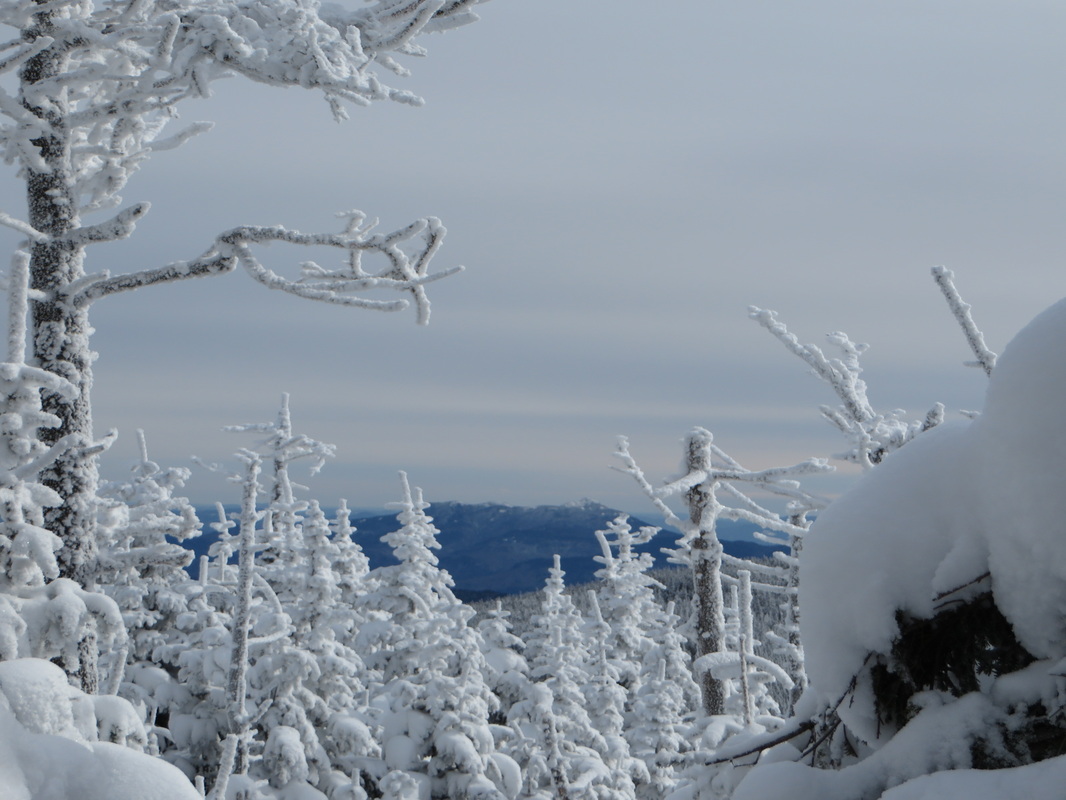
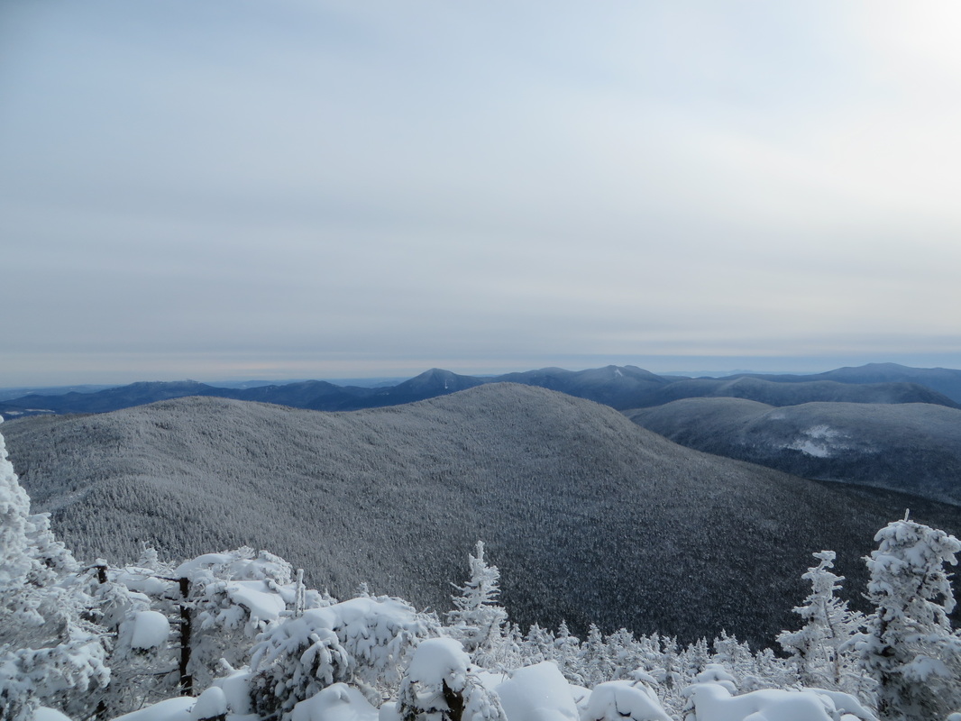
We left our snow shoes on for the 1.4 mile stretch over to the summit of South Hancock. The summit of South Hancock is also wooded and it too has an outlook just off of its summit. This outlook though much smaller and partially restricted still provides a good view down into the Sawyer River Valley. After some quick summit pics we started our way down the super steep South Hancock side of the Hancock Loop Trail. There are some great views at the beginning of the descent that look over to the Arrow Slide on North Hancock as well as across the Pemigewasset Wilderness to Franconia Ridge and Owls Head Mountain. I had heard rumors that South Hancock, with enough snow cover, had excellent grades for butt sledding. I have to say this rumor is true (we exercised great caution so we wouldn't go too fast) and we were back down to the fork in less than 20 minutes. It was pretty awesome. With our snow shoes back on our packs we headed back out the way we came as the sun disappeared behind thickening clouds. The water crossings were a bit trickier than they were in the morning but with some patience and careful planning we again made it across all of them with out incident.
I have to say that this hike made me like the Hancocks a lot more. My first time doing this hike was this past fall on a cold and wet day. Hancock Notch Trail and Cedar Brook Trail (should be called Cedar Swamp Trail) are notoriously a soggy wet and muddy mess. The water crossings can be difficult (though they weren't that day) and both of the steep sections on North and South Hancock are terribly eroded and gravelly which makes for awful footing. There were no views that day either to boot. You can read a report from that trip on my friend Chris's Blog by clicking here. While the snow covers all of the mud pits and eroded sections of trail making it easier to deal with, I have a feeling it will be a long time before I find myself on these trails again. Thanks Kyle for another great (and frigid) hike! Glad we got our views on this one!
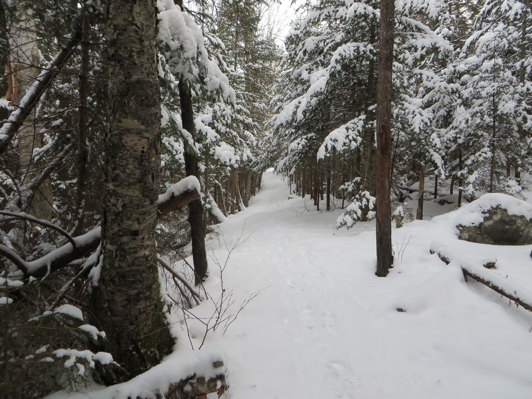
Hancock Notch Trail
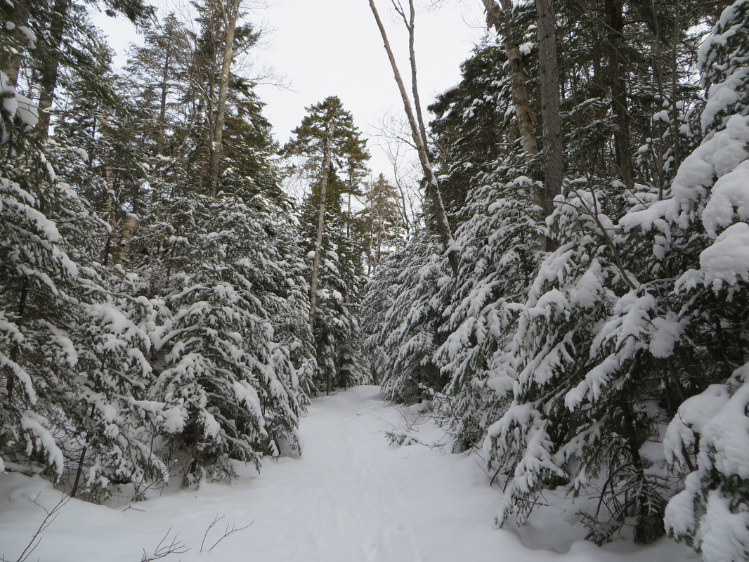
Pretty snow covered pines on Hancock Notch Trail
To the swamp!
The first crossing. It looks very sketchy but what you can't see is snow covered rocks protruding above the ice which made for great stepping stones.
Kyle makes use of the protruding rocks and tests surrounding ice with his poles
Looking down stream
Kyle on Cedar Brook Trail
Another tricky crossing. This one looks a lot easier than it really was...
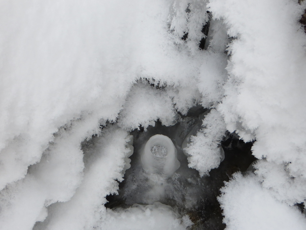
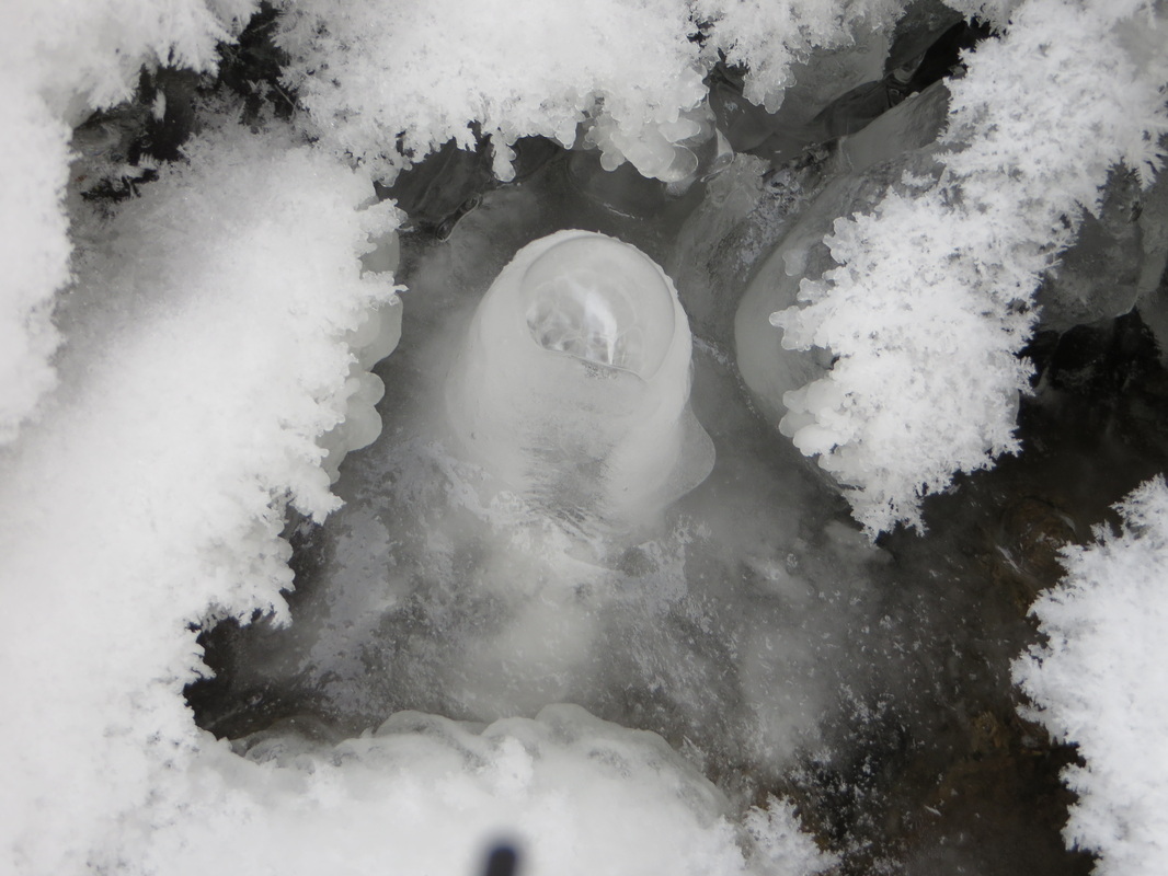
A cool little frozen ice geyser
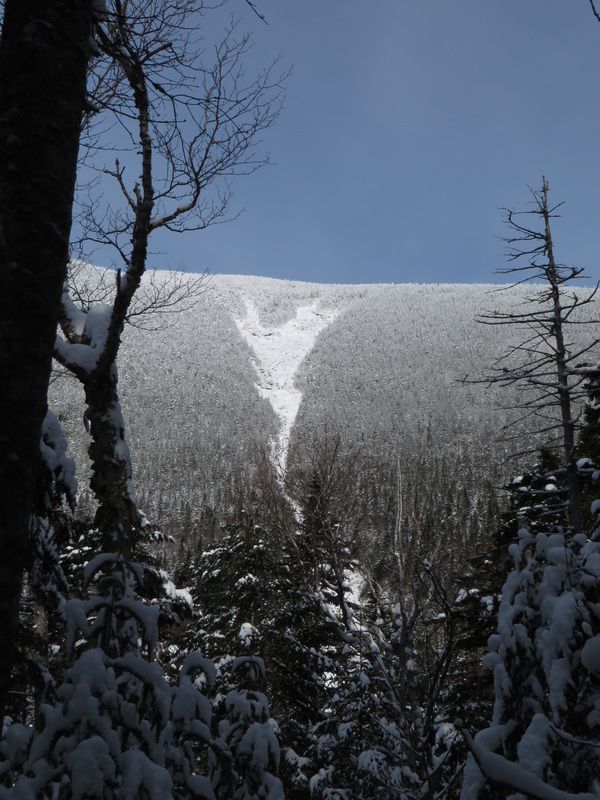
First views of the Arrow Slide on North Hancock. The next time I come back to the Hancocks it will be to climb the slide.
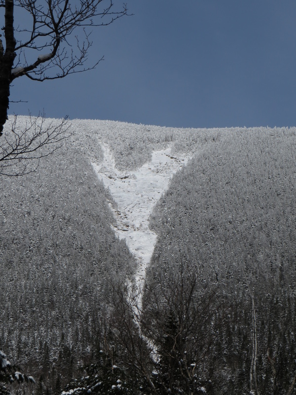
Close up of the slide
First views opening up behind us
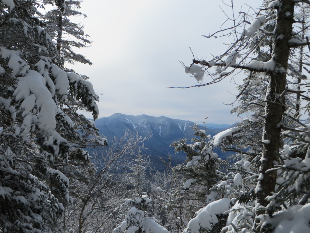
View over to South Hancock
Kyle trying to get the perfect shot
Kyle standing in the snowy tree tunnel just before the summit
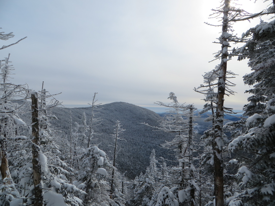
Partial views over the snowy frozen trees
Winter 4K #11 for Kyle!
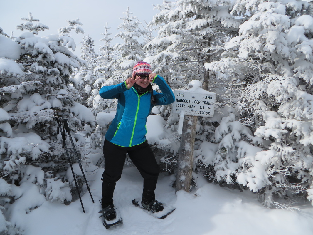
North Hancock summit: Winter 4k #20 for me!
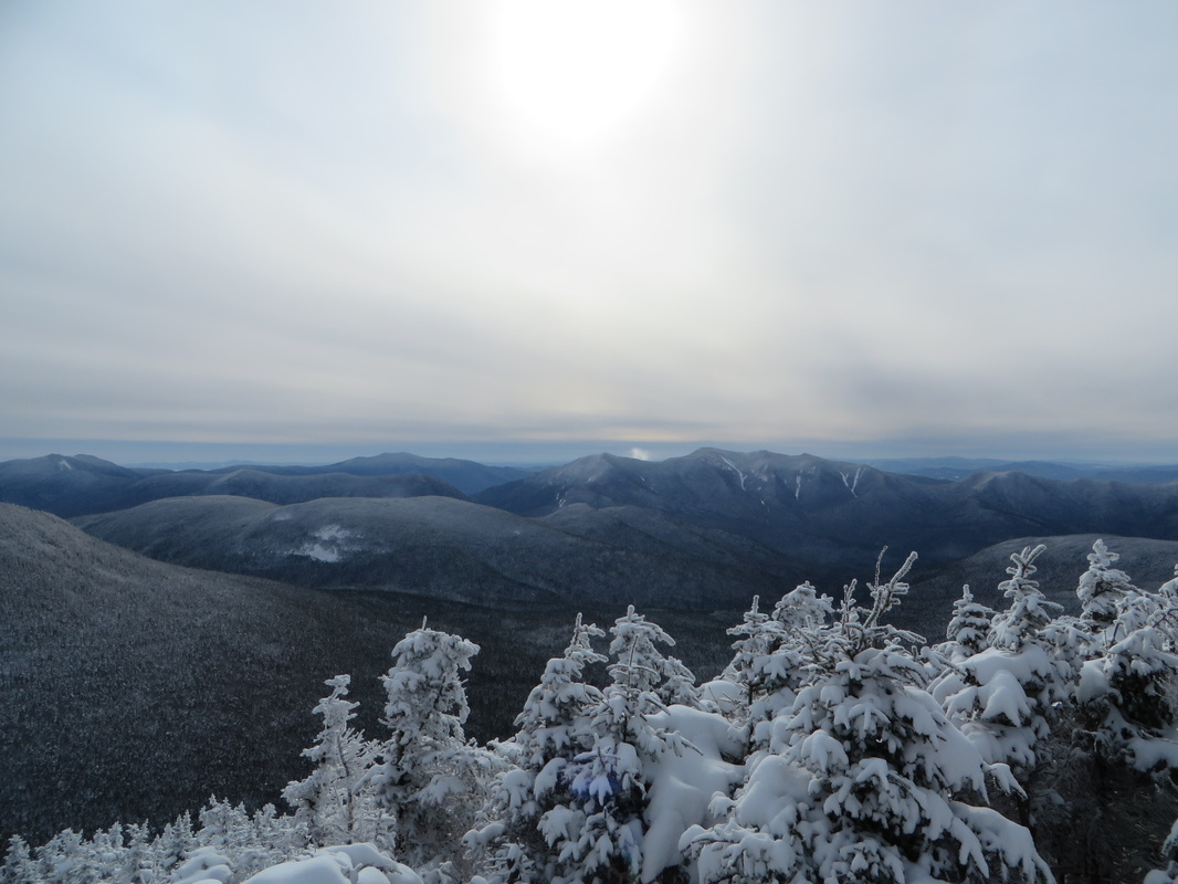
Views from the outlook on North Hancock
Looking over to South Hancock, our next destination
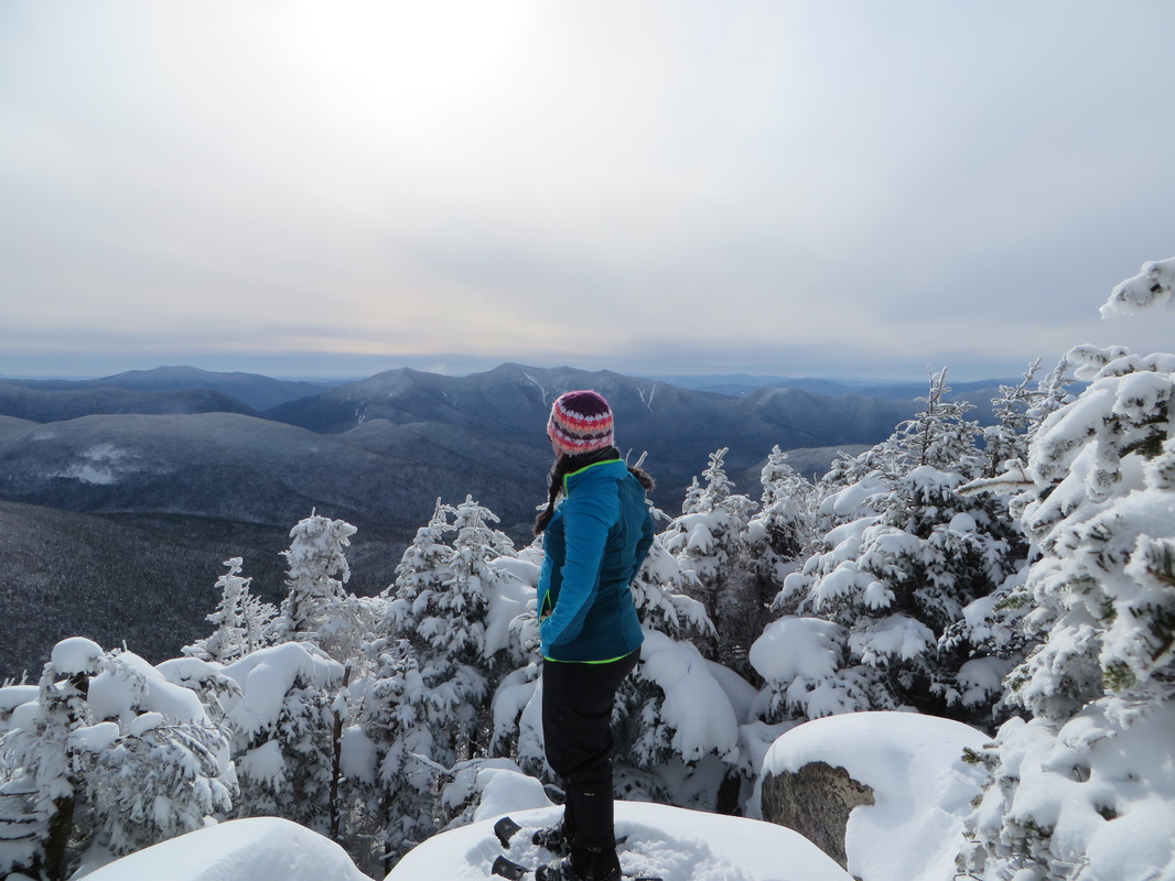
I'm admiring the view and not wanting to leave
Kyle takes it all in
Back on the trail to South Hancock!
Approaching the summit of South Hancock, looking back at the Arrow Slide on North Hancock
South Hancock! Winter 4K #12 for Kyle!
South Hancock! Winter 4K #21 for me!
I'm just gonna rest my head here for a minute...
View from the outlook on South Hancock
Heading down South Hancock, views of Arrow Slide again
Franconia Ridge and Owls Head in the distance
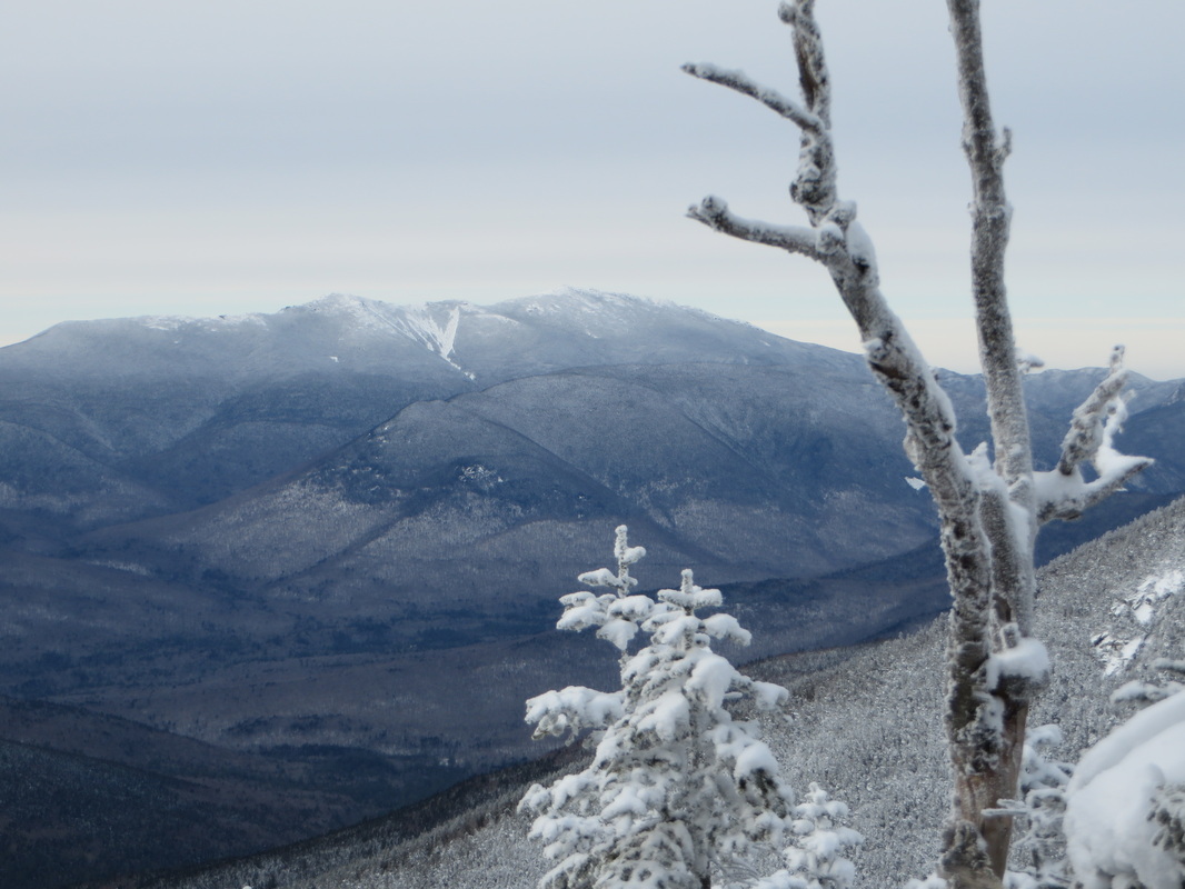
Close up of my favorite slide on Franconia Ridge and Owls Head beneath it
Here's waving goodbye until next time! I'm such a dork!
 RSS Feed